Category:Llanbedr, Vale of Grwyney
Jump to navigation
Jump to search
village near Crickhowell, Powys, Wales, United Kingdom  | |||||
| Upload media | |||||
| Instance of | |||||
|---|---|---|---|---|---|
| Location | The Vale of Grwyney, Powys, Wales | ||||
 | |||||
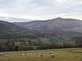
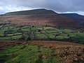
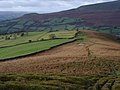
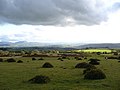
English: Llanbedr is a hamlet two miles northeast of Crickhowell in the county of Powys in south Wales. It lies above the river known as the Grwyne Fechan just above its confluence with the Grwyne Fawr in the southern reaches of the Black Mountains range. The hamlet lies within the shadow of Table Mountain, an outlying spur of Pen Cerrig-calch on which is perched the Iron Age hillfort of Crug Hywel.
Subcategories
This category has only the following subcategory.
Media in category "Llanbedr, Vale of Grwyney"
The following 48 files are in this category, out of 48 total.
-
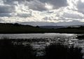 A pool on the Begwyns - geograph.org.uk - 597620.jpg 640 × 450; 56 KB
-

-
 Below the access land - geograph.org.uk - 645378.jpg 640 × 477; 87 KB
-
 Below the access land - geograph.org.uk - 645379.jpg 640 × 477; 111 KB
-
 Black Mountains in the Snow - geograph.org.uk - 586423.jpg 640 × 480; 75 KB
-
 Bridge over the Grwyne Fechan - geograph.org.uk - 74496.jpg 640 × 480; 189 KB
-
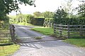 Cattle grid at Ffermwen - geograph.org.uk - 541752.jpg 640 × 425; 106 KB
-
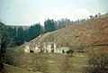
 Cottages and Church In Llanbedr - geograph.org.uk - 2026123.jpg 1,496 × 1,122; 687 KB
-
 Country road junction - geograph.org.uk - 447563.jpg 640 × 480; 105 KB
-
 Disgwylfa on the Black Mountains - geograph.org.uk - 291796.jpg 640 × 480; 79 KB
-
 Footpath into access land - geograph.org.uk - 643322.jpg 640 × 480; 90 KB
-
 Footpath into access land - geograph.org.uk - 645226.jpg 640 × 477; 116 KB
-
 Gate to the open mountainside - geograph.org.uk - 655895.jpg 640 × 480; 109 KB
-

-
 Lane In Llanbedr - geograph.org.uk - 2026142.jpg 1,496 × 1,122; 535 KB
-
 Llanbachowey - geograph.org.uk - 599871.jpg 640 × 480; 99 KB
-
 Llanbedr below Sugar Loaf - geograph.org.uk - 333839.jpg 640 × 480; 76 KB
-
 Llanbedr Church and Table Mountain - geograph.org.uk - 333831.jpg 640 × 480; 126 KB
-
 Llanbedr Hill - geograph.org.uk - 578180.jpg 640 × 426; 110 KB
-
-
 Llanbwchllyn Farm - geograph.org.uk - 578721.jpg 640 × 426; 134 KB
-
 Llwynon, The Vale of Grwyney - geograph.org.uk - 292425.jpg 640 × 480; 103 KB
-
 Looking NNE from the Sugar Loaf - geograph.org.uk - 355915.jpg 640 × 480; 70 KB
-
 Methodist chapel in Llanbedr - geograph.org.uk - 1823633.jpg 640 × 427; 84 KB
-
 Overlooking Llanbachowey Farm - geograph.org.uk - 599865.jpg 640 × 480; 54 KB
-
 Pen Cerrig-calch mountainside - geograph.org.uk - 544119.jpg 640 × 425; 72 KB
-
 Pen Cerrig-calch viewed from the east - geograph.org.uk - 293098.jpg 640 × 480; 81 KB
-
 Penwern viewed from the north-west - geograph.org.uk - 579909.jpg 640 × 426; 111 KB
-
 Perth-y-Pia Bunkhouse - geograph.org.uk - 333824.jpg 640 × 480; 104 KB
-
 Red Lion, Llanbedr - geograph.org.uk - 2316193.jpg 1,024 × 680; 158 KB
-

-

-
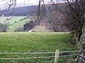
 Sheep on Llanbedr Hill - geograph.org.uk - 577300.jpg 640 × 426; 124 KB
-
 Table Mountain - geograph.org.uk - 609489.jpg 640 × 480; 140 KB
-
 Table Mountain near Crickhowell - geograph.org.uk - 122049.jpg 640 × 493; 126 KB
-
 The Beacons Way, The Black Mountains - geograph.org.uk - 292424.jpg 640 × 480; 85 KB
-

-
 The Begwyns - south west edge - geograph.org.uk - 597619.jpg 640 × 480; 54 KB
-
 The Begwyns - west side - geograph.org.uk - 597621.jpg 640 × 491; 38 KB
-
 The Hermitage - geograph.org.uk - 73647.jpg 640 × 433; 94 KB
-
 The Mill, Pont-y Felin - geograph.org.uk - 292427.jpg 640 × 480; 130 KB
-
 The Old Chapel, Llanbedr - geograph.org.uk - 293131.jpg 640 × 480; 131 KB
-

-
 The Vale of Grwyney - geograph.org.uk - 293129.jpg 640 × 480; 114 KB
-

-
 Trig point on Crug Mawr - geograph.org.uk - 291720.jpg 640 × 480; 85 KB
-
 The Roundabout - geograph.org.uk - 390747.jpg 640 × 480; 68 KB
-
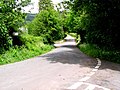
 Track above Crickhowell - geograph.org.uk - 369389.jpg 480 × 640; 158 KB


