Category:Livingston Manor, New York
Jump to navigation
Jump to search
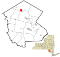
hamlet in Sullivan County, New York | |||||
| Upload media | |||||
| Instance of | |||||
|---|---|---|---|---|---|
| Location | Sullivan County, New York | ||||
| Population |
| ||||
| Area |
| ||||
 | |||||
Images pertinent to the hamlet of Livingston Manor, NY, USA, in the Town of Rockland
Subcategories
This category has the following 5 subcategories, out of 5 total.
Media in category "Livingston Manor, New York"
The following 48 files are in this category, out of 48 total.
-
Aerial - Livingston Manor, NY from SW 01 (9637923545).jpg 4,288 × 2,848; 4.53 MB
-
Aerial - Livingston Manor, NY from SW 01 - white balanced & 50pct equalized (9637966501).jpg 4,288 × 2,848; 10.42 MB
-
Aerial - Livingston Manor, NY from SW 01 - white balanced (9641178708).jpg 4,288 × 2,848; 7.74 MB
-
Aerial - Livingston Manor, NY from SW 02 (9641081598).jpg 4,288 × 2,848; 4.29 MB
-
Aerial - Livingston Manor, NY from SW 02 - white balanced & 50pct equalized (9637883309).jpg 4,288 × 2,848; 9.14 MB
-
Aerial - Livingston Manor, NY from SW 02 - white balanced (9641097962).jpg 4,288 × 2,848; 6.8 MB
-
Congregation Agudas Achim, Livingston Manor, NY.jpg 2,094 × 1,466; 504 KB
-
Downtown Livingston Manor, NY.jpg 2,418 × 1,504; 618 KB
-
FLT M30 15.9 mi - Vista to southeast - panoramio.jpg 2,048 × 1,536; 512 KB
-
FLT M31 3.9 mi - DEC Register W of Big Pond Rd - panoramio.jpg 1,536 × 2,048; 487 KB
-
FLT M31 3.92 mi - Sign on Big Pond Rd - panoramio.jpg 1,536 × 2,048; 869 KB
-
FLT M31 4.1 mi - DEC kiosk at Big Pond parking - panoramio.jpg 1,536 × 2,048; 920 KB
-
FLT M31 4.1 mi - DEC register at Big Pond parking - panoramio.jpg 1,536 × 2,048; 670 KB
-
FLT M31 4.2 mi - Designated bivouac near Big Pond - panoramio.jpg 1,536 × 2,048; 789 KB
-
FLT M31 7.4 mi - DEC kiosk at Alder Lake parking - panoramio.jpg 1,536 × 2,048; 763 KB
-
FLT M31 7.4 mi - DEC register at Alder Lake parking - panoramio.jpg 2,048 × 1,536; 624 KB
-
FLT M31 7.5 mi - Picnic tables at old mansion foundation - panoramio.jpg 2,048 × 1,536; 888 KB
-
FLT M31 7.6 mi - Designated bivouac 1 N of Alder Lake - panoramio.jpg 2,048 × 1,536; 958 KB
-
FLT M31 7.8 mi - Designated bivouac 2 N of Alder Lake - panoramio.jpg 2,048 × 1,536; 920 KB
-
FLT M31 8.0 mi - Designated bivouac 3 N of Alder Lake, picnic table - panoramio.jpg 2,048 × 1,536; 958 KB
-
FLT M31 8.15 mi - Piped spring next to trail near Alder Lake - panoramio.jpg 1,536 × 2,048; 872 KB
-
FLT M32 1.4 mi - Bivouac area 50 yards N of trail, fire ring, rock seat - panoramio.jpg 2,048 × 1,536; 931 KB
-
FLT M32 1.51 mi - Beaver Meadow Lean-to piped spring - panoramio.jpg 2,048 × 1,536; 706 KB
-
FLT M32 1.52 mi - Beaver Meadow Lean-to outhouse - panoramio.jpg 1,536 × 2,048; 698 KB
-
FLT M32 5.9 mi - Piped spring near Balsam Lake Mt. Lean-to - panoramio.jpg 1,536 × 2,048; 575 KB
-
FLT M32 6.0 mi - Balsam Lake Mt. Lean-to outhouse - panoramio.jpg 1,536 × 2,048; 580 KB
-
FLT M32 7.1 mi - DEC register near Balsam Lake parking area - panoramio.jpg 1,536 × 2,048; 747 KB
-
FLT M33 0.0 mi - DEC Kiosk at Balsam Lake DEC parking - panoramio.jpg 1,536 × 2,048; 895 KB
-
FLT M33 0.1 mi - DEC Register E of Balsam Lake DEC parking - panoramio.jpg 1,536 × 2,048; 676 KB
-
Fries Barn-Menges, Livingston Manor, New York LCCN2017712773.tif 5,202 × 3,592; 106.97 MB
-
Fries Shandelee, Livingston Manor, New York LCCN2017712774.tif 5,172 × 3,593; 106.38 MB
-
Livingston Manor Covered Bridge, NY.jpg 3,816 × 2,484; 4.28 MB
-
Livingston-manor-ny.gif 575 × 425; 31 KB
-
PostcardLivingstonManorNYMainStreet1909.jpg 672 × 434; 60 KB
-
Rockland, NY, town hall.jpg 1,496 × 1,452; 1.52 MB
-
Sullivan County Route 149 - New York.jpg 1,024 × 768; 312 KB
-
WillowemocLM.JPG 3,072 × 1,728; 784 KB


