Category:Liverpool Plains Shire
Jump to navigation
Jump to search
Deutsch: Liverpool Plains Shire ist ein lokales Verwaltungsgebiet (LGA) im australischen Bundesstaat New South Wales. Das Gebiet ist 5.086 km² groß und hat etwa 7.500 Einwohner. (→Liverpool Plains Shire)
English: Liverpool Plains Shire is a local government area located in the North West Slopes region of New South Wales, Australia. The Shire was formed on 17 March 2004 by the amalgamation of Quirindi Shire with parts of Parry, Murrurundi and Gunnedah shires. (→Liverpool Plains Shire)
Français : Le comté de Liverpool Plains est une zone d'administration locale au nord-est de la Nouvelle-Galles du Sud en Australie. Il résulte en 2004 de la fusion du comté de Quirindi avec la plus grande partie des comtés de Parry et de Murrurundi et d'une petite partie du comté de Gunnedah. (→Comté de Liverpool Plains)
Italiano: La Contea di Liverpool Plains è una Local Government Area che si trova nel Nuovo Galles del Sud. Essa si estende su di una superficie di 5.086 chilometri quadrati ed ha una popolazione di 7.965 abitanti. La sede del consiglio si trova a Quirindi. (→Contea di Liverpool Plains)
Nederlands: Liverpool Plains Shire Council is een Local Government Area (LGA) in de Australische deelstaat Nieuw-Zuid-Wales. (→Liverpool Plains Shire Council)
local government area in New South Wales, Australia   | |||||
| Upload media | |||||
| Instance of | |||||
|---|---|---|---|---|---|
| Location | New South Wales, AUS | ||||
| Capital | |||||
| Inception |
| ||||
| Population |
| ||||
| Area |
| ||||
| Elevation above sea level |
| ||||
| Different from | |||||
| official website | |||||
 | |||||
Subcategories
This category has the following 14 subcategories, out of 14 total.
Media in category "Liverpool Plains Shire"
The following 6 files are in this category, out of 6 total.
-
 A sign protesting coal in the Liverpool Plains, NSW.jpg 4,256 × 2,832; 3.82 MB
-
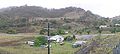 Ardglen NSW.JPG 4,181 × 1,869; 1.49 MB
-
 Duri Liverpool Plains Shire Boundary Sign.JPG 5,621 × 3,652; 6.25 MB
-
 Little Jacks Creek Liverpool Plains Shire Municipal Border Sign A.JPG 5,451 × 3,608; 9.1 MB
-
 Little Jacks Creek Municipal Border Sign A.JPG 5,714 × 3,822; 10.94 MB
-
 Willow Tree King George V Memorial Park Upgrade Monument.JPG 4,000 × 6,016; 11.81 MB


