Category:Littleham
Jump to navigation
Jump to search
English: Media related to the village and civil parish of Littleham, Devon, England
village and civil parish in Torridge, Devon, United Kingdom  | |||||
| Upload media | |||||
| Instance of | |||||
|---|---|---|---|---|---|
| Location | Torridge, Devon, South West England, England | ||||
| Population |
| ||||
| Different from | |||||
 | |||||
Subcategories
This category has only the following subcategory.
S
Media in category "Littleham"
The following 106 files are in this category, out of 106 total.
-
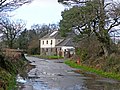
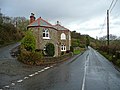
 'Moorcrest' - geograph.org.uk - 6604678.jpg 1,024 × 771; 134 KB
-
 A hedge cutter crosses Mill Bridge on the river Yeo - geograph.org.uk - 3810941.jpg 1,600 × 1,200; 939 KB
-

-
 A386 - Entrance to Hallsannery House - geograph.org.uk - 5478980.jpg 2,136 × 1,416; 1.35 MB
-
 Above Heale House - geograph.org.uk - 6605352.jpg 1,024 × 786; 209 KB
-
 An unnamed road crosses the Yeo at Yeo Bridge - geograph.org.uk - 3813928.jpg 1,600 × 1,200; 840 KB
-
 Apps Springs - geograph.org.uk - 667218.jpg 640 × 480; 138 KB
-
 Arable and woodland - geograph.org.uk - 667285.jpg 640 × 307; 39 KB
-
 Arable land near Bideford - geograph.org.uk - 4454911.jpg 800 × 531; 132 KB
-
 Church of St. Swithin, Littleham - geograph.org.uk - 6605343.jpg 773 × 1,024; 222 KB
-
 Converted farm buildings, Littleham Court - geograph.org.uk - 6604513.jpg 1,024 × 768; 163 KB
-
 Cottages at Crossways Littleham - geograph.org.uk - 701148.jpg 640 × 425; 55 KB
-
 Cottages at Littleham Court - geograph.org.uk - 6604493.jpg 1,024 × 768; 157 KB
-
 Crossroads at Littleham - geograph.org.uk - 6605239.jpg 1,024 × 768; 157 KB
-
 Crossway, Littleham - geograph.org.uk - 701158.jpg 640 × 425; 82 KB
-
 Day of the Triffids, Littleham - geograph.org.uk - 6605248.jpg 1,024 × 781; 307 KB
-
 Farmland, above the Yeo Valley - geograph.org.uk - 6606922.jpg 1,024 × 762; 201 KB
-
 Field of stubble above Whitehall House - geograph.org.uk - 6606944.jpg 1,024 × 768; 196 KB
-
 Ford at Jennett's Bridge - geograph.org.uk - 4189135.jpg 3,872 × 2,592; 4.66 MB
-
 Grazing sheep, West Ashridge - geograph.org.uk - 6605739.jpg 1,024 × 808; 177 KB
-
 Groves Cross Cottage - geograph.org.uk - 6604702.jpg 1,024 × 768; 142 KB
-
 Groves Cross Cottage - geograph.org.uk - 667275.jpg 640 × 480; 128 KB
-
 Heale Farm near Littleham, Bideford - geograph.org.uk - 6203346.jpg 5,472 × 2,274; 4.15 MB
-
 Hedge Topping Little Ashridge Triangulation Pillar - geograph.org.uk - 4742249.jpg 4,000 × 3,000; 2.92 MB
-
 Hillside, above Yeo Bridge - geograph.org.uk - 6604748.jpg 1,024 × 768; 278 KB
-
 Junction on the A386 - geograph.org.uk - 5479218.jpg 1,600 × 1,052; 414 KB
-
 Landcross Bridge on A386 - geograph.org.uk - 4323553.jpg 1,600 × 1,200; 1.53 MB
-
 Landcross bridge on the river Yeo viewed from upstream - geograph.org.uk - 3810918.jpg 1,600 × 1,200; 561 KB
-
 Landcross bridge where the A386 crosses the river Yeo - geograph.org.uk - 3810898.jpg 1,600 × 1,063; 558 KB
-
 Lane junction by Orleigh Mills - geograph.org.uk - 5241429.jpg 640 × 514; 105 KB
-
 Lane to West Ashridge - geograph.org.uk - 6605720.jpg 1,024 × 763; 199 KB
-
 Lime kilns by River Torridge (2) - geograph.org.uk - 4323534.jpg 1,600 × 1,200; 1.77 MB
-
 Lime kilns by River Torridge - geograph.org.uk - 4323530.jpg 1,600 × 1,200; 1.15 MB
-
 Limekiln on the River Torridge - geograph.org.uk - 1957288.jpg 640 × 480; 193 KB
-
 Littleham Court - geograph.org.uk - 660864.jpg 640 × 480; 80 KB
-
 Littleham Methodist Church.jpg 640 × 480; 69 KB
-
 Littleham Mill - geograph.org.uk - 670151.jpg 640 × 480; 85 KB
-
 Littleham playing field - geograph.org.uk - 660847.jpg 640 × 480; 100 KB
-
 Littleham Village Hall - geograph.org.uk - 6605347.jpg 1,024 × 746; 138 KB
-
 Littleham village hall - geograph.org.uk - 667214.jpg 640 × 480; 51 KB
-
 Looking down the river Yeo from Landcross Bridge - geograph.org.uk - 3810904.jpg 1,600 × 1,063; 466 KB
-
 Looking down the river Yeo from Mill Bridge - geograph.org.uk - 3810955.jpg 1,600 × 1,200; 467 KB
-
 Looking downstream from Rudha Bridge on the River Yeo - geograph.org.uk - 3812641.jpg 1,600 × 1,200; 917 KB
-
 Looking up the river Yeo from Landcross bridge - geograph.org.uk - 3810912.jpg 1,600 × 1,063; 514 KB
-
 Low tide in the Torridge estuary - geograph.org.uk - 1880450.jpg 640 × 480; 68 KB
-
 Making hay in the sunshine - geograph.org.uk - 6605227.jpg 1,024 × 732; 230 KB
-
 Methodist Church, Littleham - geograph.org.uk - 6605252.jpg 1,024 × 768; 162 KB
-
 Mill Bridge - geograph.org.uk - 1800717.jpg 640 × 480; 100 KB
-
 Mill Bridge on the River Yeo as viewed from upstream - geograph.org.uk - 3810977.jpg 1,600 × 1,200; 819 KB
-
 New thatched cottages - geograph.org.uk - 660863.jpg 640 × 480; 57 KB
-
 Old toll house in the Yeo valley - geograph.org.uk - 1800742.jpg 640 × 480; 92 KB
-
 Ordnance Survey Cut Mark - geograph.org.uk - 4705279.jpg 480 × 640; 92 KB
-
 Overgrown Trig Point, near Heale Farm - geograph.org.uk - 6606936.jpg 1,024 × 768; 202 KB
-
 Phonebox, Littleham - geograph.org.uk - 4497875.jpg 640 × 480; 71 KB
-
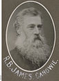 RichardBoucherJames 1870 LaterOf Hallsannery Devon.jpeg 737 × 1,024; 300 KB
-
 River Torridge - geograph.org.uk - 6606953.jpg 1,024 × 723; 183 KB
-
 River Torridge - geograph.org.uk - 6606962.jpg 1,024 × 768; 129 KB
-
 River Yeo - downstream - geograph.org.uk - 667290.jpg 640 × 480; 154 KB
-
 River Yeo - geograph.org.uk - 6604728.jpg 1,024 × 768; 334 KB
-
 River Yeo and Duntz about to join the River Torridge - geograph.org.uk - 5144650.jpg 1,600 × 1,067; 451 KB
-
 River Yeo near Edge Mill - geograph.org.uk - 660842.jpg 640 × 480; 115 KB
-
 Rudha Bridge and Ruhdabridge Farm by the River Yeo - geograph.org.uk - 3812667.jpg 3,095 × 2,321; 3.88 MB
-
 Rudha Bridge on the River Yeo - geograph.org.uk - 3812626.jpg 1,600 × 1,200; 972 KB
-
 Rudha Bridge on the River Yeo - geograph.org.uk - 3812632.jpg 1,600 × 1,200; 924 KB
-
 Rudha Bridge on the River Yeo as seen from downstream - geograph.org.uk - 3812661.jpg 1,600 × 1,200; 879 KB
-
 Scratchface Lane - geograph.org.uk - 6605363.jpg 1,024 × 768; 246 KB
-

-

-

-
 St Swithun, Littleham, churchyard (e) - geograph.org.uk - 4564947.jpg 640 × 480; 127 KB
-

-
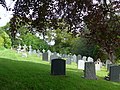 St Swithun, Littleham, churchyard (g) - geograph.org.uk - 4564950.jpg 640 × 480; 129 KB
-

-

-
 St Swithun, Littleham, churchyard (j) - geograph.org.uk - 4564956.jpg 640 × 480; 112 KB
-
 St Swithun, Littleham, churchyard (k) - geograph.org.uk - 4564958.jpg 640 × 480; 125 KB
-

-

-

-
 St Swithun, Littleham, churchyard (q) - geograph.org.uk - 4564961.jpg 640 × 480; 104 KB
-
 Terraced cottages, Littleham - geograph.org.uk - 6605338.jpg 1,024 × 837; 182 KB
-
 The church of St. Swithin, Littleham - geograph.org.uk - 5697356.jpg 6,000 × 4,000; 4.94 MB
-
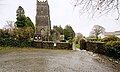 The church of St. Swithun, Littleham - geograph.org.uk - 5697347.jpg 5,976 × 3,608; 6.19 MB
-
 The church of St. Swithun, Littleham - geograph.org.uk - 5697352.jpg 6,000 × 4,000; 4.57 MB
-
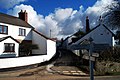
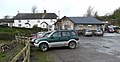 The Crealock Arms - geograph.org.uk - 667267.jpg 640 × 330; 68 KB
-
 The mouth of the Yeo at the River Torridge - geograph.org.uk - 3810888.jpg 1,600 × 1,063; 499 KB
-
 The River Yeo joins the River Torridge - geograph.org.uk - 4275531.jpg 1,024 × 768; 447 KB
-
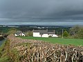
 The Yeo valley - geograph.org.uk - 4437942.jpg 800 × 531; 140 KB
-
 The Yeo Valley - geograph.org.uk - 660840.jpg 640 × 480; 102 KB
-
 Toll House - geograph.org.uk - 667202.jpg 640 × 480; 92 KB
-
 Torridge , The River Torridge - geograph.org.uk - 3355761.jpg 4,288 × 2,848; 4.37 MB
-
 Torridge , The River Yeo - geograph.org.uk - 3355744.jpg 4,288 × 2,848; 5.73 MB
-
 Torridge , The River Yeo - geograph.org.uk - 3594556.jpg 4,288 × 2,848; 6.3 MB
-
 Track and footpath to Littleham church - geograph.org.uk - 667211.jpg 640 × 480; 139 KB
-
 Track to Heale Farm - geograph.org.uk - 6606914.jpg 1,024 × 795; 211 KB
-
 Track to Upcott - geograph.org.uk - 6605734.jpg 1,024 × 768; 280 KB
-
 Turning for Littleham - geograph.org.uk - 6605194.jpg 1,024 × 763; 193 KB
-
 Turning for Orleigh Mills - geograph.org.uk - 6605218.jpg 1,024 × 739; 233 KB
-
 Two oaks - geograph.org.uk - 742850.jpg 640 × 480; 80 KB
-
 View over Yeo Vale - geograph.org.uk - 667272.jpg 640 × 361; 83 KB
-
 View south from Nethercleave - geograph.org.uk - 667198.jpg 640 × 480; 75 KB
-
 View towards Littleham - geograph.org.uk - 6605232.jpg 1,024 × 768; 210 KB
-
 View towards the Yeo valley - geograph.org.uk - 6605694.jpg 1,024 × 768; 185 KB
-
 Woods and pasture above the Yeo Valley - geograph.org.uk - 6605356.jpg 1,024 × 768; 284 KB
-
 Yeo Bridge on the river Yeo as seen from upstream - geograph.org.uk - 3813940.jpg 1,600 × 1,200; 957 KB
-
 Yeo Valley Tollhouse, Littleham - geograph.org.uk - 6114938.jpg 640 × 427; 132 KB


_-_geograph.org.uk_-_4323534.jpg)


_-_geograph.org.uk_-_4564940.jpg)
_-_geograph.org.uk_-_4564941.jpg)
_-_geograph.org.uk_-_4564943.jpg)
_-_geograph.org.uk_-_4564947.jpg)
_-_geograph.org.uk_-_4564948.jpg)
_-_geograph.org.uk_-_4564950.jpg)
_-_geograph.org.uk_-_4564952.jpg)
_-_geograph.org.uk_-_4564953.jpg)
_-_geograph.org.uk_-_4564956.jpg)
_-_geograph.org.uk_-_4564958.jpg)
_-_geograph.org.uk_-_4564967.jpg)
_-_geograph.org.uk_-_4564964.jpg)
_-_geograph.org.uk_-_4564969.jpg)
_-_geograph.org.uk_-_4564961.jpg)


