Category:Littlebourne
Jump to navigation
Jump to search
village and civil parish in Kent, United Kingdom  | |||||
| Upload media | |||||
| Instance of | |||||
|---|---|---|---|---|---|
| Location | Canterbury, Kent, South East England, England | ||||
| Population |
| ||||
| Area |
| ||||
| Said to be the same as | Littlebourne (Wikimedia duplicated page, civil parish) | ||||
 | |||||
Subcategories
This category has the following 8 subcategories, out of 8 total.
Media in category "Littlebourne"
The following 200 files are in this category, out of 444 total.
(previous page) (next page)-
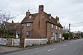
 30, The Hill - geograph.org.uk - 4492186.jpg 2,448 × 3,264; 2.44 MB
-
 77, Bekesbourne Lane - geograph.org.uk - 3694029.jpg 913 × 684; 189 KB
-
 A corner of Elbridge Farm, Littlebourne - geograph.org.uk - 6594697.jpg 640 × 480; 101 KB
-
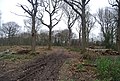
 A crossing of footpaths in Pine Wood - geograph.org.uk - 4492092.jpg 3,264 × 2,448; 3.75 MB
-
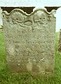
 A pair of Tombs, Church of St Vincent - geograph.org.uk - 5751616.jpg 640 × 426; 106 KB
-

-
 A row of cottages down The Hill - geograph.org.uk - 3694104.jpg 1,077 × 807; 235 KB
-
 A wooded pond - geograph.org.uk - 2835510.jpg 640 × 430; 78 KB
-
 A257 - geograph.org.uk - 2825350.jpg 640 × 430; 62 KB
-
 A257 - geograph.org.uk - 2825351.jpg 640 × 430; 82 KB
-
 A257 - geograph.org.uk - 5831855.jpg 1,024 × 681; 188 KB
-
 A257 - geograph.org.uk - 5831858.jpg 1,024 × 681; 193 KB
-
 A257 - geograph.org.uk - 5831862.jpg 1,024 × 681; 173 KB
-
 A257 towards Canterbury - geograph.org.uk - 6479282.jpg 6,000 × 4,000; 7.37 MB
-
 Accommodation Barn, The Evenhill - geograph.org.uk - 2832842.jpg 640 × 430; 49 KB
-
 Approaching 30mph zone, Littlebourne - geograph.org.uk - 333760.jpg 640 × 480; 251 KB
-
 Approaching Pine Wood - geograph.org.uk - 3723545.jpg 4,320 × 3,240; 4.55 MB
-
 Barn behind The Evenhill Inn - geograph.org.uk - 2782036.jpg 640 × 480; 77 KB
-
 Barn off Nargate St - geograph.org.uk - 2835541.jpg 640 × 430; 63 KB
-
 Barn, Reynolds Place - geograph.org.uk - 5751999.jpg 640 × 426; 75 KB
-
 Bekesbourne Lane, Littlebourne - geograph.org.uk - 4504280.jpg 2,272 × 1,704; 930 KB
-
 Bekesbourne Lane, Littlebourne - geograph.org.uk - 4504293.jpg 2,272 × 1,704; 777 KB
-
 Benchmark, Church of St Vincent - geograph.org.uk - 5751606.jpg 640 × 426; 88 KB
-
 Bluebells in Pine Wood - geograph.org.uk - 2068489.jpg 640 × 480; 230 KB
-
 Brick Kiln Cottage - geograph.org.uk - 2022158.jpg 3,072 × 2,304; 1.95 MB
-
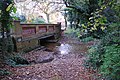
 Bridge near the watercress beds - geograph.org.uk - 2033687.jpg 3,072 × 2,304; 2.32 MB
-
 Bridlegate in Trenleypark Wood - geograph.org.uk - 1963772.jpg 3,072 × 2,304; 1.84 MB
-
 Bridleway from Lower Garrington Farm - geograph.org.uk - 4493851.jpg 3,264 × 2,448; 2.13 MB
-
 Canterbury Road west of Littlebourne - geograph.org.uk - 5446245.jpg 2,304 × 1,728; 1.25 MB
-
 Cattle by Stodmarsh Rd - geograph.org.uk - 1618891.jpg 640 × 421; 110 KB
-
 Cattle near Garrington - geograph.org.uk - 1543942.jpg 640 × 480; 177 KB
-
 Church Cottage - geograph.org.uk - 2022398.jpg 3,072 × 2,304; 1.79 MB
-
 Church of St John - geograph.org.uk - 5751991.jpg 640 × 426; 51 KB
-
 Church of St Vincent - geograph.org.uk - 5751603.jpg 425 × 640; 106 KB
-
 Church of St Vincent - geograph.org.uk - 5751620.jpg 425 × 640; 80 KB
-
 Church of St Vincent - geograph.org.uk - 5751627.jpg 640 × 425; 97 KB
-
 Church of St Vincent - geograph.org.uk - 5751630.jpg 640 × 426; 94 KB
-
 Church of St Vincent - geograph.org.uk - 5751631.jpg 640 × 426; 92 KB
-
 Church Rd - geograph.org.uk - 2832922.jpg 640 × 430; 80 KB
-
 Cleared area of Pine Wood - geograph.org.uk - 2068505.jpg 640 × 480; 217 KB
-
 Clearing for coppicing, Trenleypark Wood - geograph.org.uk - 1618833.jpg 640 × 430; 152 KB
-
 Coachman's Cottage - geograph.org.uk - 2832863.jpg 640 × 430; 83 KB
-
 Conifers by Swanton Lane - geograph.org.uk - 2822630.jpg 640 × 430; 105 KB
-
 Construction of Preston Barns, Bekesbourne Lane - geograph.org.uk - 5255267.jpg 3,264 × 2,448; 3.84 MB
-
 Coppiced area in Firdown Wood - geograph.org.uk - 2091183.jpg 640 × 480; 141 KB
-
 Coppiced section of Trenleypark Wood - geograph.org.uk - 1963803.jpg 3,072 × 2,304; 1.83 MB
-
 Coppiced trees, Trenleypark Wood - geograph.org.uk - 1618806.jpg 640 × 430; 195 KB
-
 Coppiced trees, Trenleypark Wood - geograph.org.uk - 1618817.jpg 640 × 430; 180 KB
-
 Coppicing Oldridge Wood - geograph.org.uk - 2822617.jpg 640 × 430; 126 KB
-
 Coppicing, Pine Wood - geograph.org.uk - 2825331.jpg 640 × 430; 127 KB
-
 Coppicing, Trenleypark Wood - geograph.org.uk - 1618829.jpg 640 × 430; 190 KB
-
 Corner Cottage, High Street - geograph.org.uk - 2782044.jpg 640 × 427; 86 KB
-
 Cottages at 5, 7 ^ 9 The Green - geograph.org.uk - 6478760.jpg 6,000 × 4,000; 6.92 MB
-
 Court Hill off Stodmarsh Rd - geograph.org.uk - 1618885.jpg 537 × 640; 148 KB
-
 Court Hill, Littlebourne - geograph.org.uk - 4502054.jpg 2,272 × 1,704; 828 KB
-
 Cowls at Oast House, The Green - geograph.org.uk - 6478758.jpg 6,000 × 4,000; 7.92 MB
-
 Daffodils and tulips on Nargate Street, Littlebourne - geograph.org.uk - 6433152.jpg 1,920 × 1,280; 1.57 MB
-
 Daffodils on Nargate Street, Littlebourne - geograph.org.uk - 6433151.jpg 1,920 × 1,280; 1.78 MB
-
 Daffodils on Nargate Street, Littlebourne - geograph.org.uk - 6433153.jpg 1,920 × 1,280; 2.1 MB
-
 Dancing trees at Pine Wood - geograph.org.uk - 6479283.jpg 4,000 × 6,000; 7.66 MB
-
 Dead fruit trees next to footpath - geograph.org.uk - 2091169.jpg 640 × 480; 143 KB
-
 Dead orchard trees beside a track - geograph.org.uk - 4488380.jpg 3,264 × 2,448; 3.67 MB
-
 Detached house, Jubilee Rd - geograph.org.uk - 2832892.jpg 640 × 430; 66 KB
-
 Dial Cottage - geograph.org.uk - 2832872.jpg 640 × 430; 59 KB
-
 Dial Cottages - geograph.org.uk - 5751567.jpg 640 × 426; 68 KB
-
 Dying orchard to the W of footpath - geograph.org.uk - 2091163.jpg 640 × 480; 192 KB
-
 Edge of Oldridge Wood - geograph.org.uk - 3723538.jpg 4,320 × 3,240; 4.44 MB
-
-
 Elbridge Hill House, Stodmarsh Road - geograph.org.uk - 1618876.jpg 640 × 430; 132 KB
-
 Elephant in a yard - geograph.org.uk - 2033731.jpg 3,072 × 2,304; 1.66 MB
-
 Elmleigh Road, Littlebourne - geograph.org.uk - 4502066.jpg 2,272 × 1,704; 742 KB
-
 Elridge Hill House - geograph.org.uk - 1963754.jpg 3,072 × 2,304; 2.03 MB
-
 Entering Littlebourne, A257 - geograph.org.uk - 5831865.jpg 1,024 × 681; 207 KB
-
 Entrance to footpath through Pine Wood - geograph.org.uk - 2091443.jpg 480 × 640; 228 KB
-
 Evenhill Rd - geograph.org.uk - 2832819.jpg 640 × 430; 79 KB
-
 Farm buildings on track to Woolton Farm - geograph.org.uk - 2068542.jpg 640 × 480; 135 KB
-

-
 Farm track, Higham Farm - geograph.org.uk - 1618869.jpg 640 × 430; 82 KB
-
-
 Farmland near Oldridge Wood - geograph.org.uk - 2822633.jpg 640 × 430; 57 KB
-
 Field off Swanton Lane - geograph.org.uk - 2046679.jpg 640 × 480; 121 KB
-
 Firdown Wood - geograph.org.uk - 2893312.jpg 640 × 430; 121 KB
-
 Firdown Wood - geograph.org.uk - 2893314.jpg 640 × 430; 125 KB
-
 Flowers along footpath from the A257 - geograph.org.uk - 1882839.jpg 480 × 640; 206 KB
-
 Footpath across a field - geograph.org.uk - 4491992.jpg 3,264 × 2,448; 3.89 MB
-
 Footpath across field - geograph.org.uk - 5751636.jpg 640 × 426; 63 KB
-

-
 Footpath and track junction near Ponds Cottage - geograph.org.uk - 2033777.jpg 3,072 × 2,304; 3.08 MB
-
 Footpath and track to Woolton Farm - geograph.org.uk - 2068548.jpg 640 × 480; 159 KB
-
 Footpath approaching Firdown Wood - geograph.org.uk - 2091173.jpg 640 × 480; 179 KB
-

-
 Footpath crosses Swanton Lane - geograph.org.uk - 2017542.jpg 2,304 × 3,072; 3.24 MB
-
 Footpath from the A257 - geograph.org.uk - 1882895.jpg 480 × 640; 219 KB
-
 Footpath from the church - geograph.org.uk - 2835494.jpg 640 × 430; 57 KB
-
 Footpath in Court Wood (2) - geograph.org.uk - 2033798.jpg 3,072 × 2,304; 3.02 MB
-
 Footpath in Court Wood - geograph.org.uk - 2033791.jpg 2,304 × 3,072; 3.39 MB
-
 Footpath in Firdown Wood - geograph.org.uk - 2033889.jpg 2,304 × 3,072; 3.17 MB
-
 Footpath in Pine Wood - geograph.org.uk - 2017597.jpg 2,304 × 3,072; 3.05 MB
-
 Footpath in Pine Wood - geograph.org.uk - 2022190.jpg 2,304 × 3,072; 2.85 MB
-
 Footpath in Pine Wood - geograph.org.uk - 2825308.jpg 640 × 430; 122 KB
-
 Footpath in Pine Wood - geograph.org.uk - 3723532.jpg 4,320 × 3,240; 5.65 MB
-
 Footpath in Trenleypark Wood - geograph.org.uk - 1963792.jpg 3,072 × 2,304; 2.05 MB
-
 Footpath junction near Jacob's Close - geograph.org.uk - 2033807.jpg 3,072 × 2,304; 3.13 MB
-
 Footpath junction near Pine Wood - geograph.org.uk - 2022175.jpg 3,072 × 2,304; 3.02 MB
-
 Footpath junction near Pump Lake - geograph.org.uk - 2022148.jpg 3,072 × 2,304; 1.54 MB
-
-
 Footpath off Jubilee Rd - geograph.org.uk - 2832899.jpg 640 × 430; 89 KB
-
 Footpath off Jubilee Rd - geograph.org.uk - 2832904.jpg 640 × 430; 65 KB
-
 Footpath on the edge of Court Wood - geograph.org.uk - 2091435.jpg 640 × 480; 188 KB
-
 Footpath through Court Wood - geograph.org.uk - 2091432.jpg 640 × 480; 287 KB
-
 Footpath through Firdown Wood - geograph.org.uk - 2091193.jpg 480 × 640; 211 KB
-

-

-
 Footpath through Pine Wood - geograph.org.uk - 2825317.jpg 640 × 430; 119 KB
-
 Footpath through Pine Woods - geograph.org.uk - 2068526.jpg 640 × 480; 185 KB
-

-
 Footpath through the woods - geograph.org.uk - 1869677.jpg 480 × 640; 170 KB
-
 Footpath through woodland near Fordwich - geograph.org.uk - 1869661.jpg 480 × 640; 151 KB
-
 Footpath tin Trenleypark Wood - geograph.org.uk - 1963822.jpg 2,304 × 3,072; 2.37 MB
-
 Footpath to Firdown Wood and Farthings Wood - geograph.org.uk - 2033846.jpg 3,072 × 2,304; 2.71 MB
-
 Footpath to Pine Wood - geograph.org.uk - 2022138.jpg 3,072 × 2,304; 2.51 MB
-
 Footpath to Pine Wood - geograph.org.uk - 2822631.jpg 640 × 430; 64 KB
-
 Footpath to Pine Wood - geograph.org.uk - 2822637.jpg 640 × 430; 65 KB
-
 Footpath to the A257 through Pine Wood - geograph.org.uk - 2068485.jpg 640 × 480; 190 KB
-
 Footpath towards Firdown Wood - geograph.org.uk - 2033833.jpg 3,072 × 2,304; 1.61 MB
-
 Footpath towards Nargate Street - geograph.org.uk - 2022404.jpg 3,072 × 2,304; 2.03 MB
-
 Footpath towards Pine Wood - geograph.org.uk - 2017547.jpg 3,072 × 2,304; 2.47 MB
-
 Footpath, Firdown Wood - geograph.org.uk - 2893309.jpg 640 × 430; 102 KB
-
 Footpath, Little Stour Farm - geograph.org.uk - 5751641.jpg 640 × 426; 96 KB
-
 Footpath, Oldridge Wood - geograph.org.uk - 2822624.jpg 640 × 430; 144 KB
-
 Footpath, Pine Wood - geograph.org.uk - 2825323.jpg 640 × 430; 118 KB
-
 Footpath, Pine Wood - geograph.org.uk - 2825336.jpg 640 × 430; 117 KB
-
 Footpath, Pine Wood - geograph.org.uk - 2825344.jpg 640 × 430; 114 KB
-
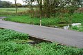 Ford and Depth Gauge near Littlebourne - geograph.org.uk - 3741616.jpg 3,872 × 2,592; 4.8 MB
-
 Ford at Lower Garrington Farm - geograph.org.uk - 3741603.jpg 3,872 × 2,592; 4.86 MB
-
 Gate into an orchard - geograph.org.uk - 4488425.jpg 3,264 × 2,448; 3.9 MB
-
 Gate near Pump Lake - geograph.org.uk - 2022154.jpg 3,072 × 2,304; 1.83 MB
-
 Graves, Church of St Vincent - geograph.org.uk - 5751595.jpg 640 × 426; 121 KB
-
-
 Graveyard, Church of St Vincent - geograph.org.uk - 5751615.jpg 640 × 426; 108 KB
-
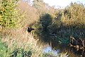 Great Stour - geograph.org.uk - 2789260.jpg 640 × 430; 120 KB
-
 Great Stour - geograph.org.uk - 2792008.jpg 640 × 430; 109 KB
-
 Great Stour - geograph.org.uk - 2792074.jpg 640 × 430; 103 KB
-
 Great Stour Valley - geograph.org.uk - 2792069.jpg 640 × 430; 62 KB
-
 Green Tunnel in Pine Wood - geograph.org.uk - 3723535.jpg 4,320 × 3,240; 4.85 MB
-
 Half-completed fence - geograph.org.uk - 4488408.jpg 3,264 × 2,448; 3.97 MB
-
 Hay Bales, Higham Farm - geograph.org.uk - 1618868.jpg 640 × 430; 136 KB
-
 High Street (A257) in Littlebourne - geograph.org.uk - 4932345.jpg 4,000 × 3,000; 2.67 MB
-
 High Street - geograph.org.uk - 2783175.jpg 640 × 480; 62 KB
-
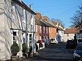
 High Street - geograph.org.uk - 3694056.jpg 1,077 × 807; 214 KB
-
 High Street - geograph.org.uk - 3694077.jpg 913 × 684; 201 KB
-
 High Street - geograph.org.uk - 3694086.jpg 913 × 684; 167 KB
-
 High Street at the junction of Nargate Street - geograph.org.uk - 6420255.jpg 1,868 × 1,196; 1.22 MB
-
 High Street, Littlebourne - geograph.org.uk - 4504306.jpg 2,272 × 1,704; 791 KB
-
 High Street, Littlebourne - geograph.org.uk - 6419786.jpg 1,920 × 1,280; 1.07 MB
-
 High Street, Littlebourne - geograph.org.uk - 6419790.jpg 1,920 × 1,280; 1.66 MB
-
 High Street, Littlebourne - geograph.org.uk - 6423754.jpg 1,920 × 1,280; 1.53 MB
-
 Higham Farm from the Stour Valley Walk - geograph.org.uk - 1618865.jpg 640 × 430; 131 KB
-
 Higham Farm, Littlebourne - geograph.org.uk - 6594533.jpg 640 × 439; 37 KB
-
 Horses in field near Pine Wood - geograph.org.uk - 2068515.jpg 640 × 480; 115 KB
-
 House and garden on Nargate Street, Littlebourne - geograph.org.uk - 6422766.jpg 1,920 × 1,280; 1.54 MB
-
 House on Canterbury Rd - geograph.org.uk - 2825353.jpg 640 × 430; 97 KB
-
 House on the edge of Littlebourne - geograph.org.uk - 5751640.jpg 640 × 426; 78 KB
-
 House, Jubilee Rd - geograph.org.uk - 2832884.jpg 640 × 430; 66 KB
-
 Houses along The Green - geograph.org.uk - 3691562.jpg 1,077 × 807; 230 KB
-
 Houses on The Green - geograph.org.uk - 2782038.jpg 640 × 480; 91 KB
-
 Houses on The Green, Littlebourne - geograph.org.uk - 4510273.jpg 640 × 480; 148 KB
-
 Houses on The Hill, Littlebourne - geograph.org.uk - 5438560.jpg 2,266 × 1,676; 1.11 MB
-
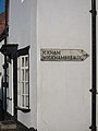 Ickham and Wickhambreaux sign - geograph.org.uk - 2783176.jpg 480 × 640; 61 KB
-
 In Pine Wood - geograph.org.uk - 2825312.jpg 640 × 430; 125 KB
-
 In Pine Wood - geograph.org.uk - 2825319.jpg 640 × 430; 123 KB
-
 In Pine Wood - geograph.org.uk - 3723524.jpg 4,320 × 3,240; 4.78 MB
-
 Jubilee Rd - geograph.org.uk - 2832879.jpg 640 × 430; 59 KB
-
 Jubilee Rd - geograph.org.uk - 5751581.jpg 640 × 426; 60 KB
-
 Jubilee Rd, Church Rd junction - geograph.org.uk - 2832919.jpg 640 × 430; 62 KB
-
 Jubilee Rd, Church Rd junction - geograph.org.uk - 5751585.jpg 640 × 426; 79 KB
-
 Jubilee Road, Littlebourne - geograph.org.uk - 4502060.jpg 2,272 × 1,704; 729 KB
-
 Jubilee Road, Littlebourne - geograph.org.uk - 4504324.jpg 2,272 × 1,704; 738 KB
-
 Jubilee Road, Littlebourne - geograph.org.uk - 4504330.jpg 2,272 × 1,704; 724 KB
-
 King William Day Centre - geograph.org.uk - 2022387.jpg 3,072 × 2,304; 1.85 MB
-
 King William IV, Littlebourne - geograph.org.uk - 4504271.jpg 2,272 × 1,704; 838 KB
-
 Kissing gate - geograph.org.uk - 2835499.jpg 640 × 430; 98 KB
-
 Kissing Gate near Nargate Street - geograph.org.uk - 2022409.jpg 3,072 × 2,304; 2.43 MB
-
 Lane leading towards Pine Wood, Littlebourne - geograph.org.uk - 4502038.jpg 2,272 × 1,704; 822 KB
-
 Layby on Canterbury Road, Littlebourne - geograph.org.uk - 5446246.jpg 2,304 × 1,728; 842 KB
-
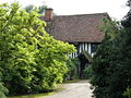
 Lee Priory, Kent - Google Art Project.jpg 4,820 × 3,066; 3.71 MB
-
 Little Stour - geograph.org.uk - 4504258.jpg 2,272 × 1,704; 1.36 MB
-
 Little Stour Farm - geograph.org.uk - 2835513.jpg 640 × 430; 72 KB
-
 A fenced entrance to Oldridge Wood - geograph.org.uk - 333717.jpg 640 × 480; 312 KB
-
 Littlebourne Chapel - geograph.org.uk - 2022394.jpg 3,072 × 2,304; 1.91 MB
-
 Littlebourne church, the north side - geograph.org.uk - 5878282.jpg 640 × 480; 102 KB
-
 Littlebourne church, the south side - geograph.org.uk - 5878283.jpg 640 × 480; 93 KB
-
 Littlebourne Court House - geograph.org.uk - 2832914.jpg 640 × 430; 72 KB
-
 Littlebourne Court House - geograph.org.uk - 5751594.jpg 640 × 426; 108 KB
-
 Littlebourne Ford - geograph.org.uk - 3741626.jpg 3,872 × 2,592; 4.8 MB
-
 Littlebourne House, 2, High Street - geograph.org.uk - 5254241.jpg 3,264 × 2,448; 2.2 MB
-
 Littlebourne Mill - geograph.org.uk - 2835553.jpg 640 × 461; 56 KB
-
 Littlebourne Primary School - geograph.org.uk - 2832928.jpg 640 × 430; 89 KB
-
 Littlebourne recreation field - geograph.org.uk - 2783180.jpg 640 × 480; 120 KB
-
 Littlebourne solar farm - geograph.org.uk - 4492036.jpg 3,264 × 2,448; 3.73 MB


_-_geograph.org.uk_-_2033798.jpg)


_in_Littlebourne_-_geograph.org.uk_-_4932345.jpg)


