Category:Little Waltham
Jump to navigation
Jump to search
English: Little Waltham is a village and civil parish just north of Chelmsford. It is adjacent to the village of Great Waltham. The Domesday Book refers to the two villages as Waltham consisting of several manors. The site of an Iron Age village was excavated before upgrading the main road north between the current villages. The parish contains the hamlet of Chatham Green.

village in Essex, England, UK  | |||||
| Upload media | |||||
| Instance of | |||||
|---|---|---|---|---|---|
| Location | Chelmsford, Essex, East of England, England | ||||
| Population |
| ||||
| Said to be the same as | Little Waltham (Wikimedia duplicated page, civil parish) | ||||
 | |||||
Subcategories
This category has the following 3 subcategories, out of 3 total.
Media in category "Little Waltham"
The following 88 files are in this category, out of 88 total.
-

-
 A boring road near Boreham - geograph.org.uk - 405464.jpg 640 × 428; 396 KB
-
 A130 to Chelmsford - geograph.org.uk - 4970530.jpg 640 × 385; 31 KB
-
 A130, southbound - geograph.org.uk - 4970535.jpg 640 × 272; 35 KB
-

-
 Approaching the end of Essex Regiment Way - geograph.org.uk - 2947693.jpg 1,600 × 1,200; 403 KB
-
 Approaching the end of the A131 - geograph.org.uk - 4970518.jpg 640 × 429; 36 KB
-
 Blasford Hill - panoramio.jpg 2,560 × 1,536; 1.22 MB
-
 Blasford Hill at the junction of Hospital Approach - geograph.org.uk - 2946809.jpg 1,600 × 1,200; 348 KB
-
 Blasford Hill, Little Waltham - geograph.org.uk - 2947696.jpg 1,600 × 1,200; 520 KB
-
 Channels Golf Club, Little Waltham, Essex - geograph.org.uk - 139328.jpg 640 × 480; 105 KB
-
 Chatham Green - geograph.org.uk - 5943403.jpg 5,184 × 3,456; 6.83 MB
-
 Chatham Green - geograph.org.uk - 5947186.jpg 3,776 × 2,520; 3.03 MB
-
 Chelmer tl707127.jpg 2,472 × 3,296; 4.77 MB
-
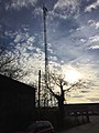 Communication mast - geograph.org.uk - 4349717.jpg 480 × 640; 66 KB
-
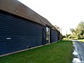 Converted barns at Alstead's Farm - geograph.org.uk - 4207699.jpg 4,320 × 3,240; 3.74 MB
-
 Countryside South of Chatham Green - geograph.org.uk - 5943400.jpg 5,184 × 3,456; 6.72 MB
-
 Crop and Concrete - geograph.org.uk - 1284662.jpg 640 × 428; 64 KB
-
 Croxton's Mill - geograph.org.uk - 6679965.jpg 1,600 × 1,067; 473 KB
-
 Domsey Lane - geograph.org.uk - 6479120.jpg 1,067 × 1,600; 651 KB
-
 Domsey Lane crosses Cranham Road - geograph.org.uk - 3295115.jpg 640 × 480; 94 KB
-
 Essex Way heading North East towards the B1008 - geograph.org.uk - 5943398.jpg 5,184 × 3,456; 5.68 MB
-
 Farmland by the A131, Chatham Green - geograph.org.uk - 2946946.jpg 1,600 × 1,200; 624 KB
-
 Field edge by Drake's Lane - geograph.org.uk - 3295082.jpg 640 × 480; 123 KB
-
 Field edge off the B1008 - geograph.org.uk - 3295331.jpg 640 × 480; 106 KB
-
 Field with footpath - geograph.org.uk - 3358114.jpg 640 × 480; 128 KB
-
 Flooded pit - geograph.org.uk - 809005.jpg 640 × 506; 76 KB
-
 Footpath junction on the Essex Way - geograph.org.uk - 5947183.jpg 3,776 × 2,520; 3.03 MB
-
 Former route of Back Lane - geograph.org.uk - 3295302.jpg 640 × 480; 129 KB
-
 Gated road, disused - geograph.org.uk - 3295122.jpg 640 × 480; 134 KB
-
 Gated road, largely disused - geograph.org.uk - 3295105.jpg 640 × 480; 166 KB
-
 Inside a Pillbox - geograph.org.uk - 1284736.jpg 428 × 640; 75 KB
-
 Land for sale, Little Waltham - geograph.org.uk - 3297238.jpg 640 × 480; 110 KB
-
 Little Belstead's Farm, Back Lane - geograph.org.uk - 3297286.jpg 640 × 480; 99 KB
-
 Little Waltham C of E Primary School - geograph.org.uk - 3295327.jpg 640 × 428; 98 KB
-
 Little Waltham church, north side - geograph.org.uk - 3295311.jpg 640 × 480; 141 KB
-
 Little Waltham Hall - geograph.org.uk - 6679956.jpg 1,600 × 1,067; 442 KB
-
 Little Waltham Sports and Social Club - geograph.org.uk - 3297200.jpg 640 × 428; 110 KB
-

-
 Little Waltham's village pump - geograph.org.uk - 1751375.jpg 3,648 × 2,736; 1.58 MB
-
 Looking over the Chelmer, Little Waltham - geograph.org.uk - 3718719.jpg 3,648 × 2,736; 4.27 MB
-
 MainStreetLittleWaltham.jpg 314 × 235; 34 KB
-
 Parking area on the A131, Chatham Green - geograph.org.uk - 2946941.jpg 1,600 × 1,200; 370 KB
-
 Parking area on the A131, Chatham Green - geograph.org.uk - 2946949.jpg 1,600 × 1,200; 596 KB
-
 Parking area on the A131, Chatham Green - geograph.org.uk - 2946955.jpg 1,600 × 1,200; 398 KB
-
 Parking area on the A131, Chatham Green - geograph.org.uk - 2946957.jpg 1,600 × 1,200; 583 KB
-
 Path and Pillbox - geograph.org.uk - 1284722.jpg 640 × 428; 89 KB
-
 Path to Little Waltham - geograph.org.uk - 1284750.jpg 428 × 640; 74 KB
-
 Path to Little Waltham Meadows Nature Reserve - geograph.org.uk - 3718720.jpg 3,648 × 2,736; 5.36 MB
-
 Phone box, Little Waltham - geograph.org.uk - 3297175.jpg 640 × 480; 150 KB
-
 Pill Box, B1008, Little Waltham - geograph.org.uk - 65349.jpg 640 × 480; 118 KB
-
 RAF - USAAF Boreham Airfield memorial - geograph.org.uk - 6336224.jpg 4,608 × 3,072; 3.66 MB
-
 Remains of former A131 - geograph.org.uk - 6315677.jpg 1,024 × 768; 324 KB
-
 River Chelmer in flood, 1990 - geograph.org.uk - 4785573.jpg 640 × 427; 189 KB
-
 Road north of the site of Boreham Airfield - geograph.org.uk - 6479147.jpg 1,067 × 1,600; 701 KB
-
 Road to Great Leighs via Lyons Hall - geograph.org.uk - 6316067.jpg 1,024 × 768; 307 KB
-
 Roof work on Domsey Lane - geograph.org.uk - 3312643.jpg 640 × 480; 125 KB
-

-
 Roundabout on Essex Regiment Way, Little Waltham - geograph.org.uk - 2947694.jpg 1,600 × 1,200; 518 KB
-
 Roundabout, A130 - geograph.org.uk - 4970524.jpg 640 × 318; 31 KB
-
 Roundabout, A130 - geograph.org.uk - 4970532.jpg 640 × 358; 34 KB
-
 Scurvy Hall lane turning, A131 - geograph.org.uk - 4970511.jpg 640 × 360; 35 KB
-
 Sheepcotes Lane - geograph.org.uk - 6679948.jpg 1,600 × 1,067; 400 KB
-
 St Martin's church, Little Waltham, Essex - geograph.org.uk - 2820418.jpg 3,648 × 2,736; 3.29 MB
-
 Subway under the A130 - geograph.org.uk - 4206776.jpg 4,320 × 3,240; 4.49 MB
-
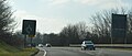
 The A130 - geograph.org.uk - 4970522.jpg 640 × 336; 24 KB
-
 The Chatham Green Diamond Jubilee Wood - geograph.org.uk - 5947194.jpg 3,776 × 2,520; 3.07 MB
-
 The end of Brook Hill, Little Waltham - geograph.org.uk - 6679942.jpg 1,600 × 1,067; 312 KB
-
 The Essex Way 59 - geograph.org.uk - 1903937.jpg 640 × 426; 65 KB
-
 The Essex Way 60 - geograph.org.uk - 1903949.jpg 640 × 426; 82 KB
-
 The Old Rectory, Little Waltham - geograph.org.uk - 3297280.jpg 640 × 480; 122 KB
-
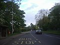
 The Street, Little Waltham - geograph.org.uk - 2041806.jpg 4,000 × 3,000; 2.86 MB
-
 The Street, Little Waltham - geograph.org.uk - 4206766.jpg 4,320 × 3,240; 4.02 MB
-
 The White Hart, The Street, Little Waltham - geograph.org.uk - 2041800.jpg 4,000 × 3,000; 2.94 MB
-
 View north from Drakes Lane - geograph.org.uk - 6479109.jpg 1,600 × 1,067; 372 KB
-
 Village Sign, Little Waltham - geograph.org.uk - 4206738.jpg 3,864 × 2,941; 4.62 MB
-
 Whitbreads Farm Lane - geograph.org.uk - 5943404.jpg 5,184 × 3,456; 5.01 MB
-
 Windmill Inn, Chatham Green - geograph.org.uk - 5943407.jpg 5,184 × 3,456; 6.11 MB
-
 Wood House Lodge - geograph.org.uk - 3295363.jpg 640 × 428; 132 KB
-
 Woodhouse Lane - geograph.org.uk - 3297145.jpg 640 × 480; 198 KB
-
 Blasford Hill Fishery - geograph.org.uk - 364190.jpg 640 × 487; 98 KB
-
 Croxton's Mill - geograph.org.uk - 364215.jpg 640 × 491; 81 KB
-
 Croxton's Mill, Essex - geograph.org.uk - 147303.jpg 640 × 480; 87 KB
-
 Drakes Lane by Drakes Farm - geograph.org.uk - 247255.jpg 640 × 480; 93 KB
-
 Fallen Willow - geograph.org.uk - 446260.jpg 640 × 460; 123 KB
-

-

-


