Category:Little Thurlow
Jump to navigation
Jump to search
English: Little Thurlow is a village and civil parish in the St Edmundsbury district of Suffolk in eastern England. Located around a mile north-east of sister village Great Thurlow, and four miles north of Haverhill, in 2005 its population was 230.
village and civil parish in Suffolk, United Kingdom  | |||||
| Upload media | |||||
| Instance of | |||||
|---|---|---|---|---|---|
| Location |
| ||||
| Population |
| ||||
 | |||||
Subcategories
This category has the following 7 subcategories, out of 7 total.
C
- The Cock, Little Thurlow (2 F)
G
- Little Thurlow Green (3 F)
L
- Low Farm, Little Thurlow (4 F)
P
T
- Temple End, Suffolk (4 F)
V
- Little Thurlow Village Sign (6 F)
Media in category "Little Thurlow"
The following 68 files are in this category, out of 68 total.
-
 A log in a field - geograph.org.uk - 5922413.jpg 1,200 × 900; 354 KB
-
 A track leading to Wadgell's Wood - geograph.org.uk - 1209941.jpg 640 × 443; 90 KB
-
 Agricultural heap by Broad Road - geograph.org.uk - 5597448.jpg 640 × 480; 113 KB
-
 Alms Houses, Little Thurlow, Suffolk - geograph.org.uk - 48969.jpg 640 × 439; 94 KB
-
 Artwork - geograph.org.uk - 2481020.jpg 1,024 × 768; 154 KB
-
 Barn on Temple End Farm - geograph.org.uk - 5922417.jpg 1,200 × 900; 322 KB
-
 Blacksmith's Cottage - geograph.org.uk - 5922085.jpg 1,200 × 866; 319 KB
-
 Broad Road - geograph.org.uk - 2023193.jpg 1,600 × 1,200; 929 KB
-
 Broad Road - geograph.org.uk - 3752281.jpg 1,024 × 768; 222 KB
-
 Broad Road looking east - geograph.org.uk - 5343260.jpg 640 × 480; 93 KB
-
 Broad Road looking east - geograph.org.uk - 5922262.jpg 1,200 × 900; 359 KB
-
 Converted Barn - geograph.org.uk - 2481019.jpg 1,024 × 768; 172 KB
-
 Cottage on Thurlow Road - geograph.org.uk - 5922074.jpg 1,200 × 900; 273 KB
-
 Cottages in Little Thurlow - geograph.org.uk - 5922385.jpg 1,200 × 900; 276 KB
-
 Country Road - geograph.org.uk - 2849710.jpg 1,024 × 768; 151 KB
-
 Cuylers, Little Thurlow - geograph.org.uk - 5922405.jpg 1,200 × 900; 232 KB
-
 Dry Ford - geograph.org.uk - 2503839.jpg 1,024 × 768; 288 KB
-
 Farm Track - geograph.org.uk - 2849718.jpg 1,024 × 768; 227 KB
-
 Farm track, Little Thurlow - geograph.org.uk - 5597500.jpg 640 × 480; 122 KB
-
 Field at Temple End - geograph.org.uk - 5922422.jpg 1,200 × 900; 249 KB
-
 Field by Temple End Road - geograph.org.uk - 4719243.jpg 2,560 × 1,920; 2.02 MB
-
 Field by Temple End Road - geograph.org.uk - 4719251.jpg 2,560 × 1,920; 1.67 MB
-
 Footpath to Little Bradley - geograph.org.uk - 2023324.jpg 1,600 × 1,200; 1.1 MB
-
 Ford at Little Thurlow - geograph.org.uk - 1067209.jpg 640 × 427; 120 KB
-
 Ford, Little Thurlow - geograph.org.uk - 5597455.jpg 640 × 480; 183 KB
-
 Former school house, Little Thurlow - geograph.org.uk - 5343216.jpg 640 × 480; 146 KB
-
 Great Thurlow Historical Map.png 953 × 720; 1.31 MB
-

-
 Lane, Little Thurlow - geograph.org.uk - 5597492.jpg 640 × 480; 137 KB
-
 Larkspur Cottage, Little Thurlow - geograph.org.uk - 5922392.jpg 1,200 × 900; 299 KB
-
 Little Thurlow churchyard in late autumn - geograph.org.uk - 5205529.jpg 1,024 × 768; 1.14 MB
-
 Little Thurlow Ford - geograph.org.uk - 3029604.jpg 3,264 × 2,448; 4.81 MB
-
 Little Thurlow in late autumn - geograph.org.uk - 5205522.jpg 1,024 × 1,024; 1.08 MB
-
 Little Thurlow Map View.PNG 932 × 527; 954 KB
-
 Little Thurlow village sign - geograph.org.uk - 6663339.jpg 3,072 × 3,072; 2.72 MB
-
 Little Thurlow village sign - geograph.org.uk - 6663341.jpg 3,072 × 3,072; 1.83 MB
-
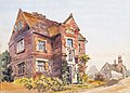 Little Thurlow – Grammar School of Sir John Soane - Augustus Hare - ref Hare-33712.jpg 2,250 × 1,620; 853 KB
-
 Little Thurlow, Church Road and a pollarded tree - geograph.org.uk - 5205517.jpg 1,024 × 768; 1.15 MB
-
 Little Thurlow, Pound Green ford - geograph.org.uk - 5205511.jpg 819 × 1,024; 1.31 MB
-
 Little Thurlow, Pound Green in autumn - geograph.org.uk - 5205501.jpg 731 × 1,024; 1.36 MB
-
 Little Thurlow, the ford at Pound Green - geograph.org.uk - 5205488.jpg 1,024 × 732; 1.23 MB
-
 Little Thurlow, the Stour Valley - geograph.org.uk - 5205453.jpg 1,024 × 765; 803 KB
-

-
 Low Farm - geograph.org.uk - 2849668.jpg 1,024 × 768; 164 KB
-
 Minor Road - geograph.org.uk - 2849724.jpg 768 × 1,024; 225 KB
-
 Park Tuft - geograph.org.uk - 2156070.jpg 1,600 × 1,200; 1.41 MB
-
 Park Turf - geograph.org.uk - 2849693.jpg 1,024 × 768; 240 KB
-
 Park Turf - geograph.org.uk - 2849700.jpg 1,024 × 768; 206 KB
-
 Pump And Post Box - geograph.org.uk - 2503818.jpg 1,200 × 1,600; 492 KB
-
 River Stour at Little Thurlow - geograph.org.uk - 5230514.jpg 2,592 × 1,944; 2.9 MB
-
 River Stour at Little Thurlow - geograph.org.uk - 5922094.jpg 1,200 × 900; 409 KB
-

-

-
 Temple End Farm - geograph.org.uk - 5343171.jpg 640 × 428; 154 KB
-
 Temple End road - geograph.org.uk - 1460063.jpg 640 × 480; 113 KB
-
 Temple End road - geograph.org.uk - 2158531.jpg 1,600 × 1,200; 1.33 MB
-
 Temple End Road - geograph.org.uk - 4719241.jpg 2,560 × 1,920; 1.43 MB
-
 Temple End road past Low Farm - geograph.org.uk - 2158537.jpg 1,600 × 1,200; 950 KB
-
 Temple End Stream and hillside - geograph.org.uk - 1067196.jpg 640 × 427; 89 KB
-

-
 The Old Inn, Little Thurlow Green - geograph.org.uk - 5922256.jpg 1,200 × 857; 381 KB
-
 Thurlow borehole - geograph.org.uk - 817430.jpg 640 × 541; 81 KB
-
 Thurlow sewage works - geograph.org.uk - 817431.jpg 640 × 426; 86 KB
-
 Towards Temple End - geograph.org.uk - 5496098.jpg 1,024 × 768; 970 KB
-
 Track from Temple End road - geograph.org.uk - 1460048.jpg 640 × 480; 132 KB
-
 Village scene in Great Thurlow - geograph.org.uk - 4450439.jpg 1,024 × 768; 423 KB
-
 Wheat field off Broad Road - geograph.org.uk - 2023186.jpg 1,600 × 1,200; 581 KB
-
 Yellow fields - geograph.org.uk - 5597502.jpg 640 × 480; 142 KB


