Category:Little Plumstead
Jump to navigation
Jump to search
village and former civil parish in Norfolk, UK  | |||||
| Upload media | |||||
| Instance of |
| ||||
|---|---|---|---|---|---|
| Location | Great and Little Plumstead, Broadland, Norfolk, East of England, England | ||||
 | |||||
Subcategories
This category has the following 3 subcategories, out of 3 total.
Media in category "Little Plumstead"
The following 52 files are in this category, out of 52 total.
-
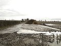
 A stagnant body of water - geograph.org.uk - 917295.jpg 480 × 640; 132 KB
-
 An ornamental bridge - geograph.org.uk - 917290.jpg 480 × 640; 187 KB
-
 Approaching Little Plumstead - geograph.org.uk - 685800.jpg 640 × 480; 165 KB
-
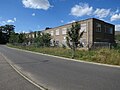 Boarded up building, Little Plumstead Hospital - geograph.org.uk - 5067782.jpg 1,600 × 1,200; 723 KB
-
 Boarded up building, Little Plumstead Hospital - geograph.org.uk - 5067803.jpg 1,600 × 1,200; 725 KB
-
 Boarded up building, Little Plumstead Hospital - geograph.org.uk - 5067804.jpg 1,600 × 1,200; 630 KB
-
 Boarded up building, Little Plumstead Hospital - geograph.org.uk - 5067809.jpg 1,600 × 1,200; 927 KB
-

-
 Bus shelter - geograph.org.uk - 685789.jpg 480 × 640; 144 KB
-
 Cycleway - geograph.org.uk - 685815.jpg 640 × 480; 131 KB
-
 Demolition at Little Plumstead Hospital - geograph.org.uk - 5067795.jpg 1,600 × 1,200; 732 KB
-
 Demolition at Little Plumstead Hospital - geograph.org.uk - 5067799.jpg 1,600 × 1,200; 832 KB
-
-
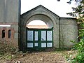
 Gated entrance - geograph.org.uk - 916462.jpg 480 × 640; 181 KB
-
 Gated entrance to Pond Plantation - geograph.org.uk - 917302.jpg 480 × 640; 155 KB
-
 Gated track - geograph.org.uk - 916455.jpg 480 × 640; 157 KB
-

-
 Hospital building - geograph.org.uk - 685940.jpg 640 × 480; 132 KB
-
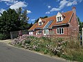
 Houses, Little Plumstead Hospital site - geograph.org.uk - 5067823.jpg 1,600 × 1,200; 458 KB
-

-
 House at Aspinall Concrete Products - geograph.org.uk - 1253301.jpg 640 × 427; 88 KB
-
 Little Plumstead - village sign - geograph.org.uk - 685766.jpg 480 × 640; 163 KB
-
 Little Plumstead Primary School - geograph.org.uk - 916428.jpg 640 × 447; 173 KB
-
 Little Plumstead village sign - geograph.org.uk - 4295934.jpg 480 × 640; 110 KB
-
 New house, Little Plumstead - geograph.org.uk - 5070210.jpg 1,600 × 1,200; 934 KB
-
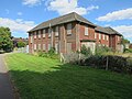
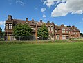
 Old Hall, Little Plumstead Hospital - geograph.org.uk - 5067790.jpg 1,600 × 1,200; 613 KB
-
 Old Hall, Little Plumstead Hospital - geograph.org.uk - 5067819.jpg 1,600 × 1,222; 722 KB
-
 Padlocked gate - geograph.org.uk - 916470.jpg 480 × 640; 185 KB
-
 Playing field, Little Plumstead - geograph.org.uk - 5070215.jpg 1,600 × 1,200; 794 KB
-
 Plumstead Hospital - geograph.org.uk - 36282.jpg 480 × 640; 100 KB
-
-
 Redundant telephone kiosk - geograph.org.uk - 920061.jpg 426 × 640; 153 KB
-
 Remains of an ancient tree - geograph.org.uk - 685917.jpg 640 × 480; 159 KB
-

-

-
 Sandhole Lane, Little Plumstead - geograph.org.uk - 5070208.jpg 1,600 × 1,200; 805 KB
-

-
 Stanford Crescent - geograph.org.uk - 685772.jpg 640 × 480; 109 KB
-

-
 The Broadland Clinic - geograph.org.uk - 685950.jpg 612 × 455; 116 KB
-

-

-
 This way to the showhomes - geograph.org.uk - 685842.jpg 640 × 480; 115 KB
-
 View north along Witton Lane - geograph.org.uk - 916435.jpg 480 × 640; 151 KB
-
 View south along Witton Lane - geograph.org.uk - 916473.jpg 480 × 640; 148 KB
-
 Village Stores - geograph.org.uk - 920053.jpg 640 × 465; 110 KB
-

-
 Kevill Davis Drive - geograph.org.uk - 685833.jpg 640 × 480; 85 KB
-
 MacMillan Way - geograph.org.uk - 685860.jpg 640 × 480; 83 KB
-
 New construction - geograph.org.uk - 685975.jpg 640 × 480; 124 KB
-
 New housing - geograph.org.uk - 685871.jpg 640 × 480; 79 KB
-
 The village of Little Plumstead - geograph.org.uk - 685782.jpg 640 × 480; 101 KB


