Category:Little Munden
Jump to navigation
Jump to search
civil parish in Hertfordshire, England | |||||
| Upload media | |||||
| Instance of | |||||
|---|---|---|---|---|---|
| Location | East Hertfordshire, Hertfordshire, East of England, England | ||||
 | |||||
Subcategories
This category has the following 4 subcategories, out of 4 total.
Media in category "Little Munden"
The following 59 files are in this category, out of 59 total.
-
 A rolling field - geograph.org.uk - 4627035.jpg 640 × 480; 171 KB
-
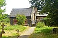
 All Saints Church, Little Munden - geograph.org.uk - 5058817.jpg 1,600 × 1,432; 703 KB
-
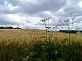 Barley field and giant hog weed - geograph.org.uk - 4533986.jpg 4,320 × 3,240; 4.11 MB
-
 Black sheep grazing near High Trees Farm - geograph.org.uk - 4534008.jpg 4,320 × 3,240; 4.21 MB
-
 Bungalow on Munden Road, Dane End - geograph.org.uk - 4669370.jpg 2,560 × 1,920; 2.13 MB
-
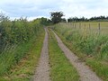 Byway to High Trees Farm - geograph.org.uk - 4534003.jpg 4,320 × 3,240; 3.49 MB
-
 Country house in Haultwick - geograph.org.uk - 4664934.jpg 2,560 × 1,920; 1.46 MB
-
 Dane End Tributary - geograph.org.uk - 194270.jpg 640 × 480; 102 KB
-
 Dane End village - geograph.org.uk - 4665573.jpg 2,544 × 1,898; 1.54 MB
-
 Entering Whempstead - geograph.org.uk - 2836581.jpg 1,600 × 1,200; 560 KB
-
 Entrance to field by Whempstead Lane - geograph.org.uk - 2836439.jpg 1,600 × 1,200; 575 KB
-
 Field by Sacombe Pound - geograph.org.uk - 4669367.jpg 2,560 × 1,920; 1.97 MB
-
 Field by The Street, Haultwick - geograph.org.uk - 4669377.jpg 2,560 × 1,920; 2.16 MB
-
 Field by Whempstead Lane - geograph.org.uk - 2836445.jpg 1,600 × 1,200; 496 KB
-
 Ford at King's Hill near Haultwick - geograph.org.uk - 3373750.jpg 3,872 × 2,592; 2.27 MB
-
 Giant hog weed in the verge - geograph.org.uk - 4533977.jpg 640 × 480; 66 KB
-
 Giffords Lane, Nasty - geograph.org.uk - 2836577.jpg 1,600 × 1,200; 608 KB
-
 Haultwick Hall seen from the road from Rush Green - geograph.org.uk - 2997593.jpg 2,560 × 1,920; 1.03 MB
-
 Junction of Munden Road and Whempstead Lane - geograph.org.uk - 2835941.jpg 1,600 × 1,200; 349 KB
-
 Junction on Munden Road, Dane End - geograph.org.uk - 4664936.jpg 2,560 × 1,920; 1.46 MB
-
 Lane to Levens Green - geograph.org.uk - 4533996.jpg 4,320 × 3,240; 4.77 MB
-
 Levens Green, Beggarman's Lane - geograph.org.uk - 4174654.jpg 640 × 480; 120 KB
-
 Levens Green, Beggarman's Lane - geograph.org.uk - 4174715.jpg 640 × 480; 67 KB
-
 Levens Green, Beggarman's Wood - geograph.org.uk - 4174659.jpg 640 × 480; 132 KB
-
 Little close in Dane End - geograph.org.uk - 4665590.jpg 2,490 × 1,824; 1.3 MB
-
 Little Munden church - geograph.org.uk - 4627029.jpg 640 × 480; 154 KB
-
 Little Munden Memorial Hall, Dane End - geograph.org.uk - 5059310.jpg 1,600 × 1,286; 480 KB
-
 Little Munden Primary School - geograph.org.uk - 5059240.jpg 1,600 × 1,201; 585 KB
-
 Little Munden Primary School - geograph.org.uk - 5059294.jpg 1,600 × 1,067; 536 KB
-
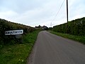 Minor road into Haultwick - geograph.org.uk - 3445199.jpg 4,320 × 3,240; 3.18 MB
-
 Munden Road, Dane End - geograph.org.uk - 4664937.jpg 2,560 × 1,920; 1.27 MB
-
 Munden Road, Dane End - geograph.org.uk - 4665577.jpg 2,560 × 1,920; 2.02 MB
-
 Munden Road, Dane End - geograph.org.uk - 4669368.jpg 2,560 × 1,920; 2.01 MB
-
 Munden Road, Dane End - geograph.org.uk - 4669371.jpg 2,560 × 1,920; 1.98 MB
-
 Near White Hill Farm - geograph.org.uk - 4533974.jpg 4,320 × 3,240; 5.83 MB
-
 Old Bourne above Whempstead Lane - geograph.org.uk - 3655732.jpg 640 × 427; 102 KB
-

-
 Potter's Hall - geograph.org.uk - 282360.jpg 640 × 428; 149 KB
-
 Road junction, Potters Green - geograph.org.uk - 4627041.jpg 640 × 480; 162 KB
-
 Rowney Priory - geograph.org.uk - 282365.jpg 640 × 428; 155 KB
-
 Sacombe, Rowney Lane - geograph.org.uk - 4174641.jpg 640 × 480; 118 KB
-

-
 Sign for the Rest and Welcome pub, Haultwick - geograph.org.uk - 4669376.jpg 2,406 × 1,692; 1.09 MB
-
 The fields around Dane End - geograph.org.uk - 1214412.jpg 640 × 480; 70 KB
-
 The Rest and Welcome (closed) - geograph.org.uk - 4627008.jpg 640 × 480; 126 KB
-
 The Rest and Welcome (closed) - geograph.org.uk - 4664935.jpg 2,560 × 1,920; 1.47 MB
-
 The road to Haultwick from Dane End - geograph.org.uk - 4669373.jpg 2,560 × 1,920; 1.4 MB
-
 The road to Haultwick from Dane End - geograph.org.uk - 4669375.jpg 2,354 × 1,602; 1.57 MB
-
 The Street, Haultwick - geograph.org.uk - 4669378.jpg 2,560 × 1,920; 2.02 MB
-
 The Street, Haultwick - geograph.org.uk - 4669379.jpg 2,560 × 1,920; 1.88 MB
-
 The Street, Haultwick - geograph.org.uk - 4670154.jpg 2,560 × 1,920; 1.36 MB
-
 Thistles colonising, Brookfield Common - geograph.org.uk - 3986938.jpg 4,320 × 3,240; 5.93 MB
-
 Triangular Junction near Green End - geograph.org.uk - 215648.jpg 640 × 480; 136 KB
-
 Turn right to Haultwick - geograph.org.uk - 4665625.jpg 2,560 × 1,920; 1.4 MB
-
 Valley of Dane End Tributary - geograph.org.uk - 3986927.jpg 4,320 × 3,240; 5.71 MB
-
 Vanfit - geograph.org.uk - 215643.jpg 640 × 480; 102 KB
-
 View WNW from Rowney Lane - geograph.org.uk - 4627065.jpg 640 × 480; 121 KB
-
 Whempstead Lane crossing a drainage ditch - geograph.org.uk - 2836437.jpg 1,600 × 1,200; 536 KB
-
 Whempstead village passing Whempstead farm - geograph.org.uk - 2836582.jpg 1,600 × 1,200; 539 KB


_-_geograph.org.uk_-_4627008.jpg)
_-_geograph.org.uk_-_4664935.jpg)


