Category:Little Maplestead
Jump to navigation
Jump to search
English: Little Maplestead is a village and civil parish in the Braintree district, in the county of Essex, England.
village and civil parish in Essex, United Kingdom  | |||||
| Upload media | |||||
| Instance of | |||||
|---|---|---|---|---|---|
| Location | Braintree, Essex, East of England, England | ||||
| Population |
| ||||
 | |||||
Subcategories
This category has the following 2 subcategories, out of 2 total.
H
- Little Maplestead Hall (3 F)
Media in category "Little Maplestead"
The following 52 files are in this category, out of 52 total.
-
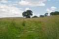
 A bridleway, viewed from Hampers Lane - geograph.org.uk - 2256280.jpg 3,648 × 2,736; 2.99 MB
-
 Arable land near Park's Farm, Little Maplestead - geograph.org.uk - 4982636.jpg 3,648 × 2,736; 3.01 MB
-
 Bridleway Near Little Mpalestead - geograph.org.uk - 5891350.jpg 3,888 × 2,592; 2.09 MB
-
 Church Road, Little Maplestead - geograph.org.uk - 6296822.jpg 4,000 × 3,000; 4.67 MB
-
 Entering Little Maplestead - geograph.org.uk - 3792449.jpg 640 × 480; 94 KB
-
 Entrance To Park's Farm - geograph.org.uk - 4651158.jpg 1,024 × 768; 308 KB
-
 Exercise track around horse paddock, Little Maplestead - geograph.org.uk - 4982635.jpg 3,648 × 2,736; 2.73 MB
-

-
 Field margin near sweetcorn crop, Little Maplestead - geograph.org.uk - 5113677.jpg 3,648 × 2,255; 4.18 MB
-
 Footpath leading off Pebmarsh Road - geograph.org.uk - 4943119.jpg 3,786 × 3,027; 2.61 MB
-
 Footpath near Mill Farm, Great Maplestead - geograph.org.uk - 5021374.jpg 3,648 × 2,432; 3.14 MB
-
 Footpath Sign - geograph.org.uk - 4651149.jpg 1,024 × 768; 294 KB
-

-
 Hedgerow west of Oak Road - geograph.org.uk - 6701263.jpg 1,024 × 768; 451 KB
-

-
 Lane alongside Seven Acre Wood - geograph.org.uk - 4942896.jpg 4,608 × 3,456; 3.33 MB
-
 Lane alongside The Grove - geograph.org.uk - 4943134.jpg 4,608 × 3,456; 3.56 MB
-
 Lane Near Little Maplestead - geograph.org.uk - 5891339.jpg 3,888 × 2,592; 4.54 MB
-
 Line of trees in arable field, Little Maplestead - geograph.org.uk - 5113685.jpg 3,648 × 2,255; 3.47 MB
-

-
 Little Maplestead, Angle Shades moth - geograph.org.uk - 4538438.jpg 2,452 × 1,640; 2.1 MB
-
 Looking across Church Road, Little Maplestead - geograph.org.uk - 6296501.jpg 4,000 × 3,000; 4.65 MB
-

-
 Mill Lane - geograph.org.uk - 4372103.jpg 640 × 480; 187 KB
-
 Mill Lane - geograph.org.uk - 4660277.jpg 768 × 1,024; 231 KB
-
 Minor Road Footpath - geograph.org.uk - 5292018.jpg 1,024 × 768; 291 KB
-
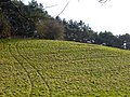
 Muddy field corner - geograph.org.uk - 4368230.jpg 640 × 480; 125 KB
-
 Oak Road - geograph.org.uk - 6701272.jpg 1,024 × 768; 368 KB
-
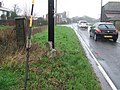
 Old Milestone - geograph.org.uk - 2288098.jpg 1,200 × 1,600; 879 KB
-
 Pasture near Bennett's Farm, Little Maplestead - geograph.org.uk - 5021380.jpg 3,648 × 2,432; 2.93 MB
-
 Pebmarsh Road - geograph.org.uk - 4941989.jpg 4,608 × 3,456; 3.34 MB
-
 Pebmarsh Road - geograph.org.uk - 4943113.jpg 4,608 × 3,456; 3.62 MB
-
 Public footpath to Little Maplestead parish church - geograph.org.uk - 2256272.jpg 3,585 × 2,593; 1.11 MB
-
 Rural lane past Pearman's Hill - geograph.org.uk - 3048097.jpg 640 × 439; 201 KB
-
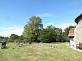
 St John the Baptist at Little Maplestead - geograph.org.uk - 6296824.jpg 4,000 × 3,000; 4.75 MB
-
 St John the Baptist at Little Maplestead - geograph.org.uk - 6296830.jpg 4,000 × 3,000; 4.76 MB
-

-
-

-
 Sudbury To Halstead - geograph.org.uk - 2288094.jpg 1,600 × 1,200; 643 KB
-
 The drive to Little Lodge Farm - geograph.org.uk - 6296498.jpg 4,000 × 3,000; 4.9 MB
-

-
 Track across the grass - geograph.org.uk - 4372095.jpg 640 × 480; 143 KB
-
 Tree by the road - geograph.org.uk - 4368205.jpg 640 × 480; 94 KB
-
 Trigpoint - geograph.org.uk - 4651209.jpg 1,024 × 768; 237 KB
-

-
 View from Church Road, Little Maplestead - geograph.org.uk - 6296506.jpg 4,000 × 3,000; 5.09 MB
-

-

-
 Water Tower - geograph.org.uk - 4651218.jpg 768 × 1,024; 129 KB
-
 Woodland and meadows by Bennett's Farm - geograph.org.uk - 3048094.jpg 640 × 480; 175 KB
-
 Young Ash Tree, Little Maplestead - geograph.org.uk - 1095488.jpg 480 × 640; 122 KB


