Category:Little Hale
Jump to navigation
Jump to search
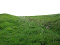
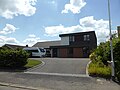
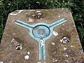
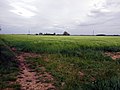
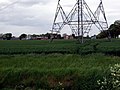
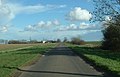
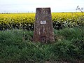
English: Little Hale is a hamlet and civil parish of around 60 houses located directly south of the larger villages of Great Hale and Heckington, 5 miles from the town of Sleaford in Lincolnshire. Little Hale is located on the eastern western edge of the Lincolnshire Fens. Adjacent villages include Burton Pedwardine, Great Hale and Helpringham.
human settlement in United Kingdom  | |||||
| Upload media | |||||
| Instance of | |||||
|---|---|---|---|---|---|
| Location | North Kesteven, Lincolnshire, East Midlands, England | ||||
| Population |
| ||||
 | |||||
Media in category "Little Hale"
The following 102 files are in this category, out of 102 total.
-
 A Track, Drain and Power Lines head North-West - geograph.org.uk - 2752143.jpg 1,237 × 797; 765 KB
-
 Alongside Helpringham Eau - geograph.org.uk - 4460628.jpg 1,024 × 730; 112 KB
-
 Any old iron - geograph.org.uk - 4465116.jpg 1,024 × 768; 286 KB
-
 Broardhurst Farm - geograph.org.uk - 4460526.jpg 1,024 × 768; 347 KB
-
 Burton Road - geograph.org.uk - 1741717.jpg 640 × 426; 74 KB
-
 Burton Road - geograph.org.uk - 1741723.jpg 426 × 640; 77 KB
-
 Burton Road towards First Farm - geograph.org.uk - 3161770.jpg 2,256 × 1,504; 935 KB
-
 Churches in a Landscape - geograph.org.uk - 6203572.jpg 4,896 × 3,672; 6.27 MB
-
 Commemorative lintel - geograph.org.uk - 6200379.jpg 4,896 × 3,672; 6.59 MB
-
 Corrugated iron barn - geograph.org.uk - 4472169.jpg 1,024 × 768; 132 KB
-
 Course of the Car Dyke - geograph.org.uk - 4460586.jpg 1,024 × 768; 230 KB
-
 Course of the Car Dyke - geograph.org.uk - 4460645.jpg 1,024 × 768; 202 KB
-
 Defibrillator and books - geograph.org.uk - 6201886.jpg 4,896 × 3,672; 6.39 MB
-
 Derelict workshops - geograph.org.uk - 4472175.jpg 1,024 × 659; 118 KB
-
 Drain in Little Hale Fen - geograph.org.uk - 4472088.jpg 1,024 × 768; 204 KB
-
 Drain in Little Hale Fen - geograph.org.uk - 4472128.jpg 1,024 × 768; 160 KB
-
 Earthen Bank - geograph.org.uk - 6200684.jpg 4,896 × 3,672; 6.9 MB
-
 Electricity substation - geograph.org.uk - 6200369.jpg 4,896 × 3,672; 6.62 MB
-
 Farm buildings and Old Forty Foot Bank - geograph.org.uk - 4460614.jpg 1,024 × 768; 166 KB
-
 Farm in Little Hale Fen - geograph.org.uk - 4460606.jpg 1,024 × 766; 104 KB
-
 Farm in Little Hale Fen - geograph.org.uk - 4472155.jpg 1,024 × 768; 118 KB
-
 Farm on Little Hale Fen - geograph.org.uk - 6200669.jpg 4,896 × 3,672; 6.78 MB
-
 Fen Road - geograph.org.uk - 4460651.jpg 1,024 × 768; 194 KB
-
 Fenland landscape - geograph.org.uk - 4465140.jpg 1,024 × 768; 188 KB
-
 Field boundary off Burton Road - geograph.org.uk - 6189822.jpg 1,024 × 768; 183 KB
-

-
 Former phone box - geograph.org.uk - 6201884.jpg 3,672 × 4,896; 5.95 MB
-
 Glebe Farm, Little Hale Fen - geograph.org.uk - 4460630.jpg 1,024 × 768; 181 KB
-
 Hard standing - geograph.org.uk - 4472082.jpg 1,024 × 768; 172 KB
-
 Helpringham's spire across the fields - geograph.org.uk - 6375675.jpg 4,896 × 3,672; 5.99 MB
-
 Home-made pillar box - geograph.org.uk - 6200361.jpg 3,672 × 4,896; 6.18 MB
-
 Infill construction - geograph.org.uk - 6203599.jpg 4,896 × 3,672; 6.75 MB
-
 Junction of Fen Road and Main Road - geograph.org.uk - 4513368.jpg 4,272 × 2,848; 6.97 MB
-

-
 Keep Out - geograph.org.uk - 6203612.jpg 4,896 × 3,672; 7.26 MB
-
 Little drain.big banks - geograph.org.uk - 4472897.jpg 1,024 × 768; 177 KB
-
 Little Hale - geograph.org.uk - 6200356.jpg 4,896 × 3,672; 6.5 MB
-
 Little Hale - geograph.org.uk - 6203594.jpg 4,896 × 3,456; 2.62 MB
-
 Little Hale Drove - geograph.org.uk - 2752289.jpg 1,280 × 853; 343 KB
-
 Little Hale Drove near Glebe farm - geograph.org.uk - 2752102.jpg 1,280 × 853; 228 KB
-
 Little Hale Drove towards Little Hale - geograph.org.uk - 2752090.jpg 682 × 1,024; 199 KB
-
 Little Hale Fen - geograph.org.uk - 2185882.jpg 640 × 480; 76 KB
-
 Little Hale Fen - geograph.org.uk - 4472145.jpg 1,024 × 768; 121 KB
-
 Little Hale Fen - geograph.org.uk - 6200662.jpg 4,896 × 3,672; 7.06 MB
-
 Little Hale Fen - geograph.org.uk - 6201677.jpg 4,896 × 3,448; 2.89 MB
-
 Little Hale Fen and Car Dyke Farm - geograph.org.uk - 4465124.jpg 1,024 × 768; 220 KB
-
 Little Hale Fen and Willoughby House - geograph.org.uk - 4465121.jpg 1,024 × 768; 196 KB
-
 Little Hale Fen trig - geograph.org.uk - 1299797.jpg 640 × 480; 109 KB
-
 Little Hale Methodist Chapel - geograph.org.uk - 6203609.jpg 4,896 × 3,672; 6.46 MB
-
 Methodist Chapel - geograph.org.uk - 182861.jpg 640 × 427; 79 KB
-
 Modern Style - geograph.org.uk - 6203604.jpg 4,896 × 3,672; 6.74 MB
-
 New houses - geograph.org.uk - 6203615.jpg 4,896 × 3,672; 6.64 MB
-
 Oilseed rape and Bicker Fen Wind Farm - geograph.org.uk - 4472113.jpg 1,024 × 636; 138 KB
-
 Oilseed rape and drain - geograph.org.uk - 4465134.jpg 1,024 × 768; 206 KB
-

-
 Old Forty Foot Bank - geograph.org.uk - 2752293.jpg 1,280 × 853; 226 KB
-
 Old Forty Foot Bank - geograph.org.uk - 4460634.jpg 1,024 × 768; 130 KB
-
 Old Forty Foot Bank - geograph.org.uk - 4472160.jpg 1,024 × 768; 117 KB
-
 Primitive Methodist Chapel - geograph.org.uk - 182865.jpg 640 × 427; 83 KB
-
 Pumping Station - geograph.org.uk - 6200656.jpg 4,896 × 3,672; 6.46 MB
-
 Pylon and trees around Broardhust Farm - geograph.org.uk - 4465160.jpg 1,024 × 768; 153 KB
-
 Pylon on Little Hale Fen - geograph.org.uk - 6200652.jpg 3,672 × 4,896; 5.95 MB
-
 Road to Broardhurst Farm - geograph.org.uk - 4472196.jpg 1,024 × 768; 149 KB
-
 Road to High Ground Farm, near Little Hale - geograph.org.uk - 3158534.jpg 1,707 × 1,098; 1.31 MB
-
 Roadway to High Ground Farm - geograph.org.uk - 6189959.jpg 1,024 × 768; 193 KB
-
 Signage at the waterworks - geograph.org.uk - 6200391.jpg 4,896 × 3,672; 6.65 MB
-
 South Forty Foot Drain - geograph.org.uk - 2185850.jpg 640 × 480; 78 KB
-
 South Forty Foot Drain - geograph.org.uk - 2185865.jpg 640 × 480; 81 KB
-
 Sunlight and trees - geograph.org.uk - 6203585.jpg 4,896 × 3,672; 6.94 MB
-
 The Beck culverted - geograph.org.uk - 4472107.jpg 1,024 × 768; 256 KB
-
 The Beck east of Broardhurst Farm - geograph.org.uk - 4472103.jpg 1,024 × 768; 166 KB
-
 The Old Forty Foot Bank - geograph.org.uk - 6200665.jpg 4,896 × 3,672; 6.37 MB
-
 The Popples - geograph.org.uk - 4460591.jpg 1,024 × 768; 211 KB
-
 The Popples - geograph.org.uk - 4472119.jpg 1,024 × 768; 188 KB
-
 The South Forty Foot - geograph.org.uk - 6200661.jpg 4,896 × 3,672; 7 MB
-
 The South Forty Foot Drain - geograph.org.uk - 6200659.jpg 4,896 × 3,672; 6.73 MB
-
 The spire across the fields - geograph.org.uk - 6203562.jpg 4,728 × 3,176; 1.23 MB
-
 Three towers in a flat landscape - geograph.org.uk - 4465107.jpg 1,024 × 768; 141 KB
-
 Track to Home Farm - geograph.org.uk - 4472165.jpg 1,024 × 768; 112 KB
-
 Track to Home Farm - geograph.org.uk - 4472203.jpg 1,024 × 768; 267 KB
-
 Tree by The Beck - geograph.org.uk - 4472096.jpg 1,024 × 768; 207 KB
-

-
 View towards a reservoir - geograph.org.uk - 4472099.jpg 1,024 × 768; 149 KB
-
 View towards Broardhurst Farm - geograph.org.uk - 4472888.jpg 1,024 × 768; 176 KB
-

-
 View towards Home Farm - geograph.org.uk - 4472201.jpg 1,024 × 768; 147 KB
-
 Water pumping station - geograph.org.uk - 6200387.jpg 4,896 × 3,672; 7 MB
-
 Willoughby House and Drive - geograph.org.uk - 2763286.jpg 1,066 × 644; 482 KB
-
 Willoughby House farm - geograph.org.uk - 6203582.jpg 4,896 × 3,672; 6.63 MB
-
 Wind farm spoils the view - geograph.org.uk - 2529457.jpg 2,592 × 1,944; 2.12 MB
-
 All in order - geograph.org.uk - 424681.jpg 640 × 480; 103 KB
-
 Barley Field - geograph.org.uk - 424652.jpg 640 × 480; 68 KB
-
 Broardhurst Farm - geograph.org.uk - 424661.jpg 640 × 480; 68 KB
-
 Farm Track - geograph.org.uk - 424668.jpg 640 × 480; 71 KB
-
 Farmland at Burton Pedwardine - geograph.org.uk - 284475.jpg 640 × 427; 57 KB
-
 Highfields Farm - geograph.org.uk - 284466.jpg 640 × 427; 60 KB
-
 Near Glebe Farm - geograph.org.uk - 369686.jpg 640 × 411; 54 KB
-
 New Dwelling Old Landscape - geograph.org.uk - 369674.jpg 640 × 415; 69 KB
-
 Storm gathering - geograph.org.uk - 369693.jpg 640 × 459; 60 KB
-
 The path to diversity - geograph.org.uk - 369679.jpg 640 × 427; 60 KB
-
 Trig Point - geograph.org.uk - 424677.jpg 640 × 480; 98 KB
-
 Willoughby House - geograph.org.uk - 369703.jpg 640 × 410; 64 KB


