Category:Little Fryup Dale, North Yorkshire
Jump to navigation
Jump to search
English: Little Fryup Dale, connected to Great Fryup Dale and EskDale. Little Fryup Beck flows into River Esk. Danby Rigg to the west, the ridge hill named 'Heads' to the east.
- see also Category:Great Fryup Dale
Subcategories
This category has only the following subcategory.
H
Media in category "Little Fryup Dale, North Yorkshire"
The following 11 files are in this category, out of 11 total.
-
 Danby Rigg - geograph.org.uk - 725369.jpg 640 × 480; 139 KB
-
 Footpath in Little Fryup Dale - geograph.org.uk - 2074113.jpg 2,048 × 1,536; 1.54 MB
-
 Horse pasture, Fairy Cross Plain - geograph.org.uk - 726479.jpg 640 × 480; 160 KB
-

-
 Little Fryup Dale in snow - geograph.org.uk - 2633005.jpg 640 × 290; 52 KB
-
 Little Fryup Panorama - geograph.org.uk - 146095.jpg 640 × 355; 41 KB
-
 Looking down Fryup Dale - geograph.org.uk - 726464.jpg 640 × 480; 137 KB
-
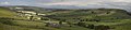 Panorama of Little Fryup Dale - geograph.org.uk - 446167.jpg 640 × 149; 27 KB
-

-
 Little Fryup Dale - geograph.org.uk - 442082.jpg 640 × 427; 66 KB
-
 Little Fryup Dale - geograph.org.uk - 442105.jpg 640 × 427; 84 KB


