Category:Little Bedwyn
Jump to navigation
Jump to search
village and civil parish in Wiltshire, United Kingdom  | |||||
| Upload media | |||||
| Instance of | |||||
|---|---|---|---|---|---|
| Location | Wiltshire, South West England, England | ||||
| Population |
| ||||
| official website | |||||
 | |||||
Subcategories
This category has the following 3 subcategories, out of 3 total.
C
- St Michael's, Little Bedwyn (13 F)
L
- Little Bedwyn Lock (9 F)
Media in category "Little Bedwyn"
The following 200 files are in this category, out of 404 total.
(previous page) (next page)-
 'Y' junction south of Thistleland - geograph.org.uk - 2625054.jpg 3,633 × 2,420; 2.11 MB
-
 5, Church Street, Little Bedwyn.jpg 4,000 × 3,000; 1.42 MB
-
 A carpet of bluebells, Cobham Frith, near Marlborough - geograph.org.uk - 1870521.jpg 1,600 × 1,200; 1.09 MB
-
 A patch of woodland at Knowle Farm - geograph.org.uk - 5444153.jpg 1,600 × 800; 491 KB
-
 A view of Jugg's Wood, Little Bedwyn - geograph.org.uk - 1243152.jpg 640 × 479; 182 KB
-

-
 A4 approaching Golden Arrow - geograph.org.uk - 4260156.jpg 1,920 × 1,310; 624 KB
-
 A4 approaching Voronzoff Gate - geograph.org.uk - 4260231.jpg 1,920 × 1,260; 801 KB
-
 A4 at Harrow Farm - geograph.org.uk - 5444129.jpg 1,600 × 1,143; 640 KB
-
 A4 Bath Road towards Hungerford - geograph.org.uk - 5909647.jpg 1,024 × 684; 174 KB
-
 A4 Froxfield - geograph.org.uk - 5355674.jpg 640 × 480; 126 KB
-
 A4 towards Hungerford - geograph.org.uk - 5909671.jpg 1,024 × 684; 195 KB
-
 A4 towards Hungerford - geograph.org.uk - 5909684.jpg 1,024 × 684; 225 KB
-
 A4 towards Marlborough - geograph.org.uk - 2916111.jpg 1,024 × 768; 136 KB
-
 A4 westbound looking towards East Croft Coppice - geograph.org.uk - 5444177.jpg 1,600 × 961; 598 KB
-
 Almshouse Copse - geograph.org.uk - 5458092.jpg 640 × 426; 31 KB
-
 Almshouse Copse - geograph.org.uk - 5655646.jpg 640 × 324; 25 KB
-
 Almshouse Copse - geograph.org.uk - 5782654.jpg 640 × 426; 39 KB
-
 Almshouse Copse - geograph.org.uk - 5918334.jpg 1,024 × 681; 85 KB
-
 Almshouse Copse - geograph.org.uk - 6058539.jpg 1,024 × 681; 127 KB
-

-
 Approaching Knowl Hill crossroads - geograph.org.uk - 2625047.jpg 3,525 × 2,351; 1.86 MB
-
 Approaching Little Bedwyn - geograph.org.uk - 6166395.jpg 741 × 1,024; 190 KB
-
 Arable landscape - geograph.org.uk - 6058533.jpg 1,024 × 681; 155 KB
-
 At Harrow Farm - geograph.org.uk - 6176420.jpg 1,024 × 758; 175 KB
-
 Autumn colours alongside the sheep pasture - geograph.org.uk - 3706691.jpg 1,024 × 768; 156 KB
-
 Bare field - geograph.org.uk - 5566991.jpg 640 × 426; 47 KB
-
 Barley by the A4 - geograph.org.uk - 4260193.jpg 1,899 × 1,124; 555 KB
-
 Barn. Little Bedwyn - geograph.org.uk - 4842714.jpg 640 × 426; 84 KB
-
 Bath Road, Chisbury - geograph.org.uk - 6361301.jpg 1,858 × 1,178; 1.14 MB
-
 Bedwyn Lock - geograph.org.uk - 6411673.jpg 1,200 × 802; 1.39 MB
-
 Beech trees and bluebells in Cobham Frith - geograph.org.uk - 2372467.jpg 1,440 × 1,080; 1.12 MB
-

-
 Beech trees, shadows and bluebells in Cobham Frith - geograph.org.uk - 2372483.jpg 1,440 × 1,080; 1.13 MB
-

-
 Belmore Copse - geograph.org.uk - 4051149.jpg 1,920 × 1,440; 738 KB
-
 Benchmark or not - geograph.org.uk - 2915894.jpg 600 × 800; 142 KB
-
 Bend in the Canal - geograph.org.uk - 3354718.jpg 3,730 × 2,818; 7.46 MB
-
 Birch Copse - geograph.org.uk - 4037919.jpg 1,920 × 2,524; 1.4 MB
-
 Birch Copse - geograph.org.uk - 4259999.jpg 1,920 × 1,440; 1.18 MB
-
 Bird-scarer, near Timbridge Farm, Wiltshire - geograph.org.uk - 2372500.jpg 1,440 × 1,080; 336 KB
-

-
 Bluebells and beeches, Cobham Frith, Savernake - geograph.org.uk - 5766545.jpg 1,024 × 768; 406 KB
-
 Bluebells in the Cobham Frith beech wood, near Marlborough - geograph.org.uk - 1870519.jpg 1,600 × 1,201; 1.02 MB
-
 Bluebells, Cobham Frith - geograph.org.uk - 5355677.jpg 640 × 362; 136 KB
-
 Bluebells, Cobham Frith, Savernake - geograph.org.uk - 5766542.jpg 1,024 × 768; 435 KB
-
 Boarding kennels at Puthall Farm - geograph.org.uk - 3499166.jpg 800 × 600; 146 KB
-
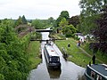 Boat leaving Little Bedwyn Lock - geograph.org.uk - 1888299.jpg 640 × 480; 100 KB
-

-
 Bridge 93, Kennet ^ Avon Canal - geograph.org.uk - 4842697.jpg 640 × 426; 86 KB
-
 Bridge crosses Great Western Mainline at Little Bedwyn - geograph.org.uk - 3102380.jpg 3,648 × 2,454; 1.2 MB
-
 Bridge No.93 - geograph.org.uk - 4842724.jpg 640 × 426; 69 KB
-
 Bridge over canal at Little Bedwyn - geograph.org.uk - 3012424.jpg 2,560 × 1,920; 1.11 MB
-
 Bridge over the Kennet ^ Avon Canal - geograph.org.uk - 4842672.jpg 640 × 426; 85 KB
-
 Bridleway near Harrow Farm - geograph.org.uk - 2324648.jpg 640 × 480; 93 KB
-

-
 Brown's Lane junction before Windmill Cottages - geograph.org.uk - 2624969.jpg 3,648 × 2,736; 2.76 MB
-
 Brown's Lane, Spaines - geograph.org.uk - 5263116.jpg 5,184 × 3,456; 7.41 MB
-
 By Potter's Lock - geograph.org.uk - 6386677.jpg 3,857 × 2,082; 971 KB
-
 Canada geese alongside the Kennet ^ Avon canal - geograph.org.uk - 3706662.jpg 1,024 × 768; 164 KB
-
 Canal and rail bridges - geograph.org.uk - 4842702.jpg 640 × 426; 69 KB
-
 Canal and Railway at Little Bedwyn - geograph.org.uk - 5073775.jpg 1,024 × 690; 205 KB
-
 Canalside buildings, Little Bedwyn - geograph.org.uk - 6386608.jpg 4,056 × 2,341; 1.57 MB
-
 Canalside house - geograph.org.uk - 4842754.jpg 640 × 426; 91 KB
-
 Canalside house, Little Bedwyn - geograph.org.uk - 4842683.jpg 640 × 426; 64 KB
-
 Canalside houses, south-west of Fore Bridge - geograph.org.uk - 3700027.jpg 1,024 × 768; 165 KB
-
 Canoeists on the Kennet ^ Avon canal - geograph.org.uk - 3700254.jpg 1,024 × 768; 162 KB
-
 Car park at the Palm restaurant - geograph.org.uk - 4937721.jpg 640 × 479; 64 KB
-
 Car wash on the A4, Chisbury - geograph.org.uk - 4928576.jpg 1,942 × 1,382; 677 KB
-
 Cattle near Chisbury - geograph.org.uk - 4259468.jpg 1,920 × 1,156; 576 KB
-
 Cattle pasture, Chisbury - geograph.org.uk - 4259264.jpg 1,920 × 1,314; 825 KB
-
 Chisbury Lane - geograph.org.uk - 2625010.jpg 3,344 × 2,470; 2.13 MB
-
 Chisbury Lane - geograph.org.uk - 4259598.jpg 1,920 × 1,296; 609 KB
-
 Chisbury Lane Farm - geograph.org.uk - 5767599.jpg 1,600 × 1,067; 480 KB
-
 Chisbury Lane Farmhouse - geograph.org.uk - 2625029.jpg 3,273 × 2,445; 1.35 MB
-
 Chisbury to Little Bedwyn Road - geograph.org.uk - 5263668.jpg 5,202 × 3,465; 4.74 MB
-
 Church Street, Little Bedwyn - geograph.org.uk - 3706715.jpg 1,024 × 768; 141 KB
-
 Church Street, Little Bedwyn - geograph.org.uk - 5263678.jpg 5,202 × 3,465; 5.02 MB
-
 Cobham Frith - geograph.org.uk - 4260032.jpg 1,920 × 2,560; 1.75 MB
-
 Cottages at Little Bedwyn - geograph.org.uk - 4813457.jpg 640 × 480; 94 KB
-
 Cottages at Little Bedwyn - geograph.org.uk - 801790.jpg 640 × 426; 90 KB
-
 Cottages near Sicily Clump - geograph.org.uk - 4259811.jpg 1,920 × 1,284; 577 KB
-
 Crossroads on Chisbury Lane - geograph.org.uk - 2624973.jpg 3,648 × 2,736; 2.03 MB
-
 Daffodils by the A4, Chisbury - geograph.org.uk - 4928056.jpg 2,048 × 1,536; 1.56 MB
-
 Denby Cottage, Little Bedwyn 01.jpg 4,079 × 3,106; 1.63 MB
-
 Denby Cottage, Little Bedwyn 02.jpg 4,000 × 3,000; 4.66 MB
-
 Direction Sign – Signpost - geograph.org.uk - 6542742.jpg 640 × 640; 269 KB
-
 Edge of Chisbury Wood - geograph.org.uk - 4259524.jpg 1,920 × 1,440; 817 KB
-
 Entering Little Bedwyn village - geograph.org.uk - 6453084.jpg 1,800 × 1,200; 410 KB
-
 Extending Windmill Cottage - geograph.org.uk - 6058535.jpg 1,024 × 681; 99 KB
-
 Fallow field - geograph.org.uk - 5566918.jpg 640 × 426; 43 KB
-
 Farm building and horse box - geograph.org.uk - 2509569.jpg 640 × 480; 159 KB
-
 Farm path - geograph.org.uk - 5263665.jpg 5,202 × 3,465; 3.95 MB
-
 Farmland and plantation, Little Bedwyn - geograph.org.uk - 737704.jpg 640 × 480; 109 KB
-
 Farmland at Oak Hill - geograph.org.uk - 3700033.jpg 1,024 × 768; 153 KB
-
 Farmland by the railway - geograph.org.uk - 4644452.jpg 640 × 426; 32 KB
-
 Farmland near Great Bedwyn - geograph.org.uk - 4886088.jpg 640 × 362; 34 KB
-
 Farmland near Potter's Lock - geograph.org.uk - 4838609.jpg 640 × 426; 53 KB
-
 Farmland north of Chisbury - geograph.org.uk - 5754582.jpg 640 × 427; 86 KB
-
 Farmland scene - geograph.org.uk - 5782646.jpg 640 × 426; 31 KB
-
 Farmland south of East Croft Coppice - geograph.org.uk - 1266800.jpg 640 × 482; 193 KB
-
 Farmland south of the A4 - geograph.org.uk - 6178992.jpg 1,024 × 724; 117 KB
-

-
 Farmland west of Chisbury - geograph.org.uk - 4259504.jpg 1,920 × 1,225; 717 KB
-
 Farmland west of Potter's Lock (no 66) - geograph.org.uk - 3700297.jpg 1,024 × 768; 122 KB
-
 Farmland, Little Bedwyn - geograph.org.uk - 2319602.jpg 640 × 480; 97 KB
-
 Farmland, Little Bedwyn - geograph.org.uk - 4440612.jpg 640 × 480; 208 KB
-
 Farmland, Little Bedwyn - geograph.org.uk - 737136.jpg 640 × 480; 121 KB
-
 Farmland, Little Bedwyn - geograph.org.uk - 737141.jpg 640 × 480; 114 KB
-
 Farmland, Little Bedwyn - geograph.org.uk - 737720.jpg 640 × 480; 139 KB
-
 Farmland, Rudge - geograph.org.uk - 857257.jpg 640 × 480; 104 KB
-
 Field - geograph.org.uk - 6058536.jpg 1,024 × 681; 123 KB
-
 Field by Bath Road, Chisbury - geograph.org.uk - 6361304.jpg 1,920 × 1,280; 1.65 MB
-
 Field by the A4 - geograph.org.uk - 4038158.jpg 1,920 × 1,127; 315 KB
-
 Field by the Chisbury Road - geograph.org.uk - 5263670.jpg 5,184 × 3,456; 7.12 MB
-
 Field by the layby on the A4 near Chisbury - geograph.org.uk - 4928555.jpg 2,048 × 1,536; 1.49 MB
-
 Field from Chisbury Road - geograph.org.uk - 5263126.jpg 4,349 × 2,633; 1.9 MB
-
 Fields and train - geograph.org.uk - 2509563.jpg 640 × 480; 154 KB
-
 Footbridge over the railway - geograph.org.uk - 4842694.jpg 640 × 426; 81 KB
-
 Footbridge over the railway at Little Bedwyn - geograph.org.uk - 5267224.jpg 5,202 × 3,465; 4.57 MB
-

-

-
 Fore Bridge (no 92) - geograph.org.uk - 3700023.jpg 1,024 × 768; 144 KB
-
 Fore Bridge (No.92) - geograph.org.uk - 4842781.jpg 640 × 426; 95 KB
-
 Fore Bridge - geograph.org.uk - 2295102.jpg 3,648 × 2,736; 2.36 MB
-
 Fore Bridge - geograph.org.uk - 4842769.jpg 640 × 426; 90 KB
-

-
 Fore Bridge, Kennet and Avon Canal - geograph.org.uk - 409159.jpg 640 × 513; 104 KB
-
 Fore Bridge, Kennet ^ Avon canal - geograph.org.uk - 6158996.jpg 1,024 × 768; 255 KB
-
 Gate in Chisbury chapel - geograph.org.uk - 5263651.jpg 5,202 × 3,465; 3.46 MB
-

-
 Golden Arrow Service Station, Froxfield, Marlborough (1) - geograph.org.uk - 1870035.jpg 1,600 × 1,200; 713 KB
-
 Golden Arrow Service Station, Froxfield, Marlborough (2) - geograph.org.uk - 1870036.jpg 1,600 × 1,200; 740 KB
-
 Golden Arrow Service Station, Froxfield,Marlborough (3) - geograph.org.uk - 1870038.jpg 1,600 × 1,200; 810 KB
-
 Grassy hillside - geograph.org.uk - 4886108.jpg 640 × 336; 26 KB
-
 Grey wagtail, Little Bedwyn - geograph.org.uk - 399698.jpg 640 × 480; 92 KB
-
 GWR mainline heading southwest towards Little Bedwyn - geograph.org.uk - 2295490.jpg 3,648 × 2,736; 1.37 MB
-
 Hand car wash on A4 - geograph.org.uk - 5909663.jpg 1,024 × 684; 200 KB
-
 Hand points the way - geograph.org.uk - 2915897.jpg 1,024 × 768; 386 KB
-
 Harrow Farm Cottage - geograph.org.uk - 4258849.jpg 1,920 × 1,331; 534 KB
-
 Harrow Farmhouse, Little Bedwyn.jpg 4,000 × 3,000; 1.18 MB
-
 Hay-stacks north of The Warren - geograph.org.uk - 2625067.jpg 3,648 × 2,736; 1.86 MB
-
 Hedge on the edge of Great Bedwyn - geograph.org.uk - 4644432.jpg 640 × 468; 39 KB
-
 High Street, Little Bedwyn - geograph.org.uk - 3012456.jpg 2,560 × 1,920; 1.13 MB
-
 Horse paddock alongside the canal towpath - geograph.org.uk - 3707899.jpg 1,024 × 768; 133 KB
-
 Horses - geograph.org.uk - 5566920.jpg 640 × 426; 49 KB
-
 Horses Keep Out - geograph.org.uk - 5767617.jpg 4,895 × 3,319; 3.09 MB
-
 Horses watching me - geograph.org.uk - 3363937.jpg 3,714 × 2,802; 4.04 MB
-
 House at the end of the bridge - geograph.org.uk - 6250793.jpg 683 × 1,024; 204 KB
-
 Isolated tree - geograph.org.uk - 5655654.jpg 640 × 426; 59 KB
-
 Jugg Wood - geograph.org.uk - 5125486.jpg 640 × 426; 35 KB
-
 Junction near Sicily Cottages - geograph.org.uk - 4259803.jpg 1,920 × 1,440; 1.18 MB
-
 Kennet , Grassy Field - geograph.org.uk - 2588471.jpg 2,456 × 1,772; 1.69 MB
-
 Kennet and Avon Canal at Fore Bridge - geograph.org.uk - 5517336.jpg 640 × 427; 83 KB
-

-
 Kennet and Avon canal near Great Bedwyn - geograph.org.uk - 5267306.jpg 5,184 × 3,456; 7.02 MB
-
 Kennet ^ Avon Canal - geograph.org.uk - 4838591.jpg 640 × 426; 66 KB
-
 Kennet ^ Avon Canal - geograph.org.uk - 4838597.jpg 640 × 426; 101 KB
-
 Kennet ^ Avon Canal - geograph.org.uk - 4838601.jpg 640 × 426; 87 KB
-
 Kennet ^ Avon Canal - geograph.org.uk - 4838832.jpg 640 × 426; 114 KB
-
 Kennet ^ Avon Canal - geograph.org.uk - 4842720.jpg 640 × 426; 106 KB
-
 Kennet ^ Avon Canal - geograph.org.uk - 4842723.jpg 640 × 426; 81 KB
-
 Kennet ^ Avon Canal - geograph.org.uk - 4842736.jpg 640 × 426; 72 KB
-
 Kennet ^ Avon Canal - geograph.org.uk - 4842741.jpg 640 × 426; 88 KB
-
 Kennet ^ Avon Canal - geograph.org.uk - 4842745.jpg 640 × 426; 82 KB
-
 Kennet ^ Avon Canal - geograph.org.uk - 4842747.jpg 640 × 426; 94 KB
-
 Kennet ^ Avon Canal - geograph.org.uk - 4842749.jpg 640 × 426; 70 KB
-
 Kennet ^ Avon Canal - geograph.org.uk - 4842797.jpg 640 × 426; 63 KB
-
 Kennet ^ Avon Canal - geograph.org.uk - 4842805.jpg 640 × 426; 104 KB
-
 Kennet ^ Avon canal between bridges 92 and 91 - geograph.org.uk - 3708485.jpg 1,024 × 768; 113 KB
-
 Kennet ^ Avon Canal Walk - geograph.org.uk - 5647123.jpg 640 × 480; 72 KB
-
 Kennet ^ Avon Canal Walk - geograph.org.uk - 5647141.jpg 640 × 480; 92 KB
-
 Kennet ^ Avon Canal Walk - geograph.org.uk - 5647152.jpg 640 × 480; 62 KB
-
 Kennet ^ Avon canal, between bridges 93 and 92 - geograph.org.uk - 3707893.jpg 1,024 × 768; 109 KB
-
 Lane leading to Little Bedwyn church - geograph.org.uk - 647241.jpg 640 × 480; 87 KB
-
 Lane to Chisbury - geograph.org.uk - 4259023.jpg 1,920 × 1,440; 763 KB
-
 Large field south-west of Parlow Bottom - geograph.org.uk - 3706686.jpg 1,024 × 768; 119 KB
-
 Lay-by by A4 - geograph.org.uk - 5444163.jpg 1,600 × 1,143; 700 KB
-
 Lay-by by A4 west of Harrow Farm - geograph.org.uk - 5444132.jpg 1,600 × 1,197; 732 KB
-
 Layby next to the A4 - geograph.org.uk - 5653819.jpg 640 × 480; 55 KB
-
 Leaving Oakhill Down Lock - geograph.org.uk - 1302147.jpg 640 × 426; 174 KB
-
 Line of trees - geograph.org.uk - 4838593.jpg 640 × 426; 93 KB
-
 Milestone by A4 - geograph.org.uk - 192121.jpg 640 × 480; 107 KB
-
 Milestone on the A4, near Cobham Frith - geograph.org.uk - 297521.jpg 640 × 378; 100 KB
-
 Little Bedwyn - Church Street - geograph.org.uk - 1269877.jpg 624 × 460; 137 KB
-
 Little Bedwyn - geograph.org.uk - 2897.jpg 640 × 480; 33 KB
-
 Little Bedwyn - High Street - geograph.org.uk - 1291926.jpg 640 × 480; 99 KB
-
 Little Bedwyn - School Lane - geograph.org.uk - 1291932.jpg 640 × 480; 73 KB
-
 Little Bedwyn - Stables - geograph.org.uk - 1279909.jpg 640 × 480; 83 KB
-
 Little Bedwyn - Street - geograph.org.uk - 1291950.jpg 640 × 480; 76 KB
-
 Little Bedwyn - The Harrow - geograph.org.uk - 1291869.jpg 640 × 480; 65 KB
-
 Little Bedwyn -Junction - geograph.org.uk - 1291939.jpg 640 × 480; 102 KB
-
 Little Bedwyn -Three Under One - geograph.org.uk - 1291958.jpg 640 × 480; 118 KB
-
 Little Bedwyn Bridge (no 94) - geograph.org.uk - 3706706.jpg 1,024 × 768; 166 KB
-
 Little Bedwyn Footbridge (no 93) - geograph.org.uk - 3706733.jpg 1,024 × 768; 111 KB
-
 Little Bedwyn from the railway footbridge - geograph.org.uk - 5263687.jpg 5,184 × 3,456; 7.36 MB
-
 Little Bedwyn from the railway footbridge - geograph.org.uk - 801768.jpg 640 × 426; 104 KB
-
 Little Bedwyn High Street - geograph.org.uk - 5267293.jpg 5,184 × 3,456; 6.38 MB
-
 Little Bedwyn Lock - geograph.org.uk - 3103422.jpg 2,288 × 1,712; 1.25 MB
-
 Little Bedwyn Lock - geograph.org.uk - 4186531.jpg 3,264 × 2,448; 2.49 MB


_-_geograph.org.uk_-_3700297.jpg)


_-_geograph.org.uk_-_3700023.jpg)
_-_geograph.org.uk_-_4842781.jpg)


_-_geograph.org.uk_-_3706706.jpg)
_-_geograph.org.uk_-_3706733.jpg)


_-_geograph.org.uk_-_1870035.jpg)
_-_geograph.org.uk_-_1870036.jpg)
_-_geograph.org.uk_-_1870038.jpg)