Category:Litlington, East Sussex
Jump to navigation
Jump to search
village in East Sussex, UK  | |||||
| Upload media | |||||
| Instance of | |||||
|---|---|---|---|---|---|
| Location | Cuckmere Valley, Wealden, East Sussex, South East England, England | ||||
 | |||||
English: Litlington is a village in the Cuckmere valley in East Sussex, England, about 7 miles to the south east of Lewes.
Subcategories
This category has the following 3 subcategories, out of 3 total.
L
- Litlington White Horse (14 F)
Media in category "Litlington, East Sussex"
The following 94 files are in this category, out of 94 total.
-
 Barn at Litlington, East Sussex - geograph.org.uk - 2423792.jpg 1,600 × 1,200; 456 KB
-
 Bend in the River - geograph.org.uk - 670444.jpg 640 × 479; 89 KB
-
 Bridleway junction above Litlington - geograph.org.uk - 2551576.jpg 640 × 480; 98 KB
-
 Burnt House Brooks National Trust sign 01.jpg 4,000 × 3,000; 3.48 MB
-

-
 Cuckmere River - geograph.org.uk - 670349.jpg 479 × 640; 66 KB
-
 Cuckmere River - geograph.org.uk - 670443.jpg 640 × 479; 73 KB
-
 Cuckmere River floods november 2023 @ Litlington White Horse 01.jpg 4,608 × 3,456; 2.71 MB
-

-
 Descending towards Litlington from Lullington Heath - geograph.org.uk - 2260032.jpg 2,592 × 1,944; 2.2 MB
-
 Fields near Litlington - geograph.org.uk - 3074524.jpg 1,600 × 1,200; 394 KB
-
 Flint Cottage, Litlington - geograph.org.uk - 1831292.jpg 640 × 430; 153 KB
-
 Footpath signpost, Litlington - geograph.org.uk - 1831305.jpg 640 × 430; 185 KB
-
 Footpath to Litlington - geograph.org.uk - 1831270.jpg 640 × 430; 154 KB
-
 Footpath towards Litlington - geograph.org.uk - 2104737.jpg 640 × 431; 81 KB
-
 Garages at Litlington - geograph.org.uk - 2631576.jpg 480 × 640; 108 KB
-
 Hedgerow near Charleston Manor - geograph.org.uk - 670371.jpg 640 × 479; 107 KB
-
 High Woods, Litlington - geograph.org.uk - 1831363.jpg 640 × 430; 131 KB
-

-
 Litlington - 1986 - geograph.org.uk - 2256425.jpg 2,271 × 1,513; 363 KB
-
 Litlington - 1986 - geograph.org.uk - 2256429.jpg 2,270 × 1,513; 315 KB
-
 Litlington - 1987 - geograph.org.uk - 2305863.jpg 2,272 × 1,514; 449 KB
-
 Litlington - farm building - geograph.org.uk - 1188116.jpg 640 × 480; 94 KB
-
 Litlington - farm building - geograph.org.uk - 1188123.jpg 640 × 480; 94 KB
-
 Litlington - farm implement - geograph.org.uk - 1226022.jpg 640 × 480; 116 KB
-
 Litlington - farm trailer - geograph.org.uk - 1216127.jpg 640 × 480; 109 KB
-
 Litlington - the Plough and Harrow - geograph.org.uk - 1169745.jpg 640 × 480; 94 KB
-
 Litlington April 2018 01.jpg 5,400 × 3,375; 14.75 MB
-
 Litlington from Cradle Hill, Seaford - geograph.org.uk - 872505.jpg 640 × 344; 102 KB
-
 Litlington Place - geograph.org.uk - 2801321.jpg 480 × 640; 107 KB
-
 Litlington Tea Garden - geograph.org.uk - 39666.jpg 640 × 480; 138 KB
-
 Litlington Tea Gardens, East Sussex - geograph.org.uk - 2439394.jpg 1,600 × 1,200; 736 KB
-
 Litlington White Horse.jpg 1,978 × 1,483; 474 KB
-
 Litlington, church and Church Farm - geograph.org.uk - 5518861.jpg 753 × 1,024; 145 KB
-
 Lullington Court 2018 01.jpg 5,065 × 3,166; 14.8 MB
-
-
 Old cart-shed at Church Farm, Litlington - geograph.org.uk - 5518857.jpg 1,024 × 790; 205 KB
-
 Old cottages in Westdean - geograph.org.uk - 36361.jpg 640 × 425; 55 KB
-
 Old school, Litlington - geograph.org.uk - 1831293.jpg 640 × 430; 154 KB
-

-
 Plough and Harrow, Littlington - geograph.org.uk - 2371095.jpg 640 × 480; 85 KB
-
 Post box and telephone booth, Litlington - geograph.org.uk - 2551497.jpg 640 × 480; 182 KB
-
 River Cuckmere south of Litlington - geograph.org.uk - 30826.jpg 640 × 480; 157 KB
-

-
 Telephone Box, Littlington - geograph.org.uk - 670352.jpg 479 × 640; 126 KB
-
 The Litlington White Horse - geograph.org.uk - 1831567.jpg 640 × 430; 88 KB
-
 The Litlington White Horse - geograph.org.uk - 3047848.jpg 3,264 × 2,448; 1.94 MB
-
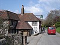
 The Plough and Harrow, Litlington (2) - geograph.org.uk - 1831289.jpg 640 × 430; 152 KB
-
 The Plough and Harrow, Litlington - geograph.org.uk - 1831286.jpg 640 × 430; 134 KB
-
 The Plough and Harrow, The Street, Litlington - geograph.org.uk - 3037478.jpg 3,264 × 2,448; 1.96 MB
-
 The Plough ^ Harrow sign - geograph.org.uk - 2371096.jpg 480 × 640; 93 KB
-

-

-
 The South Downs Way leaving Litlington - geograph.org.uk - 3115990.jpg 1,600 × 1,064; 224 KB
-
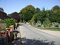
 The Street, Litlington - geograph.org.uk - 1831280.jpg 640 × 430; 154 KB
-
 The Street, Litlington - geograph.org.uk - 1831297.jpg 640 × 430; 170 KB
-
 Walking in the rain - South Downs Way at Litlington - geograph.org.uk - 3115982.jpg 1,600 × 1,064; 236 KB
-

-
 Waymark, The South Downs Way, Litlington - geograph.org.uk - 1831266.jpg 640 × 430; 147 KB
-
 White Bridge - geograph.org.uk - 670338.jpg 479 × 640; 129 KB
-
 White Horse, Hindover Hill - geograph.org.uk - 670439.jpg 640 × 479; 89 KB
-

-

-
 Bridleway through Friston Forest - geograph.org.uk - 36363.jpg 640 × 425; 86 KB
-
 Bridleways crossing, Snap Hill - geograph.org.uk - 131928.jpg 479 × 640; 173 KB
-
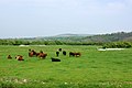 Cattle on the Cuckmere flood-plain - geograph.org.uk - 422781.jpg 640 × 428; 270 KB
-
 Charleston Bottom - geograph.org.uk - 131910.jpg 640 × 387; 150 KB
-
 Charleston Bottom meets Friston Forest - geograph.org.uk - 131923.jpg 640 × 479; 168 KB
-
 Church Farm, Litlington - geograph.org.uk - 670357.jpg 640 × 479; 72 KB
-

-
 Cottages and Pond - geograph.org.uk - 670308.jpg 479 × 640; 92 KB
-
 Cow Lane - geograph.org.uk - 670347.jpg 479 × 640; 150 KB
-
 Cuckmere River - geograph.org.uk - 426360.jpg 640 × 480; 94 KB
-
 Cuckmere River Flood Plain - geograph.org.uk - 670462.jpg 640 × 471; 67 KB
-
 Dewpond, Friston Forest - geograph.org.uk - 132039.jpg 479 × 640; 234 KB
-
 Fields near Alfriston - geograph.org.uk - 712336.jpg 640 × 480; 68 KB
-
 Footpath Crossroads - geograph.org.uk - 670296.jpg 479 × 640; 128 KB
-
 Footpath, Friston Forest - geograph.org.uk - 132033.jpg 640 × 479; 238 KB
-
 Forge Cottage, Clapham Lane, Litlington - geograph.org.uk - 670365.jpg 479 × 640; 121 KB
-
 Friston Hill - geograph.org.uk - 132038.jpg 640 × 479; 182 KB
-
 Frog Firle - geograph.org.uk - 670318.jpg 640 × 479; 96 KB
-
 Hindover Hill - geograph.org.uk - 670293.jpg 640 × 479; 112 KB
-
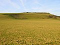 Hindover Hill - geograph.org.uk - 670426.jpg 640 × 479; 107 KB
-
 Litlington - geograph.org.uk - 670332.jpg 640 × 479; 88 KB
-
 Litlington House - geograph.org.uk - 670353.jpg 479 × 640; 113 KB
-
 New Bridge - geograph.org.uk - 670283.jpg 640 × 479; 91 KB
-
 New Bridge - geograph.org.uk - 670449.jpg 640 × 479; 83 KB
-
 Path Down Hindover Hill - geograph.org.uk - 670270.jpg 479 × 640; 94 KB
-
 Plough and Harrow, Litlington - geograph.org.uk - 670363.jpg 466 × 640; 90 KB
-
 Snow covered slope near Charleston Manor - geograph.org.uk - 131915.jpg 479 × 640; 194 KB
-
 Stile by Cuckmere River - geograph.org.uk - 422763.jpg 640 × 428; 312 KB
-
 The Cottages - geograph.org.uk - 670433.jpg 640 × 479; 87 KB
-
 Tile Barn Farm - geograph.org.uk - 670300.jpg 640 × 479; 93 KB
-
 Tumulus, Hindover Hill - geograph.org.uk - 670286.jpg 640 × 479; 92 KB


_-_geograph.org.uk_-_1831289.jpg)


