Category:Lisbellaw
Jump to navigation
Jump to search
English: Lisbellaw is a village in County Fermanagh, Northern Ireland, about 5 miles east of Enniskillen. In the 2001 Census it had a population of 1,046 people. It lies within the Fermanagh District Council area.
Gaeilge: Baile i g Contae Fhear Manach is ea Lios Béal Átha (Lisbellaw as Béarla).
village in County Fermanagh, Northern Ireland, UK  | |||||
| Upload media | |||||
| Instance of | |||||
|---|---|---|---|---|---|
| Location | Northern Ireland | ||||
 | |||||
Media in category "Lisbellaw"
The following 92 files are in this category, out of 92 total.
-
 "God save the Queen" banner, Lisbellaw - geograph.org.uk - 5518781.jpg 640 × 480; 152 KB
-
 Approaching Lisbellaw - geograph.org.uk - 921001.jpg 640 × 479; 71 KB
-
 B140 Snowhill Road, Lisbellaw - geograph.org.uk - 5518212.jpg 640 × 480; 147 KB
-
 Boats, Lough Eyes - geograph.org.uk - 5518122.jpg 640 × 480; 156 KB
-
 Bridge along Main Street, Lisbellaw - geograph.org.uk - 5518171.jpg 640 × 480; 152 KB
-
 Brook Street, Lisbellaw - geograph.org.uk - 5518180.jpg 640 × 480; 161 KB
-
 Brook Street, Lisbellaw - geograph.org.uk - 5518215.jpg 640 × 480; 149 KB
-
 Church Information Board, Lisbellaw - geograph.org.uk - 5518241.jpg 640 × 480; 174 KB
-
 Church Street, Lisbellaw - geograph.org.uk - 5518234.jpg 640 × 480; 164 KB
-
 Church Street, Lisbellaw - geograph.org.uk - 5518244.jpg 640 × 480; 161 KB
-
 Church Street, Lisbellaw - geograph.org.uk - 5518282.jpg 640 × 480; 158 KB
-
 Circular Road, Lisbellaw - geograph.org.uk - 5518295.jpg 640 × 480; 153 KB
-
 Circular Road, Lisbellaw - geograph.org.uk - 5518305.jpg 640 × 480; 163 KB
-
 Cloughcor Road, Lisbellaw - geograph.org.uk - 5518311.jpg 640 × 480; 155 KB
-
 Creighton's, Lisbellaw - geograph.org.uk - 5518204.jpg 640 × 480; 155 KB
-
 Creightons entrance porch, Lisbellaw - geograph.org.uk - 5518778.jpg 640 × 480; 194 KB
-

-
 Dividing burn, Lisbellaw - geograph.org.uk - 5518169.jpg 640 × 480; 158 KB
-

-

-
 Flats, Lisbellaw - geograph.org.uk - 5518191.jpg 640 × 480; 166 KB
-
 Former church hall, Lisbellaw - geograph.org.uk - 5518173.jpg 640 × 480; 157 KB
-

-
 G Crawford, Lisbellaw - geograph.org.uk - 5518301.jpg 640 × 480; 153 KB
-
 Garage, Lisbellaw - geograph.org.uk - 5518217.jpg 640 × 480; 143 KB
-
 Glencar Inn, Lisbellaw - geograph.org.uk - 5518792.jpg 640 × 480; 143 KB
-
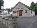 Gospel Hall, Lisbellaw - geograph.org.uk - 939921.jpg 640 × 479; 62 KB
-
 Headrush, Lisbellaw - geograph.org.uk - 5518338.jpg 640 × 480; 154 KB
-
 Inishmore Road, Lisbellaw - geograph.org.uk - 5518224.jpg 640 × 480; 170 KB
-
 Inishmore Road, Lisbellaw - geograph.org.uk - 5518228.jpg 640 × 480; 173 KB
-
 Inishmore Road, Lisbellaw - geograph.org.uk - 5518229.jpg 640 × 480; 162 KB
-

-
 Lisbellaw Co Fermanagh - geograph.org.uk - 3723584.jpg 4,000 × 2,664; 7.77 MB
-
 Lisbellaw Credit Union - geograph.org.uk - 5518327.jpg 640 × 480; 136 KB
-
 Lisbellaw Fuel ^ Feed Supplies - geograph.org.uk - 5518293.jpg 640 × 480; 165 KB
-
 Lisbellaw Gospel Hall - geograph.org.uk - 5518326.jpg 640 × 480; 161 KB
-
 Lisbellaw Medical Hall - geograph.org.uk - 5518218.jpg 640 × 480; 163 KB
-
 Lisbellaw Orange Hall - geograph.org.uk - 5518296.jpg 640 × 480; 137 KB
-
 Lisbellaw Parish Centre - geograph.org.uk - 5518317.jpg 640 × 480; 140 KB
-
 Lisbellaw Parish Church - geograph.org.uk - 167631.jpg 480 × 640; 76 KB
-
 Lisbellaw Parish Church of Ireland - geograph.org.uk - 5518238.jpg 640 × 480; 176 KB
-
 Lisbellaw Presbyterian Church - geograph.org.uk - 5518164.jpg 640 × 480; 151 KB
-
 Lisbellaw Presbyterian Church - geograph.org.uk - 921005.jpg 640 × 479; 73 KB
-
 Lisbellaw Primary School - geograph.org.uk - 5518330.jpg 640 × 480; 144 KB
-
 Lough Skale, Cloghtogle - geograph.org.uk - 5518998.jpg 640 × 480; 158 KB
-
 M ^ N Exhausts, Lisbellaw - geograph.org.uk - 5518306.jpg 640 × 480; 150 KB
-
 Main Street, Lisbellaw - geograph.org.uk - 5518157.jpg 640 × 480; 162 KB
-
 Main Street, Lisbellaw - geograph.org.uk - 5518174.jpg 640 × 480; 171 KB
-
 Main Street, Lisbellaw - geograph.org.uk - 5518177.jpg 640 × 480; 159 KB
-
 Main Street, Lisbellaw - geograph.org.uk - 5518225.jpg 640 × 480; 162 KB
-
 Main Street, Lisbellaw - geograph.org.uk - 5518284.jpg 640 × 480; 176 KB
-
 Main Street, Lisbellaw - geograph.org.uk - 5518290.jpg 640 × 480; 179 KB
-
 Main Street, Lisbellaw - geograph.org.uk - 5518333.jpg 640 × 480; 156 KB
-
 Main Street, Lisbellaw - geograph.org.uk - 5518771.jpg 640 × 480; 170 KB
-
 Methodist Church, Lisbellaw - geograph.org.uk - 5518315.jpg 640 × 480; 150 KB
-
 Methodist Manse, Lisbellaw - geograph.org.uk - 5518313.jpg 640 × 480; 158 KB
-
 Mosaic man sculpture, Lisbellaw - geograph.org.uk - 5518140.jpg 640 × 480; 169 KB
-
 Near Lisbellaw - geograph.org.uk - 921003.jpg 640 × 479; 72 KB
-
 Old mill, Lisbellaw - geograph.org.uk - 5518796.jpg 640 × 480; 147 KB
-
 Old mill, Lisbellaw - geograph.org.uk - 5518801.jpg 640 × 480; 164 KB
-

-
 Path to Topped Mountain - geograph.org.uk - 5519003.jpg 640 × 480; 151 KB
-
 Plaque, Fermanagh Central Markets 1888 - geograph.org.uk - 5518187.jpg 640 × 480; 203 KB
-
 Post Office, Lisbellaw - geograph.org.uk - 5518310.jpg 640 × 480; 166 KB
-
 Post Office, Lisbellaw - geograph.org.uk - 5518336.jpg 640 × 480; 151 KB
-
 Priests and people in Ireland (1902) (14778489694).jpg 2,416 × 1,600; 397 KB
-
 Public toilets, Lisbellaw - geograph.org.uk - 5518302.jpg 640 × 480; 149 KB
-
 Sign for Topped Mountain path - geograph.org.uk - 5519031.jpg 640 × 480; 153 KB
-
 Small church, Lisbellaw - geograph.org.uk - 5518198.jpg 640 × 480; 148 KB
-
 Spar shop, Lisbellaw - geograph.org.uk - 5518288.jpg 640 × 480; 168 KB
-
 St Mary's RC Church - geograph.org.uk - 5518320.jpg 640 × 480; 156 KB
-
 Steep path, Topped Mountain - geograph.org.uk - 5519008.jpg 640 × 480; 151 KB
-
 Store along Church Street, Lisbellaw - geograph.org.uk - 5518272.jpg 640 × 480; 151 KB
-
 Super Bite Fast Food Takeaway, Lisbellaw - geograph.org.uk - 5518221.jpg 640 × 480; 163 KB
-
 Tattygar Public Elementary School - geograph.org.uk - 5518136.jpg 640 × 480; 149 KB
-
 Tattygare Road, Lisbellaw - geograph.org.uk - 5518214.jpg 640 × 480; 145 KB
-

-

-
 The A4 by-pass at Lisbellaw - geograph.org.uk - 3243429.jpg 1,024 × 607; 82 KB
-
 The end of Station Road, Lisbellaw - geograph.org.uk - 5518202.jpg 640 × 480; 169 KB
-
 The tower of Lisbellaw Parish Church - geograph.org.uk - 3225159.jpg 671 × 1,024; 91 KB
-
 The Weighing House, Lisbellaw - geograph.org.uk - 5518182.jpg 640 × 480; 148 KB
-
 Topped Mountain Road, Mullyknock - geograph.org.uk - 5519033.jpg 640 × 480; 142 KB
-
 Topped Mountain Road, Mullyknock - geograph.org.uk - 5519039.jpg 640 × 480; 142 KB
-
 Toppedmountain Lough - geograph.org.uk - 5519025.jpg 640 × 480; 155 KB
-
 True Gents, Lisbellaw - geograph.org.uk - 5518209.jpg 640 × 480; 140 KB
-
 Vacant shop, Lisbellaw - geograph.org.uk - 5518208.jpg 640 × 480; 148 KB
-
 Vacant shop, Lisbellaw - geograph.org.uk - 5518340.jpg 640 × 480; 157 KB
-

-
 Wild Duck Diner, Lisbellaw - geograph.org.uk - 5518231.jpg 640 × 480; 157 KB
-
 Wild Duck Inn, Lisbellaw - geograph.org.uk - 5518233.jpg 640 × 480; 171 KB
-
 WWII memorial, Lisbellaw - geograph.org.uk - 5518788.jpg 640 × 480; 153 KB


_road_-_geograph.org.uk_-_3225202.jpg)


_(14778489694).jpg)


_between_Lisbellaw_and_Tamlaght_-_geograph.org.uk_-_3243781.jpg)


