Category:Liphook
Jump to navigation
Jump to search
English: Liphook is a large village in the East Hampshire district of Hampshire, England. It is 4.1 miles (6.6 km) west of Haslemere, on the A3 road. It lies on the Hampshire/West Sussex border.
village in United Kingdom  | |||||
| Upload media | |||||
| Instance of | |||||
|---|---|---|---|---|---|
| Location | Bramshott and Liphook, East Hampshire, Hampshire, South East England, England | ||||
 | |||||
Subcategories
This category has the following 10 subcategories, out of 10 total.
G
- Green Dragon pub, Liphook (3 F)
H
L
- Liphook Methodist Church (7 F)
R
- The Royal Anchor, Liphook (6 F)
S
- St Mary's Church Centre, Liphook (12 F)
Media in category "Liphook"
The following 200 files are in this category, out of 329 total.
(previous page) (next page)-
 40 mph speed limit reminder sign in Liphook, Hampshire, England 2.jpg 2,304 × 3,072; 3.35 MB
-
 40 mph speed limit reminder sign in Liphook, Hampshire, England.jpg 3,072 × 2,304; 2.81 MB
-
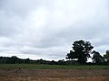
 A rare sight in Liphook (geograph 7791940).jpg 640 × 480; 75 KB
-

-

-

-

-

-

-

-

-

-

-

-

-

-

-

-

-

-

-

-

-

-

-

-

-

-

-

-

-

-

-

-

-

-

-

-

-

-

-

-

-
 Autogate in Haslemere Road - geograph.org.uk - 2253997.jpg 640 × 480; 85 KB
-

-
 Bench Mark, Bramshott - geograph.org.uk - 1995721.jpg 480 × 640; 209 KB
-
 Bookies in Station Road - geograph.org.uk - 2253535.jpg 480 × 640; 72 KB
-

-
 Bracken, Bramshott Common - geograph.org.uk - 2055771.jpg 640 × 430; 201 KB
-
 Bracken, Bramshott Common - geograph.org.uk - 2055838.jpg 640 × 430; 146 KB
-
 Bracken, Bramshott Common - geograph.org.uk - 2055843.jpg 640 × 430; 145 KB
-
 Bramshott and Liphook Parish Council HQ - geograph.org.uk - 644100.jpg 640 × 480; 107 KB
-
 Bramshott Common - geograph.org.uk - 2055800.jpg 640 × 430; 177 KB
-
 Broad track on Long Down - geograph.org.uk - 1860262.jpg 800 × 600; 94 KB
-
 Bungalows in Haslemere Road - geograph.org.uk - 2253998.jpg 640 × 480; 58 KB
-
 Bus stop near Sainsbury - geograph.org.uk - 644137.jpg 640 × 480; 68 KB
-

-
 C.J. Hampshire in The Square - geograph.org.uk - 2254393.jpg 480 × 640; 64 KB
-
 Canada Way and Midhurst Road roundabout in Liphook, Hampshire, England 2.jpg 3,072 × 2,304; 3.1 MB
-
 Canada Way and Midhurst Road roundabout in Liphook, Hampshire, England.jpg 3,072 × 2,304; 3.07 MB
-
 Car park behind Liphook Station - geograph.org.uk - 2253447.jpg 640 × 480; 52 KB
-
 Car park in Haslemere Road - geograph.org.uk - 2253996.jpg 640 × 480; 69 KB
-
 Childerstone Close - geograph.org.uk - 2254522.jpg 480 × 640; 121 KB
-
 Chiltley Manor House Liphook.jpg 5,397 × 3,537; 4.58 MB
-
 Chinese restaurant in Midhurst Road - geograph.org.uk - 2253520.jpg 480 × 640; 72 KB
-
 Chippie in Station Road - geograph.org.uk - 2253444.jpg 480 × 640; 74 KB
-
 Church path, St Mary's Bramshott - geograph.org.uk - 1989570.jpg 640 × 471; 114 KB
-

-
 Combined cycle route warning and 30 mph speed limit sign in Liphook, Hampshire, England.jpg 2,304 × 3,072; 2.69 MB
-

-
 Coopers Bridge, Liphook 01.png 877 × 661; 777 KB
-
 Coopers Bridge, Liphook 02.png 911 × 650; 837 KB
-
 Countryside to the west from Portsmouth Road in Liphook, Hampshire, England 2.jpg 3,072 × 2,304; 2.56 MB
-
 Countryside to the west from Portsmouth Road in Liphook, Hampshire, England 3.jpg 3,072 × 2,304; 2.3 MB
-
 Countryside to the west from Portsmouth Road in Liphook, Hampshire, England 4.jpg 3,072 × 2,304; 2.54 MB
-
 Countryside to the west from Portsmouth Road in Liphook, Hampshire, England.jpg 3,072 × 2,304; 2.53 MB
-

-
 Cycle shop in The Square - geograph.org.uk - 2254488.jpg 480 × 640; 87 KB
-

-
 Dentists in Station Road - geograph.org.uk - 2253521.jpg 640 × 480; 98 KB
-
 Derelict Shop at 5 London Road, Liphook (July 2019).JPG 2,600 × 2,000; 1.85 MB
-
 Derelict Shops at 1a, 1 and 3 London Road, Liphook (July 2019).JPG 2,400 × 1,600; 1.51 MB
-
 Devils Lane sign, Liphook.jpg 2,816 × 2,112; 1.35 MB
-
 Doctors surgery just off Station Road - geograph.org.uk - 2253549.jpg 640 × 480; 103 KB
-
 Dr Li in London Road - geograph.org.uk - 2254525.jpg 480 × 640; 83 KB
-
 Entering Liphook - geograph.org.uk - 2728261.jpg 640 × 430; 98 KB
-
 Entrance to Kingfisher Farm, Sandy Lane - geograph.org.uk - 2055718.jpg 640 × 430; 181 KB
-
 Entrance to the village centre on Portsmouth Road in Liphook, Hampshire, England 2.jpg 2,304 × 3,072; 3.55 MB
-
 Entrance to the village centre on Portsmouth Road in Liphook, Hampshire, England 3.jpg 2,304 × 3,072; 3.43 MB
-
 Entrance to the village centre on Portsmouth Road in Liphook, Hampshire, England 4.jpg 2,304 × 3,072; 3.33 MB
-
 Entrance to the village centre on Portsmouth Road in Liphook, Hampshire, England.jpg 2,304 × 3,072; 3.51 MB
-
 Erles Road - geograph.org.uk - 2253833.jpg 640 × 480; 101 KB
-
 Farm track across field near Liphook - geograph.org.uk - 1370697.jpg 640 × 360; 64 KB
-

-
 Ferns under the trees, Bramshott Common - geograph.org.uk - 2055769.jpg 640 × 430; 197 KB
-
 Field near Liphook - geograph.org.uk - 1370554.jpg 640 × 360; 56 KB
-

-
 Fish and chip shop in Station Road - geograph.org.uk - 643978.jpg 640 × 480; 67 KB
-
 Flats in Station Road - geograph.org.uk - 2253559.jpg 640 × 480; 99 KB
-
 Footpath across, Bramshott Common - geograph.org.uk - 2055832.jpg 640 × 430; 155 KB
-

-
 Footpath near Liphook - geograph.org.uk - 1370569.jpg 640 × 360; 59 KB
-
 Footpath off Sandy Lane - geograph.org.uk - 2055735.jpg 640 × 430; 206 KB
-
 Footpath off Sandy Lane, Kingfisher Farm - geograph.org.uk - 2055709.jpg 640 × 430; 196 KB
-

-

-
 Footpath to the A3, Bramshott Common - geograph.org.uk - 2055780.jpg 640 × 430; 156 KB
-
 Footpath, Bramshott Common - geograph.org.uk - 2055833.jpg 640 × 430; 159 KB
-
 Forest Mere - geograph.org.uk - 300459.jpg 640 × 480; 56 KB
-
 Formerly W.Pink ^ Sons Ltd - geograph.org.uk - 2254519.jpg 480 × 640; 73 KB
-
 Gables in The Square - geograph.org.uk - 2254398.jpg 480 × 640; 84 KB
-

-
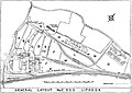 General Layout No.1 E.S.D. Liphook.jpg 827 × 586; 248 KB
-
 Goldenfields at Liphook - geograph.org.uk - 1127510.jpg 640 × 360; 70 KB
-
 Hailie, Liphook 01.png 808 × 650; 809 KB
-
 Hailie, Liphook 02.png 959 × 648; 960 KB
-
 Hailie, Liphook, Paved Walk.png 839 × 656; 884 KB
-
 Hailie, Liphook, The Garden Room.png 470 × 650; 465 KB
-
 Hammer Lane - geograph.org.uk - 2053628.jpg 640 × 430; 158 KB
-
 Hammer Lane looking north - geograph.org.uk - 2056640.jpg 640 × 430; 180 KB
-
 Hammer Lane looking south - geograph.org.uk - 2055847.jpg 640 × 430; 175 KB
-
 Hammer Vale - geograph.org.uk - 2053614.jpg 640 × 430; 128 KB
-
 Hammer Vale - geograph.org.uk - 2053620.jpg 640 × 430; 164 KB
-
 Haslemere Road and Portsmouth Road mini-roundabout in Liphook, Hampshire, England 2.jpg 3,072 × 2,304; 3.15 MB
-
 Haslemere Road and Portsmouth Road mini-roundabout in Liphook, Hampshire, England 3.jpg 3,072 × 2,304; 3.18 MB
-
 Haslemere Road and Portsmouth Road mini-roundabout in Liphook, Hampshire, England 4.jpg 2,304 × 3,072; 3.02 MB
-
 Haslemere Road and Portsmouth Road mini-roundabout in Liphook, Hampshire, England 5.jpg 2,304 × 3,072; 2.83 MB
-
 Haslemere Road and Portsmouth Road mini-roundabout in Liphook, Hampshire, England 6.jpg 2,304 × 3,072; 2.83 MB
-
 Haslemere Road and Portsmouth Road mini-roundabout in Liphook, Hampshire, England.jpg 3,072 × 2,304; 3.22 MB
-
 Haslemere Road in Liphook.JPG 3,072 × 2,304; 2.79 MB
-

-
 Hazlebank Close - geograph.org.uk - 2253826.jpg 640 × 480; 102 KB
-
 Heathland and woodland, Bramshott Common - geograph.org.uk - 2055794.jpg 640 × 430; 171 KB
-
 Heathland, Bramshott Common - geograph.org.uk - 2055821.jpg 640 × 430; 131 KB
-
 Hollycombe, steam sawmill - geograph.org.uk - 751782.jpg 640 × 426; 111 KB
-
 Homes for Sale, Liphook - geograph.org.uk - 3011799.jpg 4,288 × 3,216; 3.46 MB
-
 Horologists in London Road - geograph.org.uk - 2254490.jpg 480 × 640; 67 KB
-
 Houses in Station Road - geograph.org.uk - 2253557.jpg 640 × 480; 87 KB
-
 HSBC in London Road - geograph.org.uk - 2254514.jpg 480 × 640; 67 KB
-

-
 JMB in London Road - geograph.org.uk - 2254515.jpg 640 × 480; 86 KB
-
 Junction of Church Road and Church Lane - geograph.org.uk - 1989591.jpg 640 × 480; 111 KB
-
 Junction of Devils Lane with Chiltley Lane, Liphook.jpg 7,746 × 2,039; 13.92 MB
-
 Knockhundred Lane, Bramshott Common - geograph.org.uk - 2055808.jpg 640 × 430; 157 KB
-
 Liphook Burrell '394' 6808.jpg 1,206 × 801; 486 KB
-
 Liphook Centre.JPG 3,072 × 2,304; 3 MB
-
 Liphook Church Centre - geograph.org.uk - 1494406.jpg 640 × 369; 72 KB
-
 Liphook Church Centre - geograph.org.uk - 3843443.jpg 640 × 480; 62 KB
-
 Liphook Fire Station - geograph.org.uk - 430816.jpg 640 × 427; 181 KB
-
 Liphook Golf Course - geograph.org.uk - 3011940.jpg 4,288 × 3,216; 4.01 MB
-
 Liphook Hardware in Station Road - geograph.org.uk - 2253451.jpg 640 × 480; 78 KB
-
 Liphook in Bloom - geograph.org.uk - 3013273.jpg 4,288 × 3,216; 3.78 MB
-
 Liphook Library, London Road - geograph.org.uk - 2254524.jpg 640 × 468; 100 KB
-
 Liphook Library, London Road, Liphook (July 2019) (2).JPG 3,000 × 2,000; 2.15 MB
-
 Liphook Millennium Hall from the northwest in Liphook, Hampshire, England 2.jpg 3,072 × 2,304; 2.87 MB
-
 Liphook Millennium Hall from the northwest in Liphook, Hampshire, England.jpg 3,072 × 2,304; 2.82 MB
-
 Liphook Police Station - geograph.org.uk - 21558.jpg 640 × 426; 51 KB
-
 Liphook Police Station - geograph.org.uk - 644074.jpg 640 × 480; 61 KB
-
 Liphook services - geograph.org.uk - 3102191.jpg 640 × 414; 39 KB
-
 Liphook Services A3 south - geograph.org.uk - 2863754.jpg 640 × 480; 72 KB
-
 Liphook services, A3, eastbound - geograph.org.uk - 2794716.jpg 640 × 480; 63 KB
-
 Liphook village centre.jpg 3,264 × 1,836; 1.85 MB
-
 Liphook Village Hall - geograph.org.uk - 644109.jpg 640 × 480; 76 KB
-
 Liphook village sign - geograph.org.uk - 3685637.jpg 3,155 × 2,307; 2.98 MB
-
 Liphook, Hampshire (4356939242).jpg 2,486 × 1,864; 855 KB
-

-
 Liphook, Station Road - geograph.org.uk - 3012542.jpg 4,288 × 3,216; 3.23 MB
-

-
 Little Hammer Lane off Hammer Lane - geograph.org.uk - 2056656.jpg 640 × 420; 90 KB
-
 Longmoor Road.jpg 1,836 × 3,264; 3.52 MB
-

-

-

-

-

-

-

-

-

-

-

-
 Mid section of Station Road - geograph.org.uk - 2253560.jpg 480 × 640; 78 KB
-
 Midhurst Road in Liphook.JPG 3,072 × 2,304; 2.95 MB
-
 Midhurst Road, Liphook - geograph.org.uk - 644148.jpg 480 × 640; 60 KB
-
 Milestone, Liphook - geograph.org.uk - 3011825.jpg 3,216 × 4,288; 3.61 MB
-
 Nepalese restaurant in Station Road - geograph.org.uk - 2253446.jpg 640 × 480; 81 KB
-

-

-

-

-
 Number Twenty Six - geograph.org.uk - 2254493.jpg 640 × 480; 50 KB
-

-
 Off-licence in Station Road - geograph.org.uk - 2253449.jpg 480 × 640; 57 KB
-
 Old fashioned shop at Liphook - geograph.org.uk - 599560.jpg 640 × 480; 114 KB
-
 Opticians in Station Road - geograph.org.uk - 2253453.jpg 640 × 473; 88 KB
-
 Ornamental gate posts near Milland Place - geograph.org.uk - 350966.jpg 640 × 480; 123 KB
-
 Path, St Mary's Churchyard - geograph.org.uk - 1995205.jpg 480 × 640; 171 KB
-
 Plumbase in Station Road - geograph.org.uk - 2253562.jpg 480 × 640; 85 KB
-
 Pond by Sandy Lane - geograph.org.uk - 2053636.jpg 640 × 430; 178 KB
-
 Pond, Kingfisher Farm, Sandy Lane - geograph.org.uk - 2055705.jpg 640 × 430; 164 KB


.jpg)
_-_geograph.org.uk_-_2250495.jpg)
_-_geograph.org.uk_-_2250685.jpg)
_-_geograph.org.uk_-_2250693.jpg)
_-_geograph.org.uk_-_2250732.jpg)
_-_geograph.org.uk_-_2250501.jpg)
_-_geograph.org.uk_-_2250504.jpg)
_-_geograph.org.uk_-_2250517.jpg)
_-_geograph.org.uk_-_2252607.jpg)
_-_geograph.org.uk_-_2252662.jpg)
_-_geograph.org.uk_-_2252667.jpg)
_-_geograph.org.uk_-_2250540.jpg)
_-_geograph.org.uk_-_2252668.jpg)
_-_geograph.org.uk_-_2252673.jpg)
_-_geograph.org.uk_-_2252675.jpg)
_-_geograph.org.uk_-_2252681.jpg)
_-_geograph.org.uk_-_2252686.jpg)
_-_geograph.org.uk_-_2252706.jpg)
_-_geograph.org.uk_-_2252822.jpg)
_-_geograph.org.uk_-_2252823.jpg)
_-_geograph.org.uk_-_2252827.jpg)
_-_geograph.org.uk_-_2252836.jpg)
_-_geograph.org.uk_-_2252841.jpg)
_-_geograph.org.uk_-_2250545.jpg)
_-_geograph.org.uk_-_2250422.jpg)
_-_geograph.org.uk_-_2252856.jpg)
_-_geograph.org.uk_-_2252861.jpg)
_-_geograph.org.uk_-_2252872.jpg)
_-_geograph.org.uk_-_2252881.jpg)
_-_geograph.org.uk_-_2253248.jpg)
_-_geograph.org.uk_-_2253249.jpg)
_-_geograph.org.uk_-_2253250.jpg)
_-_geograph.org.uk_-_2253253.jpg)
_-_geograph.org.uk_-_2253255.jpg)
_-_geograph.org.uk_-_2250552.jpg)
_-_geograph.org.uk_-_2253259.jpg)
_-_geograph.org.uk_-_2253264.jpg)
_-_geograph.org.uk_-_2253267.jpg)
_-_geograph.org.uk_-_2253269.jpg)
_-_geograph.org.uk_-_2250574.jpg)
_-_geograph.org.uk_-_2250581.jpg)


.JPG)
.JPG)


_(2).JPG)


.jpg)


