Category:Linwood, Renfrewshire
Jump to navigation
Jump to search
small town in Renfrewshire, Scotland, UK  | |||||
| Upload media | |||||
| Instance of | |||||
|---|---|---|---|---|---|
| Location |
| ||||
| Population |
| ||||
 | |||||
Nederlands: Linwood is een dorp in de Schotse council Renfrewshire in het historisch graafschap Renfrewshire ongeveer 22 kilometer ten zuidwesten van Glasgow.
Subcategories
This category has the following 5 subcategories, out of 5 total.
Media in category "Linwood, Renfrewshire"
The following 19 files are in this category, out of 19 total.
-
 Bridge of Weir Railway - geograph.org.uk - 1560291.jpg 640 × 480; 101 KB
-
 Cottage at Blackstoun - geograph.org.uk - 174203.jpg 640 × 480; 51 KB
-
 East Fulton Primary School, Linwood - geograph.org.uk - 18270.jpg 640 × 480; 81 KB
-
 Fulwood Bridge - geograph.org.uk - 2176046.jpg 3,648 × 2,736; 4.99 MB
-
 Housing Development - geograph.org.uk - 426607.jpg 640 × 419; 77 KB
-
 Housing development - geograph.org.uk - 426611.jpg 640 × 404; 68 KB
-
 Kintyre Avenue, Linwood - geograph.org.uk - 1560256.jpg 640 × 480; 112 KB
-
 Linwood - geograph.org.uk - 53702.jpg 640 × 479; 83 KB
-
 Linwood from the air (geograph 4604029).jpg 640 × 480; 139 KB
-
 Linwood from the air (geograph 4892459).jpg 640 × 480; 171 KB
-
 Linwood from the air (geograph 5440984).jpg 640 × 405; 171 KB
-
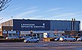 Linwood Sports Centre (geograph 2229108).jpg 3,337 × 2,066; 2.42 MB
-
 Linwood, Junction between A761 and A737 - geograph.org.uk - 18267.jpg 640 × 480; 103 KB
-
 Linwoodmoss - geograph.org.uk - 2226899.jpg 3,648 × 2,736; 5.18 MB
-
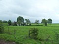
 Looking to West Walkinshaw Farm - geograph.org.uk - 501479.jpg 640 × 480; 61 KB
-
 Off Candren Road - geograph.org.uk - 169696.jpg 640 × 480; 70 KB
-
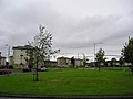
 Recreation Ground - geograph.org.uk - 54522.jpg 640 × 479; 97 KB
-
 St Brendan's High School, Linwood - geograph.org.uk - 112412.jpg 640 × 480; 71 KB
-
 Tower Block UK photo cl2-36 (Linwood 1983).jpg 2,650 × 1,750; 1 MB


.jpg)
.jpg)
.jpg)
.jpg)


.jpg)