Category:Linwood, Lincolnshire
Jump to navigation
Jump to search
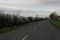
English: Linwood is a small village and civil parish on the minor road, the B1202 road that runs between Market Rasen and Wragby in Lincolnshire, England.
village and civil parish in Lincolnshire, UK  | |||||
| Upload media | |||||
| Instance of | |||||
|---|---|---|---|---|---|
| Location | West Lindsey, Lincolnshire, East Midlands, England | ||||
| Population |
| ||||
| Said to be the same as | Linwood (Wikimedia duplicated page, civil parish) | ||||
 | |||||
Subcategories
This category has only the following subcategory.
L
Media in category "Linwood, Lincolnshire"
The following 176 files are in this category, out of 176 total.
-

-
-
 B1202 entering Linwood - geograph.org.uk - 3520717.jpg 640 × 416; 57 KB
-
 B1202 north from Linwood - geograph.org.uk - 3520722.jpg 640 × 323; 52 KB
-
 B1202 towards Lissington - geograph.org.uk - 4537830.jpg 640 × 480; 59 KB
-
 Bend at Lynwode House - geograph.org.uk - 3008391.jpg 640 × 464; 78 KB
-

-
 Bus stop - geograph.org.uk - 4086731.jpg 1,024 × 683; 250 KB
-
-
 Byway to Linwood - geograph.org.uk - 194654.jpg 640 × 480; 127 KB
-
 Caravan in a field, Linwood - geograph.org.uk - 3274812.jpg 1,024 × 768; 189 KB
-
 Country road junction - geograph.org.uk - 4155744.jpg 640 × 480; 67 KB
-
 Crop field and hedgerow near Linwood - geograph.org.uk - 4537803.jpg 640 × 480; 99 KB
-
 Crop field near Walk Farm - geograph.org.uk - 4537785.jpg 640 × 480; 86 KB
-

-
 Eleanor and Lynwode Woods - geograph.org.uk - 1269853.jpg 640 × 426; 123 KB
-
 Eleanor Wood - geograph.org.uk - 4527378.jpg 640 × 480; 71 KB
-
 Entrance to Linwood Warren - geograph.org.uk - 3928864.jpg 4,272 × 2,848; 5.76 MB
-
 Entrance to Walk Farm - geograph.org.uk - 2745803.jpg 1,121 × 624; 372 KB
-
 Facing Bleasby Field - geograph.org.uk - 1123782.jpg 640 × 480; 138 KB
-
 Farm on Linwood Road - geograph.org.uk - 3927920.jpg 640 × 427; 51 KB
-
 Farm track off Linwood Road - geograph.org.uk - 3525990.jpg 2,256 × 1,504; 2.6 MB
-
 Farmland and hedgerow - geograph.org.uk - 4537776.jpg 640 × 480; 63 KB
-
 Farmland near Linwood - geograph.org.uk - 3502897.jpg 640 × 480; 47 KB
-

-
 Farmland south of market Rasen - geograph.org.uk - 3502901.jpg 640 × 589; 56 KB
-
 Farmland towards Eleanor Wood - geograph.org.uk - 4537828.jpg 640 × 480; 79 KB
-
 Farmland, Woodhill Farm - geograph.org.uk - 3523308.jpg 640 × 480; 59 KB
-

-

-

-
 Grass fields towards Glebe Farm - geograph.org.uk - 2745814.jpg 1,244 × 841; 716 KB
-

-
 Grazing Land - geograph.org.uk - 1104506.jpg 640 × 480; 92 KB
-
 Grazing land at entrance to Poultry farm - geograph.org.uk - 2456162.jpg 640 × 427; 108 KB
-
 Heading north east towards Linwood - geograph.org.uk - 4537799.jpg 640 × 480; 67 KB
-
 Hedge-lined lane approaching Manor Farm near to Linwood - geograph.org.uk - 6086821.jpg 4,000 × 3,000; 3.48 MB
-

-
 In the thick of it - geograph.org.uk - 1123743.jpg 640 × 480; 162 KB
-
 Junction on Lissingley Lane - geograph.org.uk - 4025720.jpg 1,024 × 727; 96 KB
-
 Lane heading towards Manor Farm and Linwood - geograph.org.uk - 6086824.jpg 4,000 × 3,000; 3.86 MB
-
 Lane joining Lissingly Lane near to Buslingthorpe Bridge - geograph.org.uk - 6086827.jpg 4,000 × 3,000; 2.98 MB
-
-
 Legsby Road - geograph.org.uk - 3523310.jpg 640 × 480; 77 KB
-
 Legsby Road - geograph.org.uk - 3523315.jpg 640 × 480; 89 KB
-
 Legsby Road at Linwood Warren - geograph.org.uk - 5777967.jpg 1,600 × 1,073; 848 KB
-
 Legsby Wood from Lynwode Wood - geograph.org.uk - 1123762.jpg 640 × 480; 63 KB
-
 Little Pink Church, Linwood - geograph.org.uk - 611037.jpg 480 × 640; 151 KB
-
 Linwood at phone box - geograph.org.uk - 3520721.jpg 640 × 370; 66 KB
-
 Linwood Road - geograph.org.uk - 3927943.jpg 1,024 × 683; 98 KB
-
 Linwood road at Poplars - geograph.org.uk - 3008389.jpg 640 × 455; 63 KB
-
 Linwood road near Market Rasen - geograph.org.uk - 4025733.jpg 1,024 × 768; 108 KB
-
 Linwood Warren - geograph.org.uk - 194655.jpg 640 × 480; 85 KB
-
 Linwood Warren Nature reserve entrance - geograph.org.uk - 2456171.jpg 640 × 427; 155 KB
-
 Linwood Warren, earthworks - geograph.org.uk - 3643813.jpg 640 × 427; 103 KB
-

-
 Linwood, aerial 2019 - geograph.org.uk - 6340118.jpg 800 × 533; 97 KB
-
 Linwood, B1202 bridge - geograph.org.uk - 2555420.jpg 640 × 480; 125 KB
-

-
 Lissingley Lane - geograph.org.uk - 4155747.jpg 640 × 480; 55 KB
-
 Looking out of the wood - geograph.org.uk - 1123756.jpg 640 × 480; 66 KB
-

-
 Manor Farm - geograph.org.uk - 1976595.jpg 640 × 426; 115 KB
-
 Manor Farm - geograph.org.uk - 4527369.jpg 640 × 407; 51 KB
-
 Market Rasen from the South, aerial 2013 - geograph.org.uk - 3641418.jpg 427 × 640; 108 KB
-
 Market Rasen from the South, aerial 2013 - geograph.org.uk - 3641419.jpg 640 × 427; 108 KB
-
 Market Rasen Golf Club - geograph.org.uk - 4086765.jpg 1,024 × 683; 201 KB
-
 Market Rasen ^ District Golf Club - geograph.org.uk - 3523320.jpg 640 × 480; 78 KB
-
 Market Rasen ^ District Golf Club - geograph.org.uk - 3643602.jpg 640 × 427; 70 KB
-
 Market Rasen ^ District Golf Club - geograph.org.uk - 3643606.jpg 640 × 427; 45 KB
-
 Mature Trees in Lynwode Wood - geograph.org.uk - 1123738.jpg 640 × 480; 122 KB
-
 Mill Lane - geograph.org.uk - 2745469.jpg 1,280 × 960; 228 KB
-
 Mill Lane heading towards Smith's Top Farm and Middle Rasen - geograph.org.uk - 6086830.jpg 4,000 × 3,000; 2.69 MB
-

-
 Minor road near Buslingthorpe - geograph.org.uk - 4025725.jpg 1,024 × 768; 120 KB
-
 Minor road towards Lissington - geograph.org.uk - 4537789.jpg 640 × 480; 66 KB
-

-

-
 Moated site, Linwood, aerial 2019 (1) - geograph.org.uk - 6340097.jpg 1,024 × 683; 121 KB
-
 Mud, mud, glorious mud^ - geograph.org.uk - 3272828.jpg 1,024 × 768; 153 KB
-
 National Cycle Route 1 - geograph.org.uk - 4155745.jpg 640 × 480; 74 KB
-
 National Cycle Route 1 - geograph.org.uk - 4527375.jpg 640 × 480; 80 KB
-
 National Cycle Route 1 - geograph.org.uk - 4537795.jpg 640 × 480; 76 KB
-
 National Cycle Route 1 - geograph.org.uk - 4537804.jpg 640 × 480; 79 KB
-
 National Cycle Route 1 - geograph.org.uk - 4537822.jpg 640 × 480; 81 KB
-

-
 National Cycle Route 1, Linwood - geograph.org.uk - 4537807.jpg 640 × 480; 74 KB
-
 National Cycle Route 1, Linwood - geograph.org.uk - 4537824.jpg 640 × 476; 68 KB
-

-
 Oilseed rape crop off the B1202 - geograph.org.uk - 4537827.jpg 640 × 480; 90 KB
-
 Ordnance Survey Cut Mark - geograph.org.uk - 5483715.jpg 640 × 504; 99 KB
-
 Ordnance Survey Cut Mark - geograph.org.uk - 6088739.jpg 3,777 × 2,833; 2.72 MB
-
 Paddocks behind College Farm - geograph.org.uk - 3644101.jpg 640 × 427; 57 KB
-
 Path in Lynwode Wood - geograph.org.uk - 1123250.jpg 640 × 480; 137 KB
-
 Path to Linwood (St. Cornelius) Church - geograph.org.uk - 3927951.jpg 1,024 × 683; 270 KB
-
 Poultry farm from Legsby Road - geograph.org.uk - 2456167.jpg 640 × 427; 81 KB
-
 Power lines crossing road into Linwood - geograph.org.uk - 4025730.jpg 1,024 × 768; 106 KB
-
 Railway towards Market Rasen - geograph.org.uk - 4537793.jpg 640 × 480; 66 KB
-
 Reeds and a pond in Linwood Warren - geograph.org.uk - 3643806.jpg 640 × 427; 106 KB
-

-

-
 Road junction at Linwood - geograph.org.uk - 5778104.jpg 1,600 × 1,066; 465 KB
-

-
 Road through Linwood Warren - geograph.org.uk - 2456175.jpg 640 × 427; 112 KB
-
 Road through Linwood Warren - geograph.org.uk - 3523321.jpg 640 × 480; 132 KB
-
 Road through Lynwood at phone box - geograph.org.uk - 3008394.jpg 640 × 468; 79 KB
-
 Road to The Hardings - geograph.org.uk - 4155753.jpg 640 × 480; 44 KB
-
 Route 1 - geograph.org.uk - 1976567.jpg 640 × 426; 88 KB
-

-
 Rubbish dumped in Willingham Lane - geograph.org.uk - 3644088.jpg 640 × 427; 92 KB
-
 Sheep in Linwood Warren - geograph.org.uk - 3643696.jpg 640 × 427; 87 KB
-
 Skid marks - geograph.org.uk - 1976613.jpg 640 × 426; 96 KB
-
 St Cornelius Church, Linwood - geograph.org.uk - 5778052.jpg 1,600 × 1,065; 593 KB
-
 St Cornelius Church, Linwood - geograph.org.uk - 5917182.jpg 1,065 × 1,600; 700 KB
-
 St Cornelius Church, Linwood - geograph.org.uk - 5917185.jpg 1,600 × 1,065; 751 KB
-
 St Cornelius Church, Linwood - geograph.org.uk - 5917188.jpg 1,065 × 1,600; 326 KB
-
 St Cornelius Church, Linwood - geograph.org.uk - 5917191.jpg 1,065 × 1,600; 382 KB
-
 St Cornelius Church, Linwood - geograph.org.uk - 5917193.jpg 1,065 × 1,600; 363 KB
-
 St Cornelius Church, Linwood - geograph.org.uk - 5917196.jpg 1,600 × 1,474; 503 KB
-
 St Cornelius Church, Linwood - geograph.org.uk - 5917495.jpg 1,065 × 1,600; 422 KB
-
 St Cornelius Church, Linwood - geograph.org.uk - 5917501.jpg 1,065 × 1,600; 383 KB
-
 St Cornelius Church, Linwood - geograph.org.uk - 5917503.jpg 1,600 × 1,065; 858 KB
-
 St Cornelius Church, Linwood - geograph.org.uk - 5917522.jpg 597 × 1,600; 409 KB
-
 St Cornelius Church, Linwood - geograph.org.uk - 5917524.jpg 1,276 × 1,600; 870 KB
-
 St Cornelius Church, Linwood - geograph.org.uk - 5917530.jpg 1,391 × 1,600; 889 KB
-
 St Cornelius Church, Linwood - geograph.org.uk - 5917531.jpg 931 × 1,600; 579 KB
-
 St Cornelius Church, Linwood - geograph.org.uk - 5917536.jpg 1,284 × 1,600; 1.03 MB
-
 St Cornelius Church, Linwood - geograph.org.uk - 5917543.jpg 869 × 1,600; 710 KB
-
 St Cornelius Church, Linwood - geograph.org.uk - 5917547.jpg 862 × 1,600; 575 KB
-
 St Cornelius Church, Linwood - geograph.org.uk - 5917552.jpg 872 × 1,600; 556 KB
-
 St Cornelius' Church - geograph.org.uk - 1123775.jpg 640 × 480; 87 KB
-

-

-
 The churchyard, Linwood (geograph 3274801).jpg 1,024 × 768; 207 KB
-
 The entrance to High Ropes Adventure - geograph.org.uk - 2284042.jpg 1,024 × 768; 275 KB
-
 The path from Linwood church - geograph.org.uk - 3274818.jpg 1,024 × 768; 162 KB
-
 The path from the church, Linwood - geograph.org.uk - 3274667.jpg 1,024 × 768; 223 KB
-
 The path to Linwood church (2) (geograph 3274826).jpg 1,024 × 768; 139 KB
-
 The path to Linwood church - geograph.org.uk - 3274821.jpg 768 × 1,024; 176 KB
-
 Tin tabernacle - geograph.org.uk - 1976588.jpg 640 × 426; 163 KB
-
 Track in Lynwode Wood - geograph.org.uk - 1123769.jpg 640 × 480; 166 KB
-
 Track through Eleanor Wood - geograph.org.uk - 1123731.jpg 640 × 480; 127 KB
-
 Track to Lynwode Lodge - geograph.org.uk - 2745822.jpg 1,092 × 774; 656 KB
-
 Track to Walk Farm - geograph.org.uk - 4537783.jpg 640 × 480; 77 KB
-

-
-
 View from Lynwode House - geograph.org.uk - 609895.jpg 640 × 480; 93 KB
-
 View from the churchyard, Linwood (2) - geograph.org.uk - 3274808.jpg 1,024 × 768; 157 KB
-
 View from the churchyard, Linwood - geograph.org.uk - 3274804.jpg 1,024 × 768; 177 KB
-
 View towards Manor Farm - geograph.org.uk - 3272814.jpg 1,024 × 768; 163 KB
-
 View towards Manor Farm - geograph.org.uk - 3273042.jpg 1,024 × 768; 211 KB
-
 View towards Narrow Wood - geograph.org.uk - 3272798.jpg 1,024 × 768; 164 KB
-
 Walk Farm - geograph.org.uk - 3272824.jpg 1,024 × 768; 119 KB
-
 West end of Willingham Lane - geograph.org.uk - 3528612.jpg 2,256 × 1,504; 2.57 MB
-
 Willingham Lane (track) - geograph.org.uk - 3523319.jpg 640 × 480; 102 KB
-
 Willingham Lane (track) - geograph.org.uk - 3526000.jpg 2,256 × 1,504; 2.75 MB
-
 Willingham Lane - geograph.org.uk - 4537813.jpg 640 × 480; 62 KB
-

-

-
 Woodland track - geograph.org.uk - 1123259.jpg 640 × 480; 156 KB
-
 A Line of Trees - geograph.org.uk - 1104464.jpg 640 × 480; 100 KB
-
 Approaching White Horse Corner - geograph.org.uk - 609879.jpg 640 × 480; 110 KB
-
 Bridge 25 - geograph.org.uk - 413445.jpg 640 × 480; 77 KB
-
 Byway to Lissingley Lane - geograph.org.uk - 466827.jpg 640 × 427; 53 KB
-

-

-
 Confusing Sign^ - geograph.org.uk - 501039.jpg 640 × 480; 103 KB
-
 Farm Track - geograph.org.uk - 505795.jpg 640 × 480; 72 KB
-
 Farmland near Linwood - geograph.org.uk - 186604.jpg 640 × 427; 60 KB
-
 Farmland, Buslingthorpe - geograph.org.uk - 1411126.jpg 640 × 480; 77 KB
-
 Lissingley Level Crossing - geograph.org.uk - 505788.jpg 640 × 480; 57 KB
-

-

-
 Manor Farm - geograph.org.uk - 186602.jpg 640 × 427; 62 KB
-
 Road to "The Hardings" - geograph.org.uk - 500974.jpg 640 × 480; 107 KB
-
 Sustrans Route Marker - geograph.org.uk - 505799.jpg 480 × 640; 98 KB


_-_geograph.org.uk_-_6340104.jpg)
_-_geograph.org.uk_-_6340108.jpg)
_-_geograph.org.uk_-_6340097.jpg)


_Church_-_geograph.org.uk_-_3927951.jpg)


.jpg)


_(geograph_3274826).jpg)


_-_geograph.org.uk_-_3274808.jpg)


_-_geograph.org.uk_-_3523319.jpg)
_-_geograph.org.uk_-_3526000.jpg)


_-_geograph.org.uk_-_1411140.jpg)
_-_geograph.org.uk_-_1411146.jpg)


