Category:Liniestraat, Breda
Jump to navigation
Jump to search
| Camera location | | View all coordinates using: OpenStreetMap |
|---|
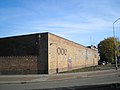
Nederlands: Afbeeldingen van de Liniestraat in de wijk Doornbos-Linie in Breda in de provincie Noord-Brabant in het zuiden van Nederland. Het is een doorgaande straat naar Station Breda en het centrum van Breda. Aan het eind van de Terheijdenseweg, Breda en aan de Liniestraat bevindt zich de voormalige fabriek van de De Faam (bron [1])
street in Breda, the Netherlands | |||||
| Upload media | |||||
| Instance of | |||||
|---|---|---|---|---|---|
| Location | Breda, North Brabant, Netherlands | ||||
| Street address |
| ||||
 | |||||
Subcategories
This category has the following 3 subcategories, out of 3 total.
Media in category "Liniestraat, Breda"
The following 12 files are in this category, out of 12 total.
-
 'De Faam' Breda (16901640076).jpg 4,239 × 2,848; 5.28 MB
-
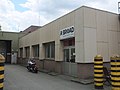 A-Broad Studio DSCF7374.jpg 2,048 × 1,536; 1.46 MB
-
 Astra-Faam-B.V. Liniestraat-19 Breda Nederland-03.JPG 2,592 × 1,944; 2.31 MB
-
 Astra-Faam-B.V. Liniestraat-19 Breda Nederland-04.JPG 2,592 × 1,944; 2.41 MB
-
 Liniestraat, Breda P1360699 copy.jpg 1,662 × 1,161; 670 KB
-
 Liniestraat, Breda P1360700 copy.jpg 1,858 × 719; 455 KB
-
 Liniestraat, Breda P1360701 copy 1.jpg 1,537 × 635; 343 KB
-
 Liniestraat, Breda P1360701 copy 2.jpg 4,000 × 1,610; 1.89 MB
-
 Omgeving nieuwe station Breda DSCF6601.JPG 2,816 × 2,112; 2.68 MB
-
 Stationslaan, Breda P1360699.jpg 4,000 × 2,672; 6.08 MB
-
 Stationslaan, Breda P1360700.jpg 4,000 × 2,672; 5.91 MB
-
 Stationslaan, Breda P1360701.jpg 4,000 × 2,672; 5.71 MB
.jpg)


