Category:Lingwood and Burlingham
Jump to navigation
Jump to search
English: Lingwood and Burlingham is a civil parish in the English county of Norfolk, comprising the large village of Lingwood together with the smaller villages of Burlingham Green, North Burlingham and South Burlingham. The villages are all within equidistant from the town of Great Yarmouth and the city of Norwich.
civil parish in the English county of Norfolk  | |||||
| Upload media | |||||
| Instance of | |||||
|---|---|---|---|---|---|
| Location | Broadland, Norfolk, East of England, England | ||||
| Area |
| ||||
 | |||||
Subcategories
This category has the following 4 subcategories, out of 4 total.
L
N
S
Media in category "Lingwood and Burlingham"
The following 200 files are in this category, out of 266 total.
(previous page) (next page)-
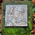
 "Cernunnos" plaque - geograph.org.uk - 4767680.jpg 640 × 545; 531 KB
-
 "Iceni Horse" plaque - geograph.org.uk - 4767536.jpg 640 × 639; 552 KB
-
 "St Andrew Angel" plaque - geograph.org.uk - 4767556.jpg 640 × 589; 586 KB
-
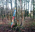
 "Tree Sitters" plaque - geograph.org.uk - 4767666.jpg 640 × 582; 580 KB
-
 "Woad working" plaque - geograph.org.uk - 4767600.jpg 640 × 616; 651 KB
-
 "Wolf" plaque - geograph.org.uk - 4767693.jpg 628 × 640; 617 KB
-
 A dip in the road - geograph.org.uk - 3433926.jpg 640 × 480; 232 KB
-
 A patch of blue cabbage - geograph.org.uk - 4849638.jpg 640 × 360; 314 KB
-
 A very muddy access road - geograph.org.uk - 4779163.jpg 640 × 360; 389 KB
-
 A walk in Burlingham Woods - geograph.org.uk - 4786698.jpg 536 × 628; 570 KB
-

-
 Ambassador Travel YT23 BDF (cropped).jpg 1,948 × 1,462; 1.58 MB
-
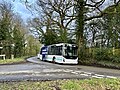 Ambassador Travel YT23 BDF.jpg 3,662 × 2,747; 6.24 MB
-

-

-

-

-
 Artwork in Drive Plantation - geograph.org.uk - 5237652.jpg 640 × 586; 617 KB
-

-
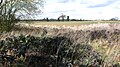
 Barley field by Buckenham Road - geograph.org.uk - 5480818.jpg 1,600 × 1,168; 300 KB
-

-
 Barns at Old Hall Farm - geograph.org.uk - 4849579.jpg 640 × 608; 577 KB
-

-

-
 Blue cabbage - geograph.org.uk - 4849664.jpg 640 × 360; 398 KB
-
 Blue cabbage gone wild - geograph.org.uk - 4849675.jpg 360 × 640; 383 KB
-
 Bracken in Belt Plantation - geograph.org.uk - 4767683.jpg 640 × 480; 541 KB
-
 Bramble patch between two crop fields - geograph.org.uk - 4849608.jpg 640 × 499; 422 KB
-
 Briar Close, Lingwood - geograph.org.uk - 4849738.jpg 640 × 360; 224 KB
-
 Building at Dell Farm - geograph.org.uk - 4779146.jpg 640 × 360; 245 KB
-
 Buildings at Dell Farm - geograph.org.uk - 4779143.jpg 640 × 360; 292 KB
-

-
 Burlingham Green - geograph.org.uk - 4779203.jpg 640 × 360; 326 KB
-
 Burlingham House - geograph.org.uk - 2234702.jpg 640 × 480; 131 KB
-
 Burlingham House care home - geograph.org.uk - 2234732.jpg 640 × 480; 117 KB
-
 Burlingham House care home - geograph.org.uk - 2234734.jpg 640 × 477; 116 KB
-
 Burlingham House care home - geograph.org.uk - 2234736.jpg 640 × 480; 98 KB
-
 Burlingham House from over the fields - geograph.org.uk - 2234610.jpg 640 × 480; 145 KB
-
 Business premises in Chapel Road - geograph.org.uk - 4849751.jpg 640 × 360; 242 KB
-
 Cabbage gone wild - geograph.org.uk - 4849654.jpg 640 × 360; 379 KB
-
 Cabbage growing by disused gravel pit - geograph.org.uk - 4849647.jpg 360 × 640; 379 KB
-
 Cabbage growing by disused gravel pit - geograph.org.uk - 4849653.jpg 360 × 640; 388 KB
-
 Cabbage on a field's edge - geograph.org.uk - 4849657.jpg 360 × 640; 378 KB
-
 Cabbage patch in crop field - geograph.org.uk - 4849637.jpg 640 × 360; 310 KB
-
 Cabbage patch on the edge of a field - geograph.org.uk - 4849643.jpg 640 × 360; 353 KB
-

-
 Car park by St Andrew's church - geograph.org.uk - 5237674.jpg 640 × 480; 493 KB
-
 Cereal crop field by Hopewell Gardens - geograph.org.uk - 4849604.jpg 640 × 360; 267 KB
-
 Cereal crop field by Old Hall Farm - geograph.org.uk - 4849557.jpg 640 × 360; 317 KB
-
 Cereal crop field by View Farm - geograph.org.uk - 4849499.jpg 640 × 360; 262 KB
-
 Church Plantation in December - geograph.org.uk - 4767541.jpg 640 × 375; 397 KB
-
 Church Road off Norwich Road - geograph.org.uk - 6152809.jpg 1,600 × 1,065; 518 KB
-
 Church Road towards South Burlingham Road - geograph.org.uk - 6152816.jpg 1,600 × 1,065; 575 KB
-
 Church Road towards St Edmund's Church - geograph.org.uk - 6152810.jpg 1,600 × 1,065; 654 KB
-
 Circular path in Church Plantation - geograph.org.uk - 4767542.jpg 640 × 480; 526 KB
-
 Clearing in Jary's Wood - geograph.org.uk - 4779184.jpg 640 × 360; 301 KB
-
 Colourful blue cabbage - geograph.org.uk - 4849677.jpg 360 × 640; 384 KB
-

-
 Crop field by Hopewell Gardens - geograph.org.uk - 4849619.jpg 640 × 619; 509 KB
-
 Crop field east of Brownslane Plantation - geograph.org.uk - 4779168.jpg 640 × 360; 270 KB
-
 Crop field near Hillcrest Farm - geograph.org.uk - 4953349.jpg 640 × 416; 42 KB
-
 Crop field south of Church Farm - geograph.org.uk - 4849550.jpg 640 × 360; 266 KB
-
 Crop field with cabbage patch - geograph.org.uk - 4849631.jpg 640 × 360; 280 KB
-
 Crop fields by Church Farm - geograph.org.uk - 4849551.jpg 640 × 360; 238 KB
-
 Crop fields by Dell Farm - geograph.org.uk - 4779160.jpg 640 × 360; 237 KB
-
 Crop fields by Lodge Cottage - geograph.org.uk - 4849515.jpg 640 × 360; 278 KB
-
 Crop fields by Lodge Farm - geograph.org.uk - 4849519.jpg 640 × 360; 219 KB
-
 Crop fields by Thoroughfare House - geograph.org.uk - 4849544.jpg 640 × 360; 236 KB
-
 Crop fields in Beighton - geograph.org.uk - 4849623.jpg 640 × 360; 282 KB
-
 Crop fields north of Lingwood - geograph.org.uk - 4849506.jpg 640 × 360; 286 KB
-
 Crop fields south of View Farm - geograph.org.uk - 4849504.jpg 640 × 360; 279 KB
-
 Crop fields west of Lingwood Lane - geograph.org.uk - 4849500.jpg 640 × 360; 249 KB
-
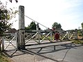
 Crossing gates in Chapel Road - geograph.org.uk - 4849747.jpg 640 × 360; 312 KB
-

-

-
 Cultivated fields by Old Hall Farm - geograph.org.uk - 4849606.jpg 640 × 360; 333 KB
-
 Cultivated fields north of Strumpshaw - geograph.org.uk - 2306923.jpg 640 × 480; 131 KB
-
 Cushion Cottage (date stone) - geograph.org.uk - 4779196.jpg 640 × 435; 436 KB
-
 Cushion Cottage - geograph.org.uk - 4779200.jpg 640 × 430; 300 KB
-
 December sunshine in Church Plantation - geograph.org.uk - 5237670.jpg 640 × 617; 551 KB
-
 Dell Corner Lane - geograph.org.uk - 5480684.jpg 1,600 × 1,217; 459 KB
-
 Dell Corner Lane - geograph.org.uk - 5480690.jpg 1,200 × 1,600; 478 KB
-
 Dell Farm (sign) - geograph.org.uk - 4779149.jpg 640 × 561; 490 KB
-
 Disused doors into a farm building - geograph.org.uk - 4779154.jpg 640 × 414; 372 KB
-
 Disused gravel pit west of Beighton - geograph.org.uk - 4849660.jpg 360 × 640; 389 KB
-

-
 Dog litter bin in Drive Plantation - geograph.org.uk - 4767557.jpg 640 × 480; 488 KB
-
 Dog litter bin in Millennium Wood - geograph.org.uk - 4767649.jpg 640 × 480; 476 KB
-
 Drive Plantation - geograph.org.uk - 4767572.jpg 640 × 605; 632 KB
-
 Driveway to Burlingham Lodge Farm - geograph.org.uk - 2118951.jpg 640 × 480; 144 KB
-
 Entrance to Cushion Cottage - geograph.org.uk - 4779199.jpg 640 × 484; 409 KB
-
 Entrance to INOSCAPE - geograph.org.uk - 4849534.jpg 640 × 360; 219 KB
-

-
 Farm track to Dell Farm - geograph.org.uk - 4779139.jpg 640 × 360; 383 KB
-
 Field boundary hedge - geograph.org.uk - 4849601.jpg 640 × 360; 273 KB
-
 Field boundary south of View Farm - geograph.org.uk - 4849509.jpg 450 × 640; 343 KB
-
 Field off Lingwood Road - geograph.org.uk - 5480133.jpg 1,600 × 1,200; 411 KB
-
 Field south of Belt Plantation - geograph.org.uk - 2118938.jpg 640 × 480; 155 KB
-
 Fields by Beighton - geograph.org.uk - 4849642.jpg 640 × 360; 304 KB
-
 Fields by Dell Farm - geograph.org.uk - 4779171.jpg 640 × 547; 395 KB
-
 Fingerpost by Jary's Wood - geograph.org.uk - 4779169.jpg 640 × 360; 267 KB
-
 Flooded road after heavy overnight rain - geograph.org.uk - 4292395.jpg 640 × 480; 167 KB
-

-
 Footpath beside Lingwood Lane - geograph.org.uk - 4849517.jpg 640 × 360; 363 KB
-
 Footpath beside Lingwood Lane - geograph.org.uk - 4849520.jpg 640 × 360; 333 KB
-
 Footpath in Drive Plantation - geograph.org.uk - 4767847.jpg 483 × 544; 347 KB
-
 Footpath into Jary's Wood - geograph.org.uk - 4779174.jpg 640 × 360; 318 KB
-
 Footpath off Norwich Road - geograph.org.uk - 4849586.jpg 640 × 360; 377 KB
-
 Footpath past Dell Farm - geograph.org.uk - 4779151.jpg 640 × 360; 302 KB
-
 Footpath through Drive Plantation - geograph.org.uk - 4767598.jpg 640 × 480; 524 KB
-
 Footpath to Buckenham Woods, Strumpshaw - geograph.org.uk - 3446980.jpg 640 × 480; 172 KB
-
 Footpath to Hopewell Gardens - geograph.org.uk - 4849593.jpg 640 × 360; 365 KB
-
 Footpath to Hopewell Gardens - geograph.org.uk - 4849620.jpg 640 × 360; 366 KB
-
 Footpath to Norwich Road - geograph.org.uk - 4849589.jpg 640 × 360; 374 KB
-
 Footpath traversing Jary's Wood - geograph.org.uk - 4779177.jpg 640 × 360; 396 KB
-
 Free Range Chickens at Thoroughfare Farm - geograph.org.uk - 6152825.jpg 1,600 × 1,065; 742 KB
-

-

-
 Frosty lane on The Green - geograph.org.uk - 5237638.jpg 640 × 480; 468 KB
-
 Frosty paddocks by Home Farm - geograph.org.uk - 5237633.jpg 640 × 397; 228 KB
-

-
 Frosty path into Millennium Plantation - geograph.org.uk - 5237641.jpg 640 × 480; 499 KB
-
 Gate and stile - geograph.org.uk - 4849573.jpg 640 × 360; 359 KB
-
 Graveyard around St Peter's church, Lingwood - geograph.org.uk - 5480854.jpg 1,600 × 1,200; 489 KB
-
 Heater Lane towards Biofield - geograph.org.uk - 6152906.jpg 1,600 × 1,065; 454 KB
-
 Hillcrest ^8 Level Crossing Information - geograph.org.uk - 6152838.jpg 886 × 1,600; 447 KB
-
 House at Dell Corner - geograph.org.uk - 4779138.jpg 640 × 360; 304 KB
-
 Information board in Belt Plantation - geograph.org.uk - 4767673.jpg 1,200 × 872; 1.01 MB
-
 Inoscape Ltd - geograph.org.uk - 4849536.jpg 640 × 360; 169 KB
-
 Iris foetidissima (Stinking iris) - geograph.org.uk - 4767547.jpg 640 × 480; 544 KB
-
 Iris foetidissima (Stinking iris) - geograph.org.uk - 4767550.jpg 632 × 640; 584 KB
-
 Ivy-clad farm building - geograph.org.uk - 4779147.jpg 640 × 415; 372 KB
-
 Ivy-clad trees in Church Plantation - geograph.org.uk - 4767531.jpg 640 × 480; 514 KB
-
 Ivy-clad trees on a field boundary - geograph.org.uk - 4849625.jpg 640 × 360; 269 KB
-
 Jary's and Adam's Wood (information board) - geograph.org.uk - 4779181.jpg 1,200 × 910; 1,008 KB
-

-
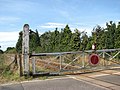 Level crossing on Chapel Road - geograph.org.uk - 1497844.jpg 640 × 480; 99 KB
-
 Level crossing on Chapel Road - geograph.org.uk - 1497850.jpg 640 × 480; 95 KB
-

-
 Lingwood First School in Chapel Road - geograph.org.uk - 4849724.jpg 640 × 360; 298 KB
-
 Lingwood First School in Chapel Road - geograph.org.uk - 4849728.jpg 640 × 360; 307 KB
-
 Lingwood First School in Chapel Road - geograph.org.uk - 4849730.jpg 640 × 352; 259 KB
-
 Lingwood Lodge - geograph.org.uk - 4849528.jpg 640 × 362; 352 KB
-
 Lingwood Road junction with A47 - geograph.org.uk - 5480661.jpg 1,600 × 1,200; 397 KB
-
 Lingwood Road to A47 - geograph.org.uk - 5480135.jpg 1,600 × 1,200; 462 KB
-
 Local art in Drive Plantation - geograph.org.uk - 4767569.jpg 640 × 510; 535 KB
-
 Local art in Drive Plantation - geograph.org.uk - 4767570.jpg 640 × 570; 525 KB
-
 Local art in Drive Plantation - geograph.org.uk - 4767571.jpg 480 × 640; 541 KB
-
 Local art in Drive Plantation - geograph.org.uk - 4767576.jpg 640 × 520; 512 KB
-
 Local art in Drive Plantation - geograph.org.uk - 4767578.jpg 640 × 628; 651 KB
-
 Local art in Drive Plantation - geograph.org.uk - 4767579.jpg 640 × 548; 621 KB
-
 Local art in Drive Plantation - geograph.org.uk - 4767580.jpg 595 × 627; 573 KB
-
 Local art in Drive Plantation - geograph.org.uk - 4767581.jpg 640 × 583; 444 KB
-
 Local art in Drive Plantation - geograph.org.uk - 4767583.jpg 640 × 480; 568 KB
-
 Local art in Drive Plantation - geograph.org.uk - 4767584.jpg 640 × 573; 628 KB
-
 Local art in Drive Plantation - geograph.org.uk - 4767585.jpg 640 × 602; 699 KB
-
 Local art in Drive Plantation - geograph.org.uk - 4767587.jpg 640 × 547; 599 KB
-
 Local art in Drive Plantation - geograph.org.uk - 4767588.jpg 640 × 480; 432 KB
-
 Local art in Drive Plantation - geograph.org.uk - 4767590.jpg 640 × 582; 656 KB
-
 Local art in Drive Plantation - geograph.org.uk - 4767592.jpg 640 × 480; 518 KB
-
 Local art in Drive Plantation - geograph.org.uk - 4767593.jpg 640 × 530; 556 KB
-
 Lunar Crescents and Stars (plaque) - geograph.org.uk - 4779191.jpg 623 × 570; 555 KB
-
 Lych gate at Lingwood Parish Cemetery - geograph.org.uk - 6152904.jpg 1,600 × 1,065; 693 KB
-

-
 Millennium Wood (information board) - geograph.org.uk - 4767648.jpg 1,200 × 853; 1.06 MB
-
 Muddy track into fields - geograph.org.uk - 4849561.jpg 640 × 360; 272 KB
-
 Narrow path beside the railway line - geograph.org.uk - 1497839.jpg 480 × 640; 103 KB
-
 Narrow path skirting a field's edge - geograph.org.uk - 4849610.jpg 640 × 360; 312 KB
-
 Narrow path to Hopewell Gardens - geograph.org.uk - 4849613.jpg 640 × 360; 348 KB
-
 New public woodland by St Peter's Church - geograph.org.uk - 5480668.jpg 1,600 × 1,200; 514 KB
-
-

-
 Old gatepost - geograph.org.uk - 4767527.jpg 438 × 640; 286 KB
-
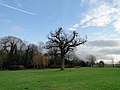
 Old oak in Millennium Wood - geograph.org.uk - 4767661.jpg 480 × 640; 432 KB
-
 Old water cart - geograph.org.uk - 2234640.jpg 640 × 480; 217 KB
-
 Ornate gate - geograph.org.uk - 4849524.jpg 640 × 435; 493 KB
-

-

-
 Pasture gates by Dell Farm - geograph.org.uk - 4779145.jpg 640 × 360; 346 KB
-
-
 Path between fields - geograph.org.uk - 4849600.jpg 640 × 360; 273 KB
-
 Path following field boundary hedge - geograph.org.uk - 4849617.jpg 640 × 360; 90 KB
-

-
 Path in Belt Plantation - geograph.org.uk - 4767677.jpg 640 × 480; 500 KB
-
 Path in Belt Plantation - geograph.org.uk - 4767679.jpg 640 × 480; 503 KB
-
 Path in Church Plantation - geograph.org.uk - 4767530.jpg 640 × 480; 550 KB
-
 Path into Millennium Wood - geograph.org.uk - 4767645.jpg 640 × 480; 442 KB
-
 Path on the edge of Drive Plantation - geograph.org.uk - 5237647.jpg 640 × 480; 477 KB
-

-
 Path through Drive Plantation - geograph.org.uk - 5237646.jpg 640 × 480; 489 KB
-
 Path through Drive Plantation - geograph.org.uk - 5237663.jpg 640 × 572; 600 KB
-
 Path through Jary's Wood - geograph.org.uk - 4779188.jpg 640 × 360; 415 KB
-
 Path through the clearing in Jary's Wood - geograph.org.uk - 4779195.jpg 640 × 347; 286 KB
-
 Path to Hopewell Gardens - geograph.org.uk - 4849595.jpg 640 × 360; 281 KB
-
 Path traversing Belt Plantation - geograph.org.uk - 4767687.jpg 640 × 480; 513 KB
-
 Path traversing Drive Plantation - geograph.org.uk - 4767553.jpg 640 × 495; 550 KB
-
 Pedestrian crossing on Chapel Road - geograph.org.uk - 1497861.jpg 480 × 640; 104 KB
-
 Pheasant drinker on a field's edge - geograph.org.uk - 4779162.jpg 640 × 542; 413 KB
-

-
 Ploughed field by Willow Farm - geograph.org.uk - 4849565.jpg 640 × 360; 275 KB


.jpg)


_-_geograph.org.uk_-_4779196.jpg)


_-_geograph.org.uk_-_4779149.jpg)


_-_geograph.org.uk_-_4767547.jpg)
_-_geograph.org.uk_-_4767550.jpg)


_-_geograph.org.uk_-_4779181.jpg)


_-_geograph.org.uk_-_4779191.jpg)


_-_geograph.org.uk_-_4767648.jpg)


