Category:Linguistic maps of Northeast India
Jump to navigation
Jump to search
Media in category "Linguistic maps of Northeast India"
The following 16 files are in this category, out of 16 total.
-
 Assamese dialects political map.png 3,766 × 2,826; 477 KB
-
 Dialects Of Punjabi~4.jpg 682 × 624; 102 KB
-
 Khasi map.png 767 × 762; 96 KB
-
 Linguistic map of Northeast India English Native.png 716 × 744; 130 KB
-
 Linguistic map of Northeast India English.png 716 × 744; 123 KB
-
 Linguistic map of Northeast India Native.png 716 × 744; 93 KB
-
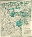
 Manipur langue 2011.png 8,182 × 10,297; 3.6 MB
-

-
-

-
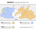 Meghalaya langues 2011.png 2,532 × 2,102; 837 KB
-
 Meghalaya langues.png 2,532 × 2,102; 834 KB
-
 Meitei language distribution.png 1,194 × 1,276; 214 KB
-
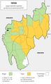
 Mizoram langues 2011.png 9,634 × 12,715; 3.33 MB
-
 Sylheti speaking zone.png 258 × 255; 21 KB
-
 Tripura langue 2011.png 6,667 × 10,909; 2.74 MB


.png)
.jpg)


