Category:Linguistic maps of Moselle
Jump to navigation
Jump to search
Departments of Metropolitan France: Ain [01] · Allier [03] · Alpes-de-Haute-Provence [04] · Hautes-Alpes [05] · Alpes-Maritimes [06] · Ardèche [07] · Cantal [15] · Charente [16] · Charente-Maritime [17] · Cher [18] · Corrèze [19] · Creuse [23] · Dordogne [24] · Drôme [26] · Indre [36] · Isère [38] · Jura [39] · Landes [40] · Loire [42] · Haute-Loire [43] · Lozère [48] · Moselle [57] · Nord [59] · Pas-de-Calais [62] · Puy-de-Dôme [63] · Pyrénées-Atlantiques [64] · Hautes-Pyrénées [65] · Bas-Rhin [67] · Haut-Rhin [68] · Rhône [69D]‡ · Saône-et-Loire [71] · Savoie [73] · Haute-Savoie [74] · Haute-Vienne [87]
Media in category "Linguistic maps of Moselle"
The following 9 files are in this category, out of 9 total.
-
 Carte moselle germanophone 2.JPG 2,311 × 1,636; 186 KB
-
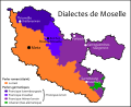 Dialectes de Moselle.svg 745 × 607; 420 KB
-
-
 Les dialectes mosellans.jpg 732 × 656; 81 KB
-
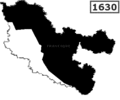
 Platt 1630.svg 750 × 601; 448 KB
-
 Toponymes germaniques alsaciens en Moselle.svg 1,000 × 859; 319 KB
-
 Toponymes germaniques lorrains en Moselle.svg 938 × 805; 383 KB
-
 Toponymes romans en Moselle.svg 938 × 805; 389 KB
-
 VerbreitungsgebietDeutscheMundarten.png 571 × 648; 60 KB


