Category:Linguistic maps of Louisiana
Appearance
States of the United States: Alaska · Arizona · California · Colorado · Connecticut · Delaware · Florida · Hawaii · Idaho · Illinois · Indiana · Kansas · Kentucky · Louisiana · Maine · Maryland · Massachusetts · Michigan · Minnesota · Missouri · Montana · Nevada · New Hampshire · New Jersey · New Mexico · New York · North Carolina · North Dakota · Ohio · Oklahoma · Oregon · Pennsylvania · Rhode Island · South Dakota · Texas · Utah · Vermont · Virginia · Washington · Wyoming
Media in category "Linguistic maps of Louisiana"
The following 10 files are in this category, out of 10 total.
-
Atakapa lang.png 558 × 597; 80 KB
-
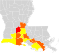
Cajun French distribution.png 300 × 275; 12 KB
-
French in the United States.png 1,064 × 1,222; 435 KB
-
Louisiana French 2000.svg 754 × 678; 451 KB
-
Louisiana French 2015.svg 5,018 × 4,515; 553 KB
-
Louisiana French Immersion Parishes.png 638 × 517; 249 KB
-
Louisiane francophone.png 651 × 552; 206 KB
-
Map of Creole-Speaking Parishes in Louisiana.JPG 673 × 540; 190 KB
-
Natchez lang.png 536 × 591; 76 KB
-
Native Languages of Louisiana.svg 446 × 388; 33 KB


