Category:Lindenhorst (Vollenhove)
Jump to navigation
Jump to search
| Object location | | View all coordinates using: OpenStreetMap |
|---|
house in Steenwijkerland, Netherlands  | |||||
| Upload media | |||||
| Instance of | |||||
|---|---|---|---|---|---|
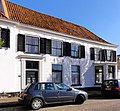
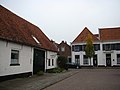
| Location | Vollenhove, Vollenhove | ||||
| Street address |
| ||||
| Located on street |
| ||||
| Heritage designation |
| ||||
 | |||||
Nederlands: Lindenhorst
|
This is a category about rijksmonument number 10536
|
| Address |
|
Media in category "Lindenhorst (Vollenhove)"
The following 8 files are in this category, out of 8 total.
-
 Bisschopstraat17 Vollenhove.jpg 2,800 × 2,584; 561 KB
-
 Kerksteeg - Vollenhove - 20244845 - RCE.jpg 1,200 × 1,195; 329 KB
-
 Overzicht Bisschopstraat - Vollenhove - 20244841 - RCE.jpg 1,197 × 1,200; 301 KB
-
 Vollenhove 038.JPG 3,264 × 2,448; 1.94 MB
-
 Vollenhoven straote.jpg 400 × 300; 85 KB
-
 Voorgevel - Vollenhove - 20245104 - RCE.jpg 1,200 × 793; 175 KB
-
 Voorgevel - Vollenhove - 20245105 - RCE.jpg 1,200 × 804; 174 KB
-
 Voorgevel met de rechter zijgevel van de havezate - Vollenhove - 20378925 - RCE.jpg 1,200 × 1,200; 255 KB


