Category:Lillingstone Dayrell
Jump to navigation
Jump to search
English: See also: - Lillingstone Lovell
Norsk bokmål: Lillingstone Dayrell er en landsby i Buckinghamshire, England. Den ligger i den enhetlige myndigheten Milton Keynes, omkring 13 km vest for Milton Keynes by.
village in the United Kingdom  | |||||
| Upload media | |||||
| Instance of |
| ||||
|---|---|---|---|---|---|
| Location | Lillingstone Dayrell with Luffield Abbey, Buckinghamshire, South East England, England | ||||
 | |||||
Subcategories
This category has only the following subcategory.
N
Media in category "Lillingstone Dayrell"
The following 15 files are in this category, out of 15 total.
-
 Cottages at L Dayrell - geograph.org.uk - 1002911.jpg 640 × 480; 81 KB
-
 Field of wheat - geograph.org.uk - 466693.jpg 640 × 480; 118 KB
-

-
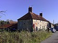
 Gate and Barn - geograph.org.uk - 1003001.jpg 640 × 480; 62 KB
-
 Lane at Dayrell - geograph.org.uk - 1002890.jpg 640 × 489; 75 KB
-
 Lodge to Lillingstone House - geograph.org.uk - 349718.jpg 640 × 453; 89 KB
-
 Ploughed field, Manor Farm - geograph.org.uk - 1003080.jpg 640 × 480; 56 KB
-
 Poorly Oak Tree - geograph.org.uk - 1002906.jpg 640 × 459; 92 KB
-
 Public Footpath - geograph.org.uk - 392187.jpg 480 × 640; 129 KB
-
 Sheep grazing - geograph.org.uk - 1003069.jpg 640 × 480; 89 KB
-
 Stile at Lillingstone Dayrell - geograph.org.uk - 1003031.jpg 640 × 522; 137 KB
-
 Buckinghamshire border - geograph.org.uk - 479455.jpg 640 × 480; 176 KB
-
 Path through Shirehill Wood - geograph.org.uk - 466650.jpg 640 × 480; 190 KB
-
 Whittlewood Forest - geograph.org.uk - 437707.jpg 640 × 480; 142 KB
-
 Wicken Wood - geograph.org.uk - 437734.jpg 640 × 480; 101 KB


