Category:Lighthorne Heath
Jump to navigation
Jump to search
village in United Kingdom  | |||||
| Upload media | |||||
| Instance of | |||||
|---|---|---|---|---|---|
| Location | Upper Lighthorne, Stratford-on-Avon, Warwickshire, West Midlands, England | ||||
 | |||||
English: Lighthorne Heath is a village in Warwickshire, England. It is located some six miles to the south east of Leamington Spa and is very close to the M40 motorway. The village began life in the 1950s, situated to the north of RAF Gaydon it housed the married airmen and officers (those unmarried lived in barracks). Before that time the site was just farmland between Gaydon and Lighthorne with a few isolated buildings. After just over thirty years of active service most of the smaller houses on the base were sold off to Stratford District Council between 1976 and 1981. Throughout the 1980s the larger houses were sold on the open market by the Ministry of Defence. The runway and RAF buildings were taken over in 1978 by British Leyland, and became a proving ground for its cars. This evolved into the Gaydon centre (where Land Rover has its headquarters) and the Heritage Motor Centre, a museum of many British cars. More recently Aston Martin built a factory here for its car production. The village got its own parish council in 2003. Before 2003 it shared a Parish Council with Lighthorne, a village 800m to the west. According to the 2001 UK Census the parish has a population of 1,225 living in 517 dwellings. The village has had a primary school for many years. The school used to be called Gaydon Primary School but changed its name to Lighthorne Heath Primary School in the 1990s.
Media in category "Lighthorne Heath"
The following 11 files are in this category, out of 11 total.
-
 Chesterton Hill-The Old Gated Road - geograph.org.uk - 3930754.jpg 1,024 × 768; 249 KB
-
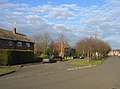
 Leam Road, Lighthorne Heath - geograph.org.uk - 2115869.jpg 2,000 × 1,502; 206 KB
-
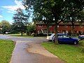
 Lighthorne Heath - geograph.org.uk - 4651210.jpg 640 × 480; 477 KB
-
 Lighthorne Heath, Leam Road - geograph.org.uk - 4651206.jpg 640 × 480; 463 KB
-
 Lighthorne Heath, Stratford Road - geograph.org.uk - 4651214.jpg 640 × 480; 482 KB
-
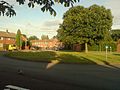
 Lighthorne Heath, Verney Road - geograph.org.uk - 4651053.jpg 640 × 480; 445 KB
-
 LighthorneHeath.jpg 861 × 646; 150 KB
-
 Northbound M40 near Warwick Services - geograph.org.uk - 4531073.jpg 640 × 480; 235 KB
-

-
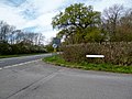
 Roundabout At Lighthorne Heath - geograph.org.uk - 1014313.jpg 640 × 480; 71 KB
-
 Marston Avenue, Lighthorne Heath - geograph.org.uk - 94726.jpg 640 × 477; 71 KB


