Category:Lies 42, Lies
Jump to navigation
Jump to search
| Object location | | View all coordinates using: OpenStreetMap |
|---|
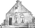
farmhouse in Terschelling, Netherlands  | |||||
| Upload media | |||||
| Instance of | |||||
|---|---|---|---|---|---|
| Location | Lies, Terschelling, Friesland, Netherlands | ||||
| Located on street |
| ||||
| Heritage designation |
| ||||
 | |||||
|
This is a category about rijksmonument number 35113
|
| Address |
|
Media in category "Lies 42, Lies"
The following 17 files are in this category, out of 17 total.
-
 Boerderij Lies 42 op Terschelling.jpg 4,288 × 3,216; 2.86 MB
-
 Deurring nr. 67-22-3b - Lies - 20442758 - RCE.jpg 1,200 × 953; 21 KB
-
 Exterieur OVERZICHT SCHUUR - Lies (Terschelling) - 20263686 - RCE.jpg 1,200 × 778; 193 KB
-

-

-
 Nr.42, exterieur aanzicht - Lies (Terschelling) - 20140019 - RCE.jpg 1,200 × 966; 225 KB
-
 Nr.42, exterieur aanzicht - Lies (Terschelling) - 20140020 - RCE.jpg 1,200 × 942; 233 KB
-
 Nr.42, exterieur aanzicht - Lies (Terschelling) - 20140021 - RCE.jpg 1,200 × 952; 434 KB
-
 Nr.42, exterieur aanzicht - Lies (Terschelling) - 20140022 - RCE.jpg 1,200 × 955; 298 KB
-
 Nr.42, exterieur aanzicht - Lies (Terschelling) - 20140023 - RCE.jpg 1,200 × 960; 317 KB
-
 Nr.42, voorgevel (anno 1721) - Lies (Terschelling) - 20140017 - RCE.jpg 1,158 × 1,200; 362 KB
-
 Nr.42, woonkamer - Lies (Terschelling) - 20140024 - RCE.jpg 952 × 1,200; 293 KB
-
 Schouw met tegelwand nr. 67-22-3c - Lies - 20442757 - RCE.jpg 1,200 × 953; 45 KB
-
 Voorgevel - Lies - 20442756 - RCE.jpg 1,200 × 953; 67 KB
-
 Voorgevel nr. 64-24-4b - Lies - 20442761 - RCE.jpg 953 × 1,200; 43 KB
-
 Zij- en voorgevel - Lies - 20442759 - RCE.jpg 1,200 × 953; 52 KB
-
 Zijgevel nr. 75-29-4b - Lies - 20442762 - RCE.jpg 1,200 × 953; 43 KB

_-_20263686_-_RCE.jpg)
_-_20263689_-_RCE.jpg)
_-_20263687_-_RCE.jpg)
_-_20140019_-_RCE.jpg)
_-_20140020_-_RCE.jpg)
_-_20140021_-_RCE.jpg)
_-_20140022_-_RCE.jpg)
_-_20140023_-_RCE.jpg)
_-_Lies_(Terschelling)_-_20140017_-_RCE.jpg)
_-_20140024_-_RCE.jpg)


