Category:Liegenschaft Rochusstraße 1
Jump to navigation
Jump to search
| Object location | | View all coordinates using: OpenStreetMap |
|---|
 | |||||
| Upload media | |||||
| Instance of | |||||
|---|---|---|---|---|---|
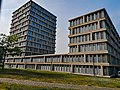
| Location | Hardtberg, Bonn, Cologne Government Region, North Rhine-Westphalia, Germany | ||||
| Located on street |
| ||||
| Inception |
| ||||
 | |||||
Media in category "Liegenschaft Rochusstraße 1"
The following 5 files are in this category, out of 5 total.
-
 BMEL Bonn 24 april 2020.jpg 3,000 × 4,000; 4.95 MB
-
 BMG Bonn 24 april 2020.jpg 4,000 × 3,000; 3.9 MB
-
 BMG building.jpg 648 × 972; 151 KB
-
 Bonn Einfahrt Bundesministerien Rochusstrasse 20080217.jpg 1,600 × 1,200; 1.03 MB
-
 Schild BMG.jpg 648 × 972; 194 KB


