Category:Lichte Gaard 5, Utrecht
Jump to navigation
Jump to search
| Object location | | View all coordinates using: OpenStreetMap |
|---|
 | |||||
| Upload media | |||||
| Instance of |
| ||||
|---|---|---|---|---|---|
| Location | Utrecht, Netherlands | ||||
| Located on street |
| ||||
| Heritage designation |
| ||||
 | |||||
|
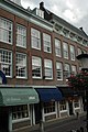
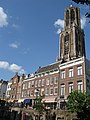
This is a category about rijksmonument number 36283
|
| Address |
|
Media in category "Lichte Gaard 5, Utrecht"
The following 8 files are in this category, out of 8 total.
-
 13-06-27-utrecht-by-RalfR-24.jpg 2,848 × 4,288; 7.82 MB
-
 13-06-27-utrecht-by-RalfR-31.jpg 4,288 × 2,848; 7.04 MB
-
 Lange Elisabethstraat Mariaplaats, 3511 Utrecht, Netherlands - panoramio (29).jpg 2,048 × 1,155; 514 KB
-
 Lichtegaard5.jpg 2,000 × 3,008; 1.94 MB
-
 Neude Janskerkhof en Domplein, Utrecht, Netherlands - panoramio (2).jpg 2,048 × 1,375; 467 KB
-
 Neude Janskerkhof en Domplein, Utrecht, Netherlands - panoramio (4).jpg 2,048 × 1,375; 497 KB
-
 Overzicht - Utrecht - 20235888 - RCE.jpg 1,200 × 950; 269 KB
-
 Utrecht-IMG 1710.JPG 2,448 × 3,264; 4.05 MB


.jpg)
.jpg)
.jpg)

