Category:Liberation of Manila historical marker
Jump to navigation
Jump to search
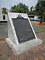
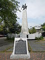
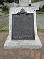
NHCP historical marker for the Battle of Manila  | |||||
| Upload media | |||||
| Instance of | |||||
|---|---|---|---|---|---|
| Commemorates | |||||
| Location | Malacañang Palace, San Miguel, Manila, Metro Manila, PH | ||||
| Street address |
| ||||
| Creator | |||||
| Inception |
| ||||
 | |||||
Media in category "Liberation of Manila historical marker"
The following 12 files are in this category, out of 12 total.
-
 0475jfManila Malacañang Freedom Park San Miguel Laurel Streetfvf 01.jpg 4,608 × 3,456; 6.98 MB
-
 0475jfManila Malacañang Freedom Park San Miguel Laurel Streetfvf 02.jpg 4,608 × 3,456; 6.01 MB
-
 0475jfManila Malacañang Freedom Park San Miguel Laurel Streetfvf 03.jpg 4,608 × 3,456; 6.86 MB
-
 0475jfManila Malacañang Freedom Park San Miguel Laurel Streetfvf 04.jpg 4,608 × 3,456; 6.78 MB
-
 FvfBulacanManila8782 02.JPG 3,456 × 4,608; 6.44 MB
-
 FvfMalacanangManila0087 39.JPG 4,608 × 3,456; 6.5 MB
-
 FvfMalacanangManila0087 40.JPG 3,456 × 4,608; 6.49 MB
-
 FvfMalacanangManila0087 41.JPG 3,456 × 4,608; 6.24 MB
-
 FvfMalacanangManila0087 42.JPG 3,456 × 4,608; 6.63 MB
-
 FvfMalacanangManila0087 44.JPG 3,456 × 4,608; 6.54 MB
-
 Liberation of Manila historical marker.jpg 425 × 621; 236 KB
-
 Manilajf8547 10.JPG 3,456 × 4,608; 6.56 MB


