Category:Lhanbryde
Jump to navigation
Jump to search
village in Moray, Scotland, UK  | |||||
| Upload media | |||||
| Instance of | |||||
|---|---|---|---|---|---|
| Location |
| ||||
| Population |
| ||||
 | |||||
English: Lhanbryde ( Gaelic: Lann Brìghde) is a village in Moray, Scotland, four miles east of Elgin. Previously bisected by the A96, it was bypassed in the early 1990s and now lies to the north of this busy trunk road. Pupils from the local Primary School, Lhanbryde Primary School, depending where they live either go to Milnes' High School or one of the two Elgin high schools, Elgin Academy or Elgin High School.
Norsk bokmål: Lhanbryde ( skotsk-gælisk Lann Brìghde) er en landsby i Moray i Skottland, rundt 6,5 km øst for Elgin. Tidligere gjennomtrafikk av motorvegen A96, men den tungt trafikkerte hovedvegen ble ledet i bue utenfor landsbyen tidlig på 1990-tallet.
Media in category "Lhanbryde"
The following 83 files are in this category, out of 83 total.
-
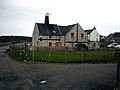
 Barra Lodge, St Andrews Road, Lhanbryde - geograph.org.uk - 389327.jpg 312 × 640; 189 KB
-
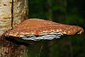 Birch Polypore, a bracket fungus. - geograph.org.uk - 274590.jpg 640 × 426; 73 KB
-
 Blackdam - geograph.org.uk - 346212.jpg 640 × 427; 227 KB
-
 Blackdam - geograph.org.uk - 346215.jpg 640 × 427; 209 KB
-
 Blackdam - geograph.org.uk - 346217.jpg 640 × 427; 290 KB
-
 Blackdam - geograph.org.uk - 346219.jpg 640 × 427; 212 KB
-
 Blackdam - geograph.org.uk - 346229.jpg 640 × 279; 122 KB
-
 Blinkbonny - geograph.org.uk - 346226.jpg 640 × 427; 178 KB
-
 Bog o' Fearn - geograph.org.uk - 251035.jpg 640 × 221; 116 KB
-
 Bridge over Red Burn - geograph.org.uk - 373998.jpg 640 × 427; 249 KB
-
 Broken Gate - geograph.org.uk - 373839.jpg 640 × 369; 213 KB
-
 Burnside - geograph.org.uk - 373991.jpg 640 × 427; 269 KB
-
 Clinbaht near Lhanbryde - geograph.org.uk - 153021.jpg 640 × 480; 137 KB
-
-
 Dark Pool - geograph.org.uk - 373856.jpg 427 × 640; 316 KB
-
 Darkland by Lhanbryde - geograph.org.uk - 152999.jpg 640 × 480; 82 KB
-
 Deanshillock - geograph.org.uk - 282852.jpg 640 × 320; 176 KB
-
 Dykeside - geograph.org.uk - 282860.jpg 640 × 367; 194 KB
-
 Dykeside - geograph.org.uk - 282862.jpg 640 × 349; 182 KB
-
 Findlay's Seat - geograph.org.uk - 374037.jpg 640 × 427; 298 KB
-
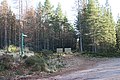
 Forest Road - geograph.org.uk - 290280.jpg 640 × 427; 250 KB
-
 Grazing cattle near Bellevue. - geograph.org.uk - 270884.jpg 640 × 462; 128 KB
-
 Horses in field by Milltown. - geograph.org.uk - 252991.jpg 640 × 426; 88 KB
-
 Hunt Hill - geograph.org.uk - 374042.jpg 640 × 427; 285 KB
-
 In the reedy margins of Lochnabo - geograph.org.uk - 988752.jpg 640 × 458; 100 KB
-
 Ivy Cottage, Blackdam - geograph.org.uk - 346222.jpg 640 × 427; 231 KB
-
 Ivy Cottage, Blackdam - geograph.org.uk - 346227.jpg 640 × 427; 202 KB
-
 Jelly Antler Fungus or Calocera viscosa. - geograph.org.uk - 274746.jpg 640 × 426; 175 KB
-
 Larch - geograph.org.uk - 373953.jpg 427 × 640; 283 KB
-
 Larch Twigs - geograph.org.uk - 373961.jpg 362 × 640; 250 KB
-
 Lhanbryde - geograph.org.uk - 152994.jpg 640 × 480; 117 KB
-
 Lhanbryde - geograph.org.uk - 389307.jpg 640 × 380; 218 KB
-
 Lhanbryde 1905.jpg 1,812 × 1,125; 1.83 MB
-
 Lhanbryde Old Churchyard - geograph.org.uk - 389296.jpg 640 × 372; 266 KB
-
 Lhanbryde Old Churchyard - geograph.org.uk - 389336.jpg 640 × 427; 262 KB
-
 Lhanbryde. - geograph.org.uk - 101043.jpg 640 × 480; 133 KB
-
 Lhanbryde.JPG 1,280 × 960; 291 KB
-
 Loch na Bo House near Lhanbryde - geograph.org.uk - 152987.jpg 640 × 480; 86 KB
-
 Loch Oire - geograph.org.uk - 877443.jpg 640 × 417; 274 KB
-
 Longhill Mill near Lhanbryde - geograph.org.uk - 153082.jpg 640 × 480; 78 KB
-
 Looking over the Gorse to Lhanbryde. - geograph.org.uk - 177974.jpg 640 × 427; 117 KB
-
 Maseda in the Shade - geograph.org.uk - 1189285.jpg 640 × 387; 241 KB
-
 Milltown farm buildings. - geograph.org.uk - 252994.jpg 640 × 426; 95 KB
-
 Monkey Puzzle Tree at Loch na Bo - geograph.org.uk - 1376361.jpg 536 × 640; 158 KB
-
 Moss of Findlayseat - geograph.org.uk - 374018.jpg 640 × 427; 227 KB
-
 Moss of Findlayseat - geograph.org.uk - 374022.jpg 640 × 427; 212 KB
-
 Moss of Findlayseat - geograph.org.uk - 374026.jpg 640 × 427; 207 KB
-
 Old railway bridge, Lhanbryde.JPG 4,317 × 2,770; 8.32 MB
-
 Orange Peel Fungus, a Cup fungus. - geograph.org.uk - 274612.jpg 640 × 480; 183 KB
-
 Railway Bridge near Lhanbryde - geograph.org.uk - 1057824.jpg 640 × 427; 265 KB
-
 Railway Bridge West of Lhanbryde. - geograph.org.uk - 152973.jpg 640 × 480; 103 KB
-
 Red Burn - geograph.org.uk - 373836.jpg 640 × 427; 303 KB
-
 Redburn - geograph.org.uk - 374014.jpg 640 × 427; 257 KB
-
 Rothes Cycle Trail - geograph.org.uk - 373862.jpg 640 × 427; 282 KB
-
 Scots Pine and Silver Birch - geograph.org.uk - 282865.jpg 513 × 640; 299 KB
-
 Sheep Near Lhanbryde - geograph.org.uk - 1057834.jpg 640 × 331; 183 KB
-
 Sleepieshill Scots pine - geograph.org.uk - 760524.jpg 640 × 479; 141 KB
-
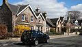 St Andrews Road, Lhanbryde - geograph.org.uk - 389302.jpg 640 × 366; 226 KB
-
 St Andrews Road, Lhanbryde - geograph.org.uk - 389331.jpg 640 × 367; 223 KB
-
 St Andrews-Lhanbryd Kirk - geograph.org.uk - 840426.jpg 640 × 358; 235 KB
-
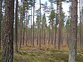
 Teindland Forest - geograph.org.uk - 373829.jpg 427 × 640; 268 KB
-
 Teindland Forest - geograph.org.uk - 373833.jpg 427 × 640; 278 KB
-
 Teindland Forest - geograph.org.uk - 373870.jpg 427 × 640; 306 KB
-
 Teindland Forest - geograph.org.uk - 373875.jpg 640 × 427; 248 KB
-
 Teindland Forest - geograph.org.uk - 373920.jpg 640 × 427; 311 KB
-
 Teindland Forest - geograph.org.uk - 373929.jpg 427 × 640; 311 KB
-
 Teindland Forest - geograph.org.uk - 373935.jpg 640 × 427; 265 KB
-
 Teindland Forest - geograph.org.uk - 373942.jpg 640 × 427; 295 KB
-
 Teindland Forest - geograph.org.uk - 373949.jpg 427 × 640; 283 KB
-
 Teindland Mains - geograph.org.uk - 373845.jpg 640 × 427; 251 KB
-
 Teindland Mains - geograph.org.uk - 373848.jpg 640 × 427; 216 KB
-
 Teindland Wells - geograph.org.uk - 373850.jpg 640 × 313; 158 KB
-
 The "dry" loch to the west of Loch Na Bo. - geograph.org.uk - 274570.jpg 640 × 426; 130 KB
-
 The avenue to Loch Na Bo House - geograph.org.uk - 719524.jpg 640 × 426; 149 KB
-
 The Crooked Wood - geograph.org.uk - 741741.jpg 640 × 480; 121 KB
-
 Triangulation Pillar - geograph.org.uk - 373881.jpg 427 × 640; 288 KB
-

-

-
 Waterlogged Fields near Lhanbryde - geograph.org.uk - 1057847.jpg 640 × 427; 249 KB
-
 Wester Bog o' Fearn - geograph.org.uk - 251037.jpg 640 × 405; 207 KB
-
 Willow Fomes, a bracket fungus. - geograph.org.uk - 274606.jpg 640 × 480; 149 KB
-
 Nature reclaims the "dry" loch. - geograph.org.uk - 274581.jpg 640 × 426; 151 KB
-
 Sauchen Burn - geograph.org.uk - 373973.jpg 640 × 427; 264 KB


