Category:Leytonstone
Jump to navigation
Jump to search
area of East London  | |||||
| Upload media | |||||
| Instance of | |||||
|---|---|---|---|---|---|
| Location | London Borough of Waltham Forest, Greater London, London, England | ||||
| Different from | |||||
 | |||||
Subcategories
This category has the following 9 subcategories, out of 9 total.
Media in category "Leytonstone"
The following 200 files are in this category, out of 321 total.
(previous page) (next page)-

-
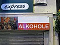 Off licence frontage sign in Leytonstone, London, England.jpg 3,939 × 2,954; 6.48 MB
-
 Aylmer Rd - geograph.org.uk - 5835241.jpg 1,024 × 681; 181 KB
-
 Aylmer Road (25722257237).jpg 4,608 × 3,456; 3.49 MB
-
 Aylmer Road (38782968550).jpg 4,608 × 3,456; 3.93 MB
-
 Aylmer Road (38782984940).jpg 4,608 × 3,456; 3.91 MB
-
 Aylmer Road (38782996300).jpg 4,608 × 3,456; 3.81 MB
-
 Aylmer Road (39698132845).jpg 4,608 × 3,456; 3.58 MB
-
 Aylmer Road (40550423442).jpg 4,608 × 3,456; 4.1 MB
-
 Aylmer Road 694A, 696A, 698A High Road (25722242717).jpg 4,608 × 3,456; 3.89 MB
-
 Aylmer Road 694A, 696A, 698A High Road (38782974450).jpg 4,608 × 3,456; 3.86 MB
-
 Aylmer Road 694A, 696A, 698A High Road (38782976690).jpg 4,608 × 3,456; 3.52 MB
-
 Aylmer Road 694A, 696A, 698A High Road (38782979690).jpg 4,608 × 3,456; 3.48 MB
-
 Aylmer Road Leytonstone Muslim Community Centre (40550426032).jpg 4,608 × 3,456; 3.98 MB
-
 Aylmer Road London City Mission Station (25722260907).jpg 4,608 × 3,456; 3.98 MB
-
 Aylmer Road London City Mission Station (38782643980).jpg 4,608 × 3,456; 4.02 MB
-
 Aylmer Road London City Mission Station (38782991590).jpg 4,608 × 3,456; 3.53 MB
-
 Aylmer Road Tommy Flynn's (38783000480).jpg 4,608 × 3,456; 4.15 MB
-
 Barclay Rd - geograph.org.uk - 5835203.jpg 1,024 × 681; 166 KB
-
 Barclay Road (25722114167).jpg 4,608 × 3,456; 3.93 MB
-
 Barclay Road (40550290702).jpg 4,608 × 3,456; 4.17 MB
-
 Barclay Road Bike Hangar (40550294662).jpg 4,608 × 3,456; 3.51 MB
-
 Beachcroft Rd - geograph.org.uk - 5830725.jpg 1,024 × 681; 156 KB
-
 Beachcroft Road (40591194021).jpg 4,608 × 3,456; 3.6 MB
-
 Beacontree Road (40593079591).jpg 4,608 × 3,456; 3.72 MB
-
 Bend on Gainsborough Road, Leytonstone - geograph.org.uk - 3846573.jpg 2,560 × 1,920; 1.99 MB
-
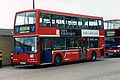 Blue Triangle TL903 V903 FEC.jpg 1,695 × 1,130; 274 KB
-
 Brockway Close (38782161720).jpg 4,608 × 3,456; 3.8 MB
-
 Browning Rd - geograph.org.uk - 5835248.jpg 1,024 × 681; 181 KB
-
 Browning Road (25722341367).jpg 4,608 × 3,456; 3.82 MB
-
 Browning Road (25722347307).jpg 4,608 × 3,456; 3.69 MB
-
 Browning Road (25722359867).jpg 4,608 × 3,456; 4.06 MB
-
 Browning Road (25722364467).jpg 4,608 × 3,456; 4.14 MB
-
 Browning Road (25722374797).jpg 4,608 × 3,456; 3.71 MB
-
 Browning Road (25722376587).jpg 4,608 × 3,456; 3.72 MB
-
 Browning Road (25722381547).jpg 4,608 × 3,456; 3.91 MB
-
 Browning Road (26721546898).jpg 4,608 × 3,456; 4.04 MB
-
 Browning Road (26721556778).jpg 4,608 × 3,456; 4.17 MB
-
 Browning Road (38783033360).jpg 4,608 × 3,456; 3.5 MB
-
 Browning Road (38783060480).jpg 4,608 × 3,456; 4.06 MB
-
 Browning Road (38783070780).jpg 4,608 × 3,456; 3.49 MB
-
 Browning Road (38783076500).jpg 4,608 × 3,456; 3.83 MB
-
 Browning Road (38783079660).jpg 4,608 × 3,456; 3.9 MB
-
 Browning Road (38783098440).jpg 4,608 × 3,456; 3.81 MB
-
 Browning Road (38783100800).jpg 4,608 × 3,456; 3.88 MB
-
 Browning Road (38783107350).jpg 4,608 × 3,456; 4 MB
-
 Browning Road (38783130110).jpg 4,608 × 3,456; 3.74 MB
-
 Browning Road (39698170825).jpg 4,608 × 3,456; 3.64 MB
-
 Browning Road (39698176085).jpg 4,608 × 3,456; 3.95 MB
-
 Browning Road (39698183655).jpg 4,608 × 3,456; 3.62 MB
-
 Browning Road (39698205325).jpg 4,608 × 3,456; 3.62 MB
-
 Browning Road (39882223714).jpg 4,608 × 3,456; 3.68 MB
-
 Browning Road (39882229474).jpg 4,608 × 3,456; 3.81 MB
-
 Browning Road (39882235204).jpg 4,608 × 3,456; 3.91 MB
-
 Browning Road (39882257044).jpg 4,608 × 3,456; 3.66 MB
-
 Browning Road (39882264644).jpg 4,608 × 3,456; 3.93 MB
-
 Browning Road (40550493862).jpg 4,608 × 3,456; 3.75 MB
-
 Browning Road (40550517392).jpg 4,608 × 3,456; 3.89 MB
-
 Browning Road (40593162571).jpg 4,608 × 3,456; 3.61 MB
-
 Browning Road High Road Leytonstone (39880873094).jpg 4,608 × 3,456; 4.02 MB
-
 Browning Road High Road Leytonstone (40549101912).jpg 4,608 × 3,456; 4.02 MB
-
 Browning Road North Star (38783054080).jpg 4,608 × 3,456; 3.95 MB
-
 Browning Road North Star (38783063790).jpg 4,608 × 3,456; 3.76 MB
-
 Browning Road North Star (39698197665).jpg 4,608 × 3,456; 3.87 MB
-
 Browning Road North Star (40593095941).jpg 4,608 × 3,456; 3.99 MB
-
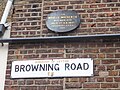
 Browning Road Sir Morell Mackenzie plaque (25722368707).jpg 4,608 × 3,456; 3.8 MB
-
 Browning Road Sir Morell Mackenzie plaque (25722370647).jpg 4,608 × 3,456; 3.83 MB
-
 Browning Road Sir Morell Mackenzie plaque (25722372407).jpg 4,608 × 3,456; 3.88 MB
-
 Browning Road Sir Morell Mackenzie plaque (40550497872).jpg 4,608 × 3,456; 3.83 MB
-
 Burghley Rd - geograph.org.uk - 5835212.jpg 1,024 × 681; 141 KB
-
 Burghley Road (39696714885).jpg 4,608 × 3,456; 3.61 MB
-
 Burghley Road (39881290364).jpg 4,608 × 3,456; 3.52 MB
-
 Burghley Road (39881292054).jpg 4,608 × 3,456; 3.88 MB
-
 Burghley Road, Leytonstone - geograph.org.uk - 4865457.jpg 1,280 × 960; 301 KB
-
 Bushwood Area 1.jpg 2,592 × 1,944; 1.41 MB
-
 Bushwood Area 2.jpg 2,592 × 1,944; 1.65 MB
-
 Bushwood Area 3.jpg 2,592 × 1,944; 1.69 MB
-
 Carlton Road (25722263147).jpg 4,608 × 3,456; 3.65 MB
-
 Cathall Rd, B161 - geograph.org.uk - 5830591.jpg 1,024 × 681; 181 KB
-
 Church Lane (40549436572).jpg 4,608 × 3,456; 3.86 MB
-
 Church Lane (40549477682).jpg 4,608 × 3,456; 3.52 MB
-
 Church Lane (40549481162).jpg 4,608 × 3,456; 3.51 MB
-
 Church Lane (40549483322).jpg 4,608 × 3,456; 3.63 MB
-
 Church Lane - geograph.org.uk - 5835293.jpg 1,024 × 681; 217 KB
-
 Church Lane - geograph.org.uk - 5839348.jpg 1,024 × 681; 193 KB
-
 Church Lane Leytonstone Library (25721285367).jpg 3,456 × 4,608; 3.69 MB
-
 Church Lane Leytonstone Library (25721289087).jpg 4,608 × 3,456; 3.49 MB
-
 Church Lane Leytonstone Library (38781964890).jpg 4,608 × 3,456; 3.78 MB
-
 Church Lane Leytonstone Library (38781977190).jpg 4,608 × 3,456; 3.49 MB
-
 Church Lane Leytonstone Library (38781978810).jpg 4,608 × 3,456; 3.54 MB
-
 Church Lane Leytonstone Library (38781980430).jpg 4,608 × 3,456; 3.55 MB
-
 Church Lane Leytonstone Library (38781982350).jpg 4,608 × 3,456; 4.18 MB
-
 Church Lane Leytonstone Library (40591987501).jpg 4,608 × 3,456; 4.08 MB
-
 Church Lane Leytonstone Library (40591997961).jpg 3,456 × 4,608; 3.77 MB
-
 Church Lane Leytonstone Library (40592012421).jpg 3,456 × 4,608; 3.77 MB
-
 Church Lane, E11 - geograph.org.uk - 4081641.jpg 640 × 480; 105 KB
-
 Closed Post Office - Grove Green Road, E11.jpg 2,133 × 1,600; 619 KB
-
 Colworth Road, Leytonstone - geograph.org.uk - 3846889.jpg 2,560 × 1,920; 1.41 MB
-
 Corbicum sign.jpg 4,032 × 3,024; 4.77 MB
-
 Corner of Norlington Road and Richmond Road, E11 - geograph.org.uk - 5984930.jpg 1,024 × 684; 237 KB
-
 Cotton Close (26721165938).jpg 4,608 × 3,456; 3.71 MB
-
 Cotton Close Davies Lane (26721129428).jpg 4,608 × 3,456; 3.98 MB
-
 Davies Lane (26721167238).jpg 4,608 × 3,456; 3.58 MB
-
 Davies Lane (26721171088).jpg 4,608 × 3,456; 4.01 MB
-
 Davies Lane (38782170860).jpg 4,608 × 3,456; 3.63 MB
-
 Davies Lane (38782174640).jpg 4,608 × 3,456; 3.69 MB
-
 Davies Lane (40592697801).jpg 4,608 × 3,456; 3.56 MB
-
 Davies Lane - geograph.org.uk - 5830834.jpg 1,024 × 681; 163 KB
-
 Davies Lane High Road Leytonstone (40591023581).jpg 4,608 × 3,456; 3.64 MB
-
 Denmark Street (25720648767).jpg 4,608 × 3,456; 3.57 MB
-
 DSCN8337 (38781179980).jpg 4,608 × 3,456; 4 MB
-
 DSCN8338 (39696323515).jpg 4,608 × 3,456; 3.57 MB
-
 DSCN8470 (40592044091).jpg 4,608 × 3,456; 4.02 MB
-
 DSCN8615 (39698278455).jpg 4,608 × 3,456; 4.03 MB
-
 DSCN8671 (40550454652).jpg 4,608 × 3,456; 3.55 MB
-
 DSCN8824 (40550140992).jpg 4,608 × 3,456; 3.93 MB
-
 Fairlop Road, Leytonstone - geograph.org.uk - 5155903.jpg 1,280 × 960; 463 KB
-
 Ferndale Rd - geograph.org.uk - 5830830.jpg 1,024 × 681; 136 KB
-
 Ferndale Road (25721940117).jpg 4,608 × 3,456; 3.6 MB
-
 Ferndale Road (38781113070).jpg 4,608 × 3,456; 3.57 MB
-
 Ferndale Road High Road Leytonstone (25720426157).jpg 4,608 × 3,456; 3.75 MB
-
 Gainsborough Road (26720209738).jpg 4,608 × 3,456; 3.56 MB
-
 Gainsborough Road (26720214398).jpg 4,608 × 3,456; 3.53 MB
-
 Gainsborough Road (38781799950).jpg 4,608 × 3,456; 3.8 MB
-
 Gainsborough Road (38781809030).jpg 4,608 × 3,456; 3.68 MB
-
 Gainsborough Road (39881029694).jpg 4,608 × 3,456; 4.1 MB
-
 Gainsborough Road (39881034274).jpg 4,608 × 3,456; 4.23 MB
-
 Gainsborough Road (39881039174).jpg 4,608 × 3,456; 3.56 MB
-
 Gainsborough Road (39881068144).jpg 4,608 × 3,456; 3.93 MB
-
 Gainsborough Road Lemna Road (39696710855).jpg 4,608 × 3,456; 3.55 MB
-
 Garage, Vernon Road, Leytonstone.jpg 3,762 × 2,759; 6.41 MB
-
 Grove Green Road, Leytonstone.jpg 4,274 × 3,562; 12.23 MB
-
 Grove Rd - geograph.org.uk - 5835244.jpg 1,024 × 680; 164 KB
-
 Grove Road (38783010060).jpg 3,456 × 4,608; 3.51 MB
-
 Grove Road (38783011810).jpg 3,456 × 4,608; 3.51 MB
-
 Grove Road (38783014950).jpg 4,608 × 3,456; 3.64 MB
-
 Grove Road (38783021000).jpg 4,608 × 3,456; 4.12 MB
-
 Grove Road (39696883235).jpg 4,608 × 3,456; 3.51 MB
-
 Grove Road (40593057281).jpg 4,608 × 3,456; 3.69 MB
-
 Harrington Rd - geograph.org.uk - 5835201.jpg 1,024 × 681; 177 KB
-
 Harrington Road (25721434377).jpg 4,608 × 3,456; 3.76 MB
-
 Harrington Road (39697186285).jpg 4,608 × 3,456; 3.59 MB
-
 Harrington Road (39697215085).jpg 4,608 × 3,456; 4.01 MB
-
 Harrington Road (40549594842).jpg 4,608 × 3,456; 3.9 MB
-
 Harrington Road (40549596622).jpg 4,608 × 3,456; 3.81 MB
-
 Harrington Road - geograph.org.uk - 6557060.jpg 6,000 × 4,000; 6.69 MB
-
 Harrington Road Alfred Hitchcock mural (38782077950).jpg 3,456 × 4,608; 3.5 MB
-
 Harrington Road Alfred Hitchcock mural (38782079980).jpg 4,608 × 3,456; 3.68 MB
-
 Harrington Road Alfred Hitchcock mural (39697173045).jpg 4,608 × 3,456; 4.01 MB
-
 Harrington Road Alfred Hitchcock mural (39697174205).jpg 4,608 × 3,456; 3.55 MB
-
 Harrington Road Alfred Hitchcock mural (39697175305).jpg 3,456 × 4,608; 3.56 MB
-
 Harrington Road Alfred Hitchcock mural (39697191645).jpg 4,608 × 3,456; 3.91 MB
-
 Harrington Road Alfred Hitchcock mural (39697202445).jpg 4,608 × 3,456; 4.07 MB
-
 Harrington Road Alfred Hitchcock mural (39697206855).jpg 4,608 × 3,456; 3.57 MB
-
 Harrington Road Alfred Hitchcock mural (39697210465).jpg 4,608 × 3,456; 3.55 MB
-
 Harrington Road Alfred Hitchcock mural (39881310424).jpg 4,608 × 3,456; 3.68 MB
-
 Harrington Road Alfred Hitchcock mural (39881311844).jpg 4,608 × 3,456; 3.93 MB
-
 Harrington Road Alfred Hitchcock mural (39881316134).jpg 4,608 × 3,456; 3.51 MB
-
 Harrington Road C. Hawkes ghost sign (39881334624).jpg 4,608 × 3,456; 3.59 MB
-
 Harrington Road C. Hawkes ghost sign (39881336614).jpg 4,608 × 3,456; 3.64 MB
-
 Harrington Road C. Hawkes ghost sign (39881338754).jpg 4,608 × 3,456; 3.57 MB
-
 Harrington Road C. Hawkes ghost sign (39881341464).jpg 4,608 × 3,456; 3.66 MB
-
 Harrow Green (26719639418).jpg 4,608 × 3,456; 4.14 MB
-
 Harrow Green (26719652498).jpg 4,608 × 3,456; 3.82 MB
-
 Harrow Green (38781341420).jpg 4,608 × 3,456; 4.23 MB
-
 Harrow Green (39696431565).jpg 4,608 × 3,456; 3.7 MB
-
 Harrow Green High Road Leytonstone (25720644397).jpg 4,608 × 3,456; 3.71 MB
-
 Harrow Green High Road Leytonstone (38781260280).jpg 4,608 × 3,456; 3.6 MB
-
 Harrow Green High Road Leytonstone (38781364970).jpg 4,608 × 3,456; 3.79 MB
-
 Harrow Green High Road Leytonstone (39696374765).jpg 4,608 × 3,456; 3.59 MB
-
 Harrow Green High Road Leytonstone (40548725552).jpg 4,608 × 3,456; 3.72 MB
-
 Harrow Green High Road Leytonstone (40548730672).jpg 4,608 × 3,456; 3.64 MB
-
 Harrow Green High Road Leytonstone (40591213301).jpg 4,608 × 3,456; 3.63 MB
-
 Harrow Green Leyton & Leytonstone War Memorial (25720702897).jpg 4,608 × 3,456; 3.61 MB
-
 Harrow Green Leyton & Leytonstone War Memorial (40548778622).jpg 4,608 × 3,456; 3.56 MB
-
 Harrow Green Leyton & Leytonstone War Memorial (40591283211).jpg 4,608 × 3,456; 3.61 MB
-
 Harvey Rd - geograph.org.uk - 5835213.jpg 1,024 × 681; 139 KB
-
 Harvey Road (38782021040).jpg 4,608 × 3,456; 4.14 MB
-
 Harvey Road (40550352572).jpg 4,608 × 3,456; 3.92 MB
-
 Harvey Road (40592932601).jpg 4,608 × 3,456; 4.02 MB
-
 Harvey Road (40592941221).jpg 4,608 × 3,456; 3.54 MB
-
 Harvey Road The Red Lion (40592939221).jpg 4,608 × 3,456; 2.94 MB
-
 Hitchcock Business Estate (25720520077).jpg 4,608 × 3,456; 3.55 MB
-
 Hitchcock Business Estate (39696278575).jpg 4,608 × 3,456; 3.48 MB
-
 Hitchcock Business Estate (39696283265).jpg 4,608 × 3,456; 3.62 MB
-
 Houses on Grove Green Road, Leytonstone - geograph.org.uk - 6426658.jpg 1,920 × 1,280; 1.06 MB
-
 Howard Road (25720752027).jpg 4,608 × 3,456; 3.98 MB
-
 Howard Road (39880660194).jpg 4,608 × 3,456; 3.88 MB
-
 Joseph Ray Road (25720442617).jpg 4,608 × 3,456; 3.72 MB
-
 Joseph Ray Road (25720452237).jpg 4,608 × 3,456; 3.76 MB
-
 Joseph Ray Road (26719378138).jpg 4,608 × 3,456; 3.76 MB
-
 Joseph Ray Road (38781090210).jpg 4,608 × 3,456; 3.83 MB
-
 Joseph Ray Road (38781095550).jpg 4,608 × 3,456; 3.82 MB
-
 Joseph Ray Road (39696226135).jpg 4,608 × 3,456; 3.76 MB
-
 Joseph Ray Road (39696228765).jpg 4,608 × 3,456; 3.8 MB
-
 Joseph Ray Road (39696230665).jpg 4,608 × 3,456; 3.86 MB
-
 Joseph Ray Road (39696238175).jpg 4,608 × 3,456; 3.61 MB
-
 Joseph Ray Road (39880368744).jpg 4,608 × 3,456; 3.51 MB
-
 Joseph Ray Road (40548605072).jpg 4,608 × 3,456; 3.64 MB
-
 Joseph Ray Road Jewson (40591078661).jpg 4,608 × 3,456; 3.76 MB


.jpg)
.jpg)
.jpg)
.jpg)
.jpg)
.jpg)
.jpg)
.jpg)
.jpg)
.jpg)
.jpg)
.jpg)
.jpg)
.jpg)
.jpg)

.jpg)
.jpg)
.jpg)

.jpg)


.jpg)

.jpg)
.jpg)
.jpg)
.jpg)
.jpg)
.jpg)
.jpg)
.jpg)
.jpg)
.jpg)
.jpg)
.jpg)
.jpg)
.jpg)
.jpg)
.jpg)
.jpg)
.jpg)
.jpg)
.jpg)
.jpg)
.jpg)
.jpg)
.jpg)
.jpg)
.jpg)
.jpg)
.jpg)
.jpg)
.jpg)
.jpg)
.jpg)
.jpg)
.jpg)
.jpg)
.jpg)
.jpg)
.jpg)
.jpg)
.jpg)

.jpg)
.jpg)
.jpg)


.jpg)

.jpg)
.jpg)
.jpg)
.jpg)


.jpg)
.jpg)
.jpg)
.jpg)
.jpg)
.jpg)
.jpg)
.jpg)
.jpg)
.jpg)


.jpg)
.jpg)
.jpg)
.jpg)
.jpg)
.jpg)
.jpg)

.jpg)
.jpg)
.jpg)
.jpg)
.jpg)
.jpg)
.jpg)
.jpg)


.jpg)
.jpg)
.jpg)
.jpg)
.jpg)
.jpg)
.jpg)
.jpg)
.jpg)
.jpg)
.jpg)
.jpg)


.jpg)
.jpg)
.jpg)
.jpg)
.jpg)
.jpg)

.jpg)
.jpg)
.jpg)
.jpg)
.jpg)

.jpg)
.jpg)
.jpg)
.jpg)
.jpg)
.jpg)
.jpg)
.jpg)
.jpg)
.jpg)
.jpg)
.jpg)
.jpg)
.jpg)
.jpg)
.jpg)
.jpg)
.jpg)
.jpg)
.jpg)
.jpg)
.jpg)
.jpg)
.jpg)
.jpg)
.jpg)
.jpg)
.jpg)
.jpg)
.jpg)

.jpg)
.jpg)
.jpg)
.jpg)
.jpg)
.jpg)
.jpg)
.jpg)

.jpg)
.jpg)
.jpg)
.jpg)
.jpg)
.jpg)
.jpg)
.jpg)
.jpg)
.jpg)
.jpg)
.jpg)
.jpg)
.jpg)
.jpg)