Category:Leysdown
Jump to navigation
Jump to search
civil parish in Swale, Kent, England  | |||||
| Upload media | |||||
| Instance of | |||||
|---|---|---|---|---|---|
| Location | Swale, Kent, South East England, England | ||||
 | |||||

Subcategories
This category has the following 5 subcategories, out of 5 total.
Media in category "Leysdown"
The following 200 files are in this category, out of 741 total.
(previous page) (next page)-
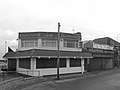 "Talk of the Town", Leysdown-on-Sea - geograph.org.uk - 2011433.jpg 3,488 × 2,616; 2.09 MB
-
 'Orinoco' in the Swale - geograph.org.uk - 4116514.jpg 696 × 1,024; 114 KB
-
 1-4, Park Avenue - geograph.org.uk - 5273184.jpg 3,264 × 2,448; 3.75 MB
-
 A bend in Shellness Road near Leysdown - geograph.org.uk - 6270324.jpg 3,255 × 2,032; 1.74 MB
-
 A Dutch sailing barge at the mouth of the Swale - geograph.org.uk - 5869437.jpg 1,024 × 806; 104 KB
-
 A small wind pump - geograph.org.uk - 4410711.jpg 640 × 426; 49 KB
-
 A typical scene at Leysdown-on-Sea - geograph.org.uk - 5272364.jpg 4,000 × 3,000; 4.89 MB
-
 A wind pump, Harty Marshes - geograph.org.uk - 4397425.jpg 640 × 426; 62 KB
-
 Air raid shelter near Ferry House Inn - geograph.org.uk - 4854146.jpg 640 × 480; 166 KB
-
 Along the sea wall at Shellbeach - geograph.org.uk - 4427520.jpg 4,000 × 3,000; 4.19 MB
-
 Along the sea wall to Shellness - geograph.org.uk - 4148641.jpg 4,000 × 3,000; 4.06 MB
-
 Along the sea wall towards Harty - geograph.org.uk - 4148537.jpg 4,000 × 3,000; 4.06 MB
-
 Alongside Leysdown Road at Bay View - geograph.org.uk - 5272357.jpg 4,000 × 3,000; 4.83 MB
-
 Alongside Leysdown Road at Bay View - geograph.org.uk - 5272359.jpg 4,000 × 3,000; 4.77 MB
-
 Alterations to 108, Leysdown Road - geograph.org.uk - 5275342.jpg 3,264 × 2,448; 3.85 MB
-
 B2231 - geograph.org.uk - 4395256.jpg 640 × 426; 36 KB
-
 B2231 - geograph.org.uk - 4395271.jpg 640 × 426; 40 KB
-
 B2231 - geograph.org.uk - 4395282.jpg 640 × 426; 49 KB
-
 B2231 - geograph.org.uk - 4395319.jpg 640 × 426; 52 KB
-
 B2231, Leysdown - geograph.org.uk - 4395309.jpg 640 × 426; 58 KB
-
 B2231, Leysdown - geograph.org.uk - 4395316.jpg 640 × 426; 55 KB
-
 Baitdigger on Leysdown Mudflats - geograph.org.uk - 1023448.jpg 640 × 481; 86 KB
-
 Bandstand under construction, The Spinney, Leysdown Road - geograph.org.uk - 4712640.jpg 3,264 × 2,448; 3.89 MB
-
 Bandstand, The Spinney, Leysdown Road - geograph.org.uk - 5273205.jpg 3,264 × 2,448; 2.65 MB
-
 Bank alongside Capel Fleet - geograph.org.uk - 4150234.jpg 4,000 × 3,000; 4.08 MB
-
 Barn, Muswell Manor - geograph.org.uk - 4453628.jpg 640 × 426; 34 KB
-
 Barn, Sayes Court Farm - geograph.org.uk - 4436326.jpg 640 × 426; 84 KB
-
 Bay View Gardens, Bay View - geograph.org.uk - 4565315.jpg 2,272 × 1,704; 759 KB
-
 Beach and groynes - geograph.org.uk - 4397401.jpg 640 × 426; 60 KB
-
 Beach between Leysdown and Warden - geograph.org.uk - 4853154.jpg 640 × 480; 119 KB
-
 Beach recreational zoning - geograph.org.uk - 4853169.jpg 640 × 480; 108 KB
-
 Beach side house at Shellness - geograph.org.uk - 4426599.jpg 4,000 × 3,000; 4.37 MB
-
 Beach south of Shellness - geograph.org.uk - 4397473.jpg 640 × 426; 82 KB
-
 Beach, Leysdown-on-Sea - geograph.org.uk - 4853003.jpg 640 × 480; 124 KB
-
 Bend in seawall - geograph.org.uk - 4430391.jpg 640 × 426; 68 KB
-
 Bend in the seawall - geograph.org.uk - 4410535.jpg 640 × 426; 69 KB
-
 Bend in the track - geograph.org.uk - 4447424.jpg 640 × 426; 62 KB
-
 Bend, Quiet lane - geograph.org.uk - 4436367.jpg 640 × 426; 72 KB
-
 Bird hide, Swale Nature Reserve - geograph.org.uk - 4575288.jpg 2,272 × 1,704; 899 KB
-
 Birds feeding - geograph.org.uk - 4405452.jpg 640 × 426; 48 KB
-
 Blocked access along sea wall at Leysdown - geograph.org.uk - 6034913.jpg 1,024 × 768; 147 KB
-
 Blocked exit route from beach at Leysdown - geograph.org.uk - 6034919.jpg 1,832 × 3,264; 924 KB
-
 Boat on Swale mud - geograph.org.uk - 4854703.jpg 640 × 480; 74 KB
-
 Brewers Hill Farmhouse - geograph.org.uk - 4447322.jpg 640 × 426; 75 KB
-
 Bridleway - geograph.org.uk - 4436340.jpg 640 × 426; 69 KB
-
 Bridleway - geograph.org.uk - 4436447.jpg 640 × 426; 58 KB
-
 Bridleway - geograph.org.uk - 4447382.jpg 640 × 426; 63 KB
-
 Bridleway, Harty Marshes - geograph.org.uk - 4447388.jpg 640 × 426; 61 KB
-
 Bridleway, Harty Marshes - geograph.org.uk - 4447453.jpg 640 × 426; 42 KB
-
 Building site, 349-355, Leysdown Road - geograph.org.uk - 4712644.jpg 3,264 × 2,448; 3.87 MB
-
 Building site, Park Avenue - geograph.org.uk - 4711203.jpg 3,264 × 2,448; 3.77 MB
-
 Byways junction - geograph.org.uk - 4431051.jpg 640 × 426; 84 KB
-
 Capel Fleet - geograph.org.uk - 4574964.jpg 2,272 × 1,704; 792 KB
-
 Capel Fleet - geograph.org.uk - 4574978.jpg 2,272 × 1,704; 628 KB
-
 Capel Fleet near the Raptor Viewpoint - geograph.org.uk - 4150206.jpg 4,000 × 3,000; 4.34 MB
-

-
 Capel Fleet seen from Harty Ferry Road - geograph.org.uk - 5272450.jpg 4,000 × 3,000; 4.89 MB
-
 Capel Fleet seen from Harty Ferry Road - geograph.org.uk - 5272467.jpg 3,863 × 2,897; 1.83 MB
-
 Capel Fleet seen from Harty Ferry Road - geograph.org.uk - 5272470.jpg 4,000 × 3,000; 4.41 MB
-
 Capel Fleet seen from near Harty Ferry Road - geograph.org.uk - 5272480.jpg 4,000 × 3,000; 4.87 MB
-
 Car Park at Leysdown Coastal Park - geograph.org.uk - 1286729.jpg 640 × 561; 73 KB
-
 Caravans near Leysdown-on-Sea - geograph.org.uk - 3756511.jpg 3,488 × 2,616; 2.23 MB
-

-
 Church of St Thomas - geograph.org.uk - 4430558.jpg 640 × 426; 65 KB
-
 Church of St Thomas - geograph.org.uk - 4431071.jpg 640 × 426; 51 KB
-
 Church of St Thomas - geograph.org.uk - 4431090.jpg 426 × 640; 60 KB
-
 Cliff View Gardens, Bay View - geograph.org.uk - 4565317.jpg 2,272 × 1,704; 807 KB
-
 Cliff View Gardens, Bay View - geograph.org.uk - 5272362.jpg 4,000 × 3,000; 4.63 MB
-
 Close-up of Leysdown-on-Sea Village Sign - geograph.org.uk - 2074736.jpg 2,304 × 3,072; 1.56 MB
-
 Coast south of Leysdown-on-Sea - geograph.org.uk - 6270327.jpg 2,851 × 2,060; 2.08 MB
-

-
 Coin Castle, Leysdown-on-Sea - geograph.org.uk - 2011509.jpg 3,488 × 2,616; 2.1 MB
-
 Coronation Drive, Bay View - geograph.org.uk - 4565330.jpg 2,272 × 1,704; 806 KB
-
 Creek, Swale Nature Reserve - geograph.org.uk - 4405359.jpg 640 × 426; 74 KB
-
 Crops near The Ferry Inn - geograph.org.uk - 4436796.jpg 640 × 426; 63 KB
-
 Crops, Isle of Harty - geograph.org.uk - 4436557.jpg 640 × 426; 58 KB
-
 Crops, Isle of Harty - geograph.org.uk - 4445093.jpg 640 × 426; 64 KB
-
 Danes Drive, Bay View - geograph.org.uk - 4565325.jpg 2,272 × 1,704; 715 KB
-
 Danes Drive, Bay View - geograph.org.uk - 4565332.jpg 2,272 × 1,704; 750 KB
-
 Derelict bungalow, Leysdown-on-Sea - geograph.org.uk - 3756605.jpg 3,488 × 2,616; 1.79 MB
-
 Derelict bungalow, Leysdown-on-Sea - geograph.org.uk - 3756606.jpg 3,488 × 2,616; 2.01 MB
-
 Derelict groyne - geograph.org.uk - 4397420.jpg 640 × 426; 67 KB
-
 Dire warnings on the road to Shellness - geograph.org.uk - 4148251.jpg 4,000 × 3,000; 4.17 MB
-
 Ditch by Capel Fleet - geograph.org.uk - 4857251.jpg 640 × 480; 112 KB
-
 Double groyne at Shellness - geograph.org.uk - 4426552.jpg 4,000 × 3,000; 3.91 MB
-
 Drain and pump by Capel Fleet - geograph.org.uk - 4853490.jpg 640 × 480; 122 KB
-
 Drain and sheepfold - geograph.org.uk - 360824.jpg 640 × 480; 89 KB
-
 Drainage Canal - geograph.org.uk - 4066062.jpg 1,632 × 918; 456 KB
-
 Drainage channel near Capel Fleet - geograph.org.uk - 4150209.jpg 4,000 × 3,000; 4.02 MB
-
 Drainage channel next to Capel Fleet - geograph.org.uk - 4150223.jpg 4,000 × 3,000; 4.32 MB
-
 Drainage channel on Leysdown Marshes - geograph.org.uk - 4150215.jpg 4,000 × 3,000; 3.99 MB
-
 Drainage channel, Harty Marshes - geograph.org.uk - 4453552.jpg 640 × 426; 41 KB
-

-
 Drainage ditch leading to Capel Fleet - geograph.org.uk - 5272686.jpg 4,000 × 3,000; 4.91 MB
-
 Drainage ditch near Capel Fleet - geograph.org.uk - 4150228.jpg 4,000 × 3,000; 4.04 MB
-
 Drainage ditch next to Capel Fleet - geograph.org.uk - 4150231.jpg 4,000 × 3,000; 4.51 MB
-
 Drainage ditch on Leysdown Marshes - geograph.org.uk - 4149087.jpg 4,000 × 3,000; 4.28 MB
-
 Drainage ditch, Harty Marshes - geograph.org.uk - 4447436.jpg 640 × 426; 58 KB
-
 Drainage ditch, Harty Marshes - geograph.org.uk - 4575306.jpg 2,272 × 1,704; 775 KB
-
 Drainage ditch, Harty Marshes - geograph.org.uk - 4575311.jpg 2,272 × 1,704; 694 KB
-
 Drainage ditch, near Harty - geograph.org.uk - 4575050.jpg 2,272 × 1,704; 705 KB
-

-

-

-

-
 Dutch sailing-barge heading into the Swale - geograph.org.uk - 4110019.jpg 1,024 × 761; 120 KB
-
 Dyke in Leysdown Marshes - geograph.org.uk - 1312064.jpg 640 × 480; 102 KB
-
 Eastern Road, Leysdown - geograph.org.uk - 1827368.jpg 3,600 × 2,400; 1.18 MB
-
 Eastern Road, Leysdown-on-Sea - geograph.org.uk - 3756535.jpg 3,488 × 2,616; 1.71 MB
-
 Elliotts Farmhouse - geograph.org.uk - 4445143.jpg 640 × 426; 71 KB
-
 Entering Leysdown on Sea - geograph.org.uk - 4395296.jpg 640 × 426; 43 KB
-
 Extensive mudflats near Shellness - geograph.org.uk - 4397448.jpg 640 × 426; 51 KB
-
 Farm track leading off Harty Ferry Road - geograph.org.uk - 4574887.jpg 2,272 × 1,704; 774 KB
-
 Farm track near Harty - geograph.org.uk - 4575049.jpg 2,272 × 1,704; 806 KB
-
 Farmland near Elliotts Farm - geograph.org.uk - 4445133.jpg 640 × 426; 71 KB
-
 Farmland near Elliotts Farm - geograph.org.uk - 4445137.jpg 640 × 426; 46 KB
-
 Farmland near Elliotts Farm - geograph.org.uk - 4445146.jpg 640 × 426; 52 KB
-
 Farmland near Muswell Manor - geograph.org.uk - 4453624.jpg 640 × 426; 45 KB
-
 Farmland near Shellness - geograph.org.uk - 4405379.jpg 640 × 426; 47 KB
-
 Farmland near Swale Reserve - geograph.org.uk - 4405965.jpg 640 × 426; 48 KB
-
 Farmland near The Ferry Inna - geograph.org.uk - 4436373.jpg 640 × 426; 41 KB
-
 Farmland on the Harty Marshes - geograph.org.uk - 4397418.jpg 640 × 346; 48 KB
-
 Farmland on the Isle of Sheppey - geograph.org.uk - 4405421.jpg 640 × 426; 41 KB
-
 Farmland, Harty Marshes - geograph.org.uk - 4397435.jpg 640 × 426; 53 KB
-
 Farmland, Harty Marshes - geograph.org.uk - 4447354.jpg 640 × 426; 64 KB
-
 Farmland, Harty Marshes - geograph.org.uk - 4447401.jpg 640 × 426; 63 KB
-
 Farmland, Harty Marshes - geograph.org.uk - 4447411.jpg 640 × 426; 60 KB
-
 Farmland, Harty Marshes - geograph.org.uk - 4447447.jpg 640 × 426; 55 KB
-
 Farmland, Harty Marshes - geograph.org.uk - 4447456.jpg 640 × 368; 46 KB
-
 Farmland, Harty Marshes - geograph.org.uk - 4453567.jpg 640 × 426; 54 KB
-
 Farmland, Harty Marshes - geograph.org.uk - 4453568.jpg 640 × 426; 60 KB
-
 Farmland, Harty Marshes - geograph.org.uk - 4453570.jpg 640 × 426; 59 KB
-
 Farmland, Harty Marshes - geograph.org.uk - 4453573.jpg 640 × 426; 55 KB
-
 Farmland, Harty Marshes - geograph.org.uk - 4453619.jpg 640 × 426; 53 KB
-
 Farmland, Harty Marshes - geograph.org.uk - 4453638.jpg 640 × 426; 39 KB
-
 Farmland, Isle of Harty - geograph.org.uk - 4445107.jpg 640 × 426; 55 KB
-
 Farmland, Isle of Harty - geograph.org.uk - 4445148.jpg 640 × 426; 50 KB
-
 Farmland, Park Farm - geograph.org.uk - 4436354.jpg 640 × 377; 51 KB
-
 Farmland, Park Farm - geograph.org.uk - 4436358.jpg 640 × 426; 52 KB
-
 Farmland, Sayes Court - geograph.org.uk - 4436345.jpg 640 × 426; 58 KB
-
 Farmland, Shellness - geograph.org.uk - 4405386.jpg 640 × 410; 42 KB
-
 Feeding on the mudflats - geograph.org.uk - 4397443.jpg 640 × 426; 55 KB
-
 Feeding on the mudflats - geograph.org.uk - 4397446.jpg 640 × 426; 49 KB
-
 Fence across The Marshes - geograph.org.uk - 4410690.jpg 640 × 426; 56 KB
-
 Ferry House Inn from Harty Ferry hard - geograph.org.uk - 4853601.jpg 640 × 480; 102 KB
-
 Field drain - geograph.org.uk - 4405428.jpg 640 × 426; 51 KB
-
 Field south of Mocketts - geograph.org.uk - 4436802.jpg 640 × 426; 36 KB
-
 Finger post between Harty and Shellness - geograph.org.uk - 4575312.jpg 2,272 × 1,704; 1.47 MB
-

-

-

-
 Fishing smacks at the mouth of the Swale - geograph.org.uk - 4115794.jpg 784 × 1,024; 138 KB
-
 Fishing smacks competing in the Swale Match - geograph.org.uk - 4611777.jpg 750 × 1,024; 120 KB
-
 Flat farmland - geograph.org.uk - 4397411.jpg 640 × 411; 49 KB
-
 Flat farmland - geograph.org.uk - 4405438.jpg 640 × 401; 41 KB
-
 Flat farmland - geograph.org.uk - 4453618.jpg 640 × 367; 42 KB
-
 Flat land - geograph.org.uk - 4395370.jpg 640 × 426; 48 KB
-
 Flock of starlings - geograph.org.uk - 1023430.jpg 640 × 481; 56 KB
-
 Flock of starlings landing - geograph.org.uk - 1023439.jpg 640 × 481; 83 KB
-
 Flocks of birds feeding on the mud - geograph.org.uk - 4397437.jpg 640 × 426; 51 KB
-

-
 Flower and Crafts Festival at St Thomas Church, Harty - geograph.org.uk - 5021503.jpg 4,608 × 3,456; 3.38 MB
-
 Footbridge near Pump Hill - geograph.org.uk - 4857401.jpg 640 × 480; 141 KB
-
 Footpath - geograph.org.uk - 4430494.jpg 640 × 426; 57 KB
-
 Footpath across the marshes - geograph.org.uk - 4405446.jpg 640 × 426; 61 KB
-
 Footpath across the marshes - geograph.org.uk - 4405889.jpg 640 × 426; 48 KB
-
 Footpath across the marshes - geograph.org.uk - 4405962.jpg 640 × 426; 57 KB
-
 Footpath at Elliotts Farm - geograph.org.uk - 4445142.jpg 640 × 426; 59 KB
-
 Footpath bend - geograph.org.uk - 4405431.jpg 640 × 426; 57 KB
-
 Footpath heading west - geograph.org.uk - 4405384.jpg 640 × 426; 57 KB
-
 Footpath just north of Shellbeach - geograph.org.uk - 4397412.jpg 640 × 426; 58 KB
-
 Footpath off the lane - geograph.org.uk - 4436397.jpg 640 × 426; 105 KB
-
 Footpath on Old Counter Wall - geograph.org.uk - 4410522.jpg 640 × 426; 58 KB
-
 Footpath on sea wall - geograph.org.uk - 4405374.jpg 640 × 426; 60 KB
-
 Footpath on seawall - geograph.org.uk - 4397402.jpg 640 × 426; 51 KB
-
 Footpath on seawall - geograph.org.uk - 4410557.jpg 640 × 426; 46 KB
-
 Footpath on seawall - geograph.org.uk - 4410683.jpg 640 × 426; 63 KB
-
 Footpath on seawall - geograph.org.uk - 4410698.jpg 640 × 426; 55 KB
-
 Footpath on seawall - geograph.org.uk - 4410704.jpg 640 × 426; 60 KB
-
 Footpath on seawall - geograph.org.uk - 4410730.jpg 640 × 426; 61 KB
-
 Footpath on seawall - geograph.org.uk - 4430382.jpg 640 × 426; 48 KB
-
 Footpath signpost - geograph.org.uk - 4430497.jpg 640 × 426; 58 KB
-
 Footpath to Harty - geograph.org.uk - 4430528.jpg 640 × 426; 85 KB
-
 Footpath to Harty - geograph.org.uk - 4430554.jpg 640 × 426; 72 KB
-
 Footpath, Swale Nature Reserve - geograph.org.uk - 4405442.jpg 640 × 426; 59 KB
-
 Footpath, Swale Nature Reserve - geograph.org.uk - 4405959.jpg 640 × 426; 60 KB
-
 Footpath, Swale Nature Reserve - geograph.org.uk - 4405967.jpg 640 × 426; 51 KB
-
 Footpaths, Leysdown - geograph.org.uk - 4852987.jpg 640 × 480; 140 KB
-
 Forge Cottage - geograph.org.uk - 4445135.jpg 640 × 426; 40 KB
-
 Former coastguard cottages, Shellness - geograph.org.uk - 4856662.jpg 640 × 480; 141 KB
-
 Former pillbox at Shell Ness - geograph.org.uk - 4426648.jpg 4,000 × 3,000; 4.21 MB
-
 Former trackbed of Sheppey Light Railway - geograph.org.uk - 3065643.jpg 816 × 612; 128 KB
-
 Four Sheep - geograph.org.uk - 4436387.jpg 640 × 426; 49 KB
-
 Frydays Diner, Leysdown-on-Sea - geograph.org.uk - 2011359.jpg 3,488 × 2,616; 2.18 MB
-
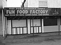 Fun Food Factory, Leysdown-on-Sea - geograph.org.uk - 2011557.jpg 3,488 × 2,616; 2.22 MB
-
 Gated track - geograph.org.uk - 4447324.jpg 640 × 426; 71 KB
-
 Gnawed board, footbridge near Pump Hill - geograph.org.uk - 4857408.jpg 640 × 480; 185 KB
-
 Grove Avenue, Leysdown-on-Sea - geograph.org.uk - 3756532.jpg 3,488 × 2,616; 1.51 MB
-
 Grove Way, Leysdown-on-Sea - geograph.org.uk - 4565309.jpg 2,272 × 1,704; 826 KB
-
 Groyne, Leysdown-on-Sea - geograph.org.uk - 4853014.jpg 640 × 480; 117 KB


_-_geograph.org.uk_-_5485420.jpg)
_-_geograph.org.uk_-_5485423.jpg)
_-_geograph.org.uk_-_5484992.jpg)


