Category:Leybuchtsiel
Jump to navigation
Jump to search
| Object location | | View all coordinates using: OpenStreetMap |
|---|
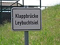
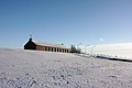
Deutsch: Das Leybuchtsiel ist eine Schleuse mit einer Zugbrücke und einem benachbarten Schöpfwerk zwischen dem Norder Tief und dem Störtebekerkanal.
English: The Leybuchtsiel is a canal lock with drawbridge and a pumping station in East Frisia.
.jpg) | |||||
| Upload media | |||||
| Instance of | |||||
|---|---|---|---|---|---|
| Location | Norden, Aurich, Lower Saxony, Germany | ||||
| Located in or next to body of water | |||||
 | |||||
Media in category "Leybuchtsiel"
The following 41 files are in this category, out of 41 total.
-
 2013-05-03 Fotoflug Nordholz Papenburg HP 3061.JPG 5,760 × 3,840; 6.57 MB
-
 2013-05-03 Fotoflug Nordholz Papenburg HP 3062.JPG 5,760 × 3,840; 6.61 MB
-
 2013-05-03 Fotoflug Nordholz Papenburg HP 3063.JPG 5,760 × 3,840; 7.15 MB
-
 2013-05-03 Fotoflug Nordholz Papenburg HP 3064.JPG 5,760 × 3,840; 6.96 MB
-
 2013-05-03 Fotoflug Nordholz Papenburg HP 3065.JPG 5,760 × 3,840; 7.72 MB
-
 2013-05-03 Fotoflug Nordholz Papenburg HP 3066.JPG 5,760 × 3,840; 7.73 MB
-
 2013-05-03 Fotoflug Nordholz Papenburg HP 3067.JPG 5,760 × 3,840; 7.52 MB
-
 2013-05-03 Fotoflug Nordholz Papenburg HP 3068.JPG 5,760 × 3,840; 7.41 MB
-
 2013-05-03 Fotoflug Nordholz Papenburg HP 3069.JPG 5,760 × 3,840; 7.32 MB
-
 2013-05-03 Fotoflug Nordholz Papenburg HP 3070.JPG 5,760 × 3,840; 7.5 MB
-
 2013-05-03 Fotoflug Nordholz Papenburg HP 3071.JPG 5,760 × 3,840; 7.69 MB
-
 2013-05-03 Fotoflug Nordholz Papenburg HP 3072.JPG 5,760 × 3,840; 7.48 MB
-
 2013-05-03 Fotoflug Nordholz Papenburg HP 3073.JPG 5,760 × 3,840; 8.06 MB
-
 2013-05-03 Fotoflug Nordholz Papenburg HP 3074.JPG 5,760 × 3,840; 7.72 MB
-
 2013-05-03 Fotoflug Nordholz Papenburg HP 3075.JPG 5,760 × 3,840; 7.6 MB
-
 2013-05-03 Fotoflug Nordholz Papenburg HP 3076.JPG 5,760 × 3,840; 7.75 MB
-
 2013-05-03 Fotoflug Nordholz Papenburg HP 3077.JPG 5,760 × 3,840; 7.76 MB
-
 2013-05-03 Fotoflug Nordholz Papenburg HP 3078.JPG 5,760 × 3,840; 8.87 MB
-
 2013-05-03 Fotoflug Nordholz Papenburg HP 3079.JPG 5,760 × 3,840; 9.06 MB
-
 2013-05-03 Fotoflug Nordholz Papenburg HP 3080.JPG 5,760 × 3,840; 8.49 MB
-
 2013-05-03 Fotoflug Nordholz Papenburg HP 3081.JPG 5,760 × 3,840; 8.29 MB
-
 Blick-von-der-Klappbrücke Leybuchtsiel Mth 6097.JPG 3,264 × 2,448; 1.82 MB
-
 Blick-von-der-Klappbrücke Leybuchtsiel Mth 6100.JPG 3,264 × 2,448; 2.46 MB
-
 Klappbrücke Leybuchtsiel Mth 6092.JPG 3,264 × 2,448; 2.52 MB
-
 Klappbrücke Leybuchtsiel Mth 6093.JPG 3,264 × 2,448; 1.96 MB
-
 Klappbrücke Leybuchtsiel Mth 6094.JPG 3,264 × 2,448; 1.98 MB
-
 Klappbrücke Leybuchtsiel Mth 6095.JPG 3,264 × 2,448; 1.96 MB
-
 Klappbrücke Leybuchtsiel Mth 6096.JPG 3,264 × 2,448; 1.98 MB
-
 Klappbrücke Leybuchtsiel Mth 6105.JPG 3,264 × 2,448; 2.13 MB
-
 Leybuchtsiel (Norden).jpg 3,888 × 2,592; 3.54 MB
-
 Leybuchtsiel 4569.JPG 3,258 × 2,256; 1.56 MB
-
 Leybuchtsiel 4571.JPG 3,262 × 2,258; 1.47 MB
-
 Leybuchtsiel 4578.JPG 3,082 × 2,134; 1.5 MB
-
 Leybuchtsiel 4583.JPG 2,946 × 2,040; 1.13 MB
-
 Pedalstation-an-der-Klappbrücke Leybuchtsiel Mth 6098.JPG 3,264 × 2,448; 2.04 MB
-
 Pedalstation-an-der-Klappbrücke Leybuchtsiel Mth 6104.JPG 3,264 × 2,448; 2.85 MB
-
 Sascha Grosser - Steg am Wasser- IMG 3404.jpg 5,184 × 3,456; 3.77 MB
-
 Schoepfwerk Leybuchtsiel.jpg 3,888 × 2,592; 3.79 MB
-
 Schöpfwerk Leybuchtsiel Mth 6102.JPG 2,448 × 3,264; 2.39 MB
-
 Schöpfwerk-und-Klappbrücke Leybuchtsiel Mth 6101.JPG 3,264 × 2,448; 2.24 MB
-
 Wasserstandsanzeige-am-Schöpfwerk Leybuchtsiel Mth 6103.JPG 2,448 × 3,264; 2.12 MB


