Category:Level crossings in Kent
Jump to navigation
Jump to search
Ceremonial counties of England: Bedfordshire · Berkshire · Buckinghamshire · Cambridgeshire · Cheshire · Cornwall · Cumbria · Derbyshire · Devon · Dorset · Durham · East Riding of Yorkshire · East Sussex · Essex · Gloucestershire · Greater London · Greater Manchester · Hampshire · Herefordshire · Hertfordshire · Kent · Lancashire · Leicestershire · Lincolnshire · Merseyside · North Yorkshire · Northamptonshire · Northumberland · Nottinghamshire · Oxfordshire · Rutland · Shropshire · Somerset · South Yorkshire · Staffordshire · Suffolk · Surrey · Tyne and Wear · Warwickshire · West Midlands · West Sussex · West Yorkshire · Wiltshire · Worcestershire
City-counties: Bristol ·
Former historic counties:
Other former counties:
City-counties: Bristol ·
Former historic counties:
Other former counties:
Subcategories
This category has the following 5 subcategories, out of 5 total.
G
- Gillingham level crossing (5 F)
- Grain crossing signal box (12 F)
T
- Teston level crossing (6 F)
Media in category "Level crossings in Kent"
The following 200 files are in this category, out of 325 total.
(previous page) (next page)-
 319220 approaches Pilgrims Way Footpath Crossing 2E28 (15778727474).jpg 4,896 × 3,672; 4.84 MB
-
 375710 at Wye Railway Station (27082502830).jpg 4,896 × 3,379; 6.26 MB
-
 A 'special' train at Caldecott Crossing - geograph.org.uk - 2058535.jpg 1,280 × 960; 582 KB
-
 A Javelin leaves the level crossing at Grove Ferry - geograph.org.uk - 4934115.jpg 4,608 × 3,456; 3.48 MB
-

-
 Approaching the level crossing on King Street - geograph.org.uk - 3984921.jpg 4,000 × 3,000; 4.31 MB
-
 Aylesford Level Crossing - geograph.org.uk - 3590369.jpg 3,488 × 2,616; 2.22 MB
-
 Battery Road level crossing - geograph.org.uk - 1894489.jpg 800 × 584; 93 KB
-
 Battery Road level crossing - geograph.org.uk - 1894531.jpg 800 × 586; 109 KB
-
 Battery Road Level Crossing - geograph.org.uk - 3219698.jpg 2,256 × 1,496; 727 KB
-
 Beckets Level Crossing (open).jpg 1,366 × 768; 90 KB
-
 Beckets Level Crossing.jpg 1,366 × 768; 87 KB
-
 Beltring Level Crossing (open).jpg 1,366 × 768; 162 KB
-
 Beltring Level Crossing.jpg 1,366 × 768; 140 KB
-
 Beltring Road - geograph.org.uk - 4435523.jpg 2,357 × 1,571; 1.68 MB
-
 Beltring Road, near East Peckham - geograph.org.uk - 3638375.jpg 640 × 360; 90 KB
-
 Botolph's Bridge Level Crossing on the RH&DR.jpg 630 × 470; 103 KB
-
 Botolph's Bridge Road level crossing - geograph.org.uk - 2634206.jpg 4,000 × 3,000; 3.84 MB
-
 Botolphs Bridge RH&DR railway station (site), Kent (geograph 6907409).jpg 1,600 × 1,199; 486 KB
-
 Bowdell Level Crossing - geograph.org.uk - 4002458.jpg 640 × 480; 179 KB
-
 Bridge St - geograph.org.uk - 4947828.jpg 640 × 426; 66 KB
-
 British Rail Class 375 No. 375 304 at East Farleigh Station Level Crossing - January 2021.jpg 5,472 × 3,553; 12.45 MB
-
 Broad Oak Level Crossing (open).jpg 1,366 × 768; 114 KB
-
 Broad Oak level crossing - geograph.org.uk - 985508.jpg 640 × 430; 63 KB
-
 Broad Oak Level Crossing.jpg 1,366 × 768; 123 KB
-
 Broad Oak Road - geograph.org.uk - 5072929.jpg 4,608 × 3,456; 3.4 MB
-
 Broadoak Crossing - geograph.org.uk - 5666215.jpg 3,264 × 2,448; 3.86 MB
-
 Brookland Level Crossing (open).jpg 1,366 × 768; 113 KB
-

-
 Caldecot Level Crossing - geograph.org.uk - 3220161.jpg 2,256 × 1,496; 900 KB
-
 Canterbury rail crossing I.jpg 4,288 × 3,216; 3.62 MB
-
 Canterbury rail crossing II.jpg 4,288 × 3,216; 3.63 MB
-

-
 Chartham station geograph-3104808-by-Ben-Brooksbank.jpg 2,319 × 1,376; 3.28 MB
-
 Chilham Mill Level Crossing (27359181655).jpg 4,896 × 3,672; 8.51 MB
-
 Cliffsend Level Crossing - geograph.org.uk - 4596731.jpg 2,272 × 1,704; 786 KB
-
 Clockhouse Crossing - geograph.org.uk - 4713328.jpg 4,608 × 3,456; 3.56 MB
-
 Clockhouse Crossing - geograph.org.uk - 4713330.jpg 4,608 × 3,456; 3.33 MB
-
 Closing the gate - geograph.org.uk - 272596.jpg 640 × 480; 118 KB
-
 Closing the gates (again) - geograph.org.uk - 3466465.jpg 1,024 × 768; 227 KB
-
 Closing the gates - geograph.org.uk - 3466448.jpg 1,024 × 768; 281 KB
-
 Cold Blow level crossing - geograph.org.uk - 801972.jpg 640 × 480; 253 KB
-
 Coldharbour Lane Level Crossing - geograph.org.uk - 4993219.jpg 4,608 × 3,456; 3.37 MB
-
 Coldharbour Lane level crossing - geograph.org.uk - 5118006.jpg 4,608 × 3,456; 3.34 MB
-
 Crossing over the railway - geograph.org.uk - 4972682.jpg 4,608 × 3,456; 3.34 MB
-
 Crossing to Bax Farm - geograph.org.uk - 4972718.jpg 4,608 × 3,456; 3.37 MB
-
 Crossing to Shorne - geograph.org.uk - 48191.jpg 482 × 640; 90 KB
-
 Cuxton Level Crossing and Signal Box - geograph.org.uk - 3930249.jpg 3,488 × 2,616; 2.13 MB
-
 Cuxton signal box and level crossing - 25969729321.jpg 4,828 × 3,365; 5.89 MB
-
 Disappearing freight train - geograph.org.uk - 5822450.jpg 4,000 × 3,000; 4.91 MB
-
 Dollands Moor Level Crossing (open).jpg 1,291 × 725; 378 KB
-
 Dollands Moor Level Crossing - geograph.org.uk - 4300639.jpg 1,120 × 632; 419 KB
-

-
 Drains, Lanes and Lines - geograph.org.uk - 394294.jpg 640 × 473; 168 KB
-
 East Farleigh manual level crossing - 20525486274.jpg 4,896 × 3,672; 7.37 MB
-
 East Farleigh manual level crossing - 20527048013.jpg 4,896 × 3,672; 7.1 MB
-
 East Farleigh manual level crossing - 20960006100.jpg 4,896 × 3,672; 7.24 MB
-
 East Farleigh manual level crossing.jpg 4,896 × 3,672; 7.48 MB
-
 East Farleigh railway station (1) - geograph.org.uk - 4542240.jpg 640 × 480; 106 KB
-
 East Farleigh signal box and level crossing - 25312568834.jpg 4,896 × 3,672; 7.58 MB
-
 East Farleigh signal box and level crossing - 25312770494.jpg 4,896 × 3,672; 6.53 MB
-
 East Farleigh signal box and level crossing - 25316606513.jpg 4,896 × 3,672; 7.21 MB
-
 East Farleigh signal box and level crossing - 25644706440.jpg 4,896 × 3,672; 7.09 MB
-
 East Farleigh signal box and level crossing - 25644768430.jpg 4,896 × 3,672; 7.31 MB
-
 East Farleigh signal box and level crossing - 25824432682.jpg 4,896 × 3,672; 7.16 MB
-
 East Farleigh signal box and level crossing - 25824454022.jpg 4,896 × 3,672; 7.9 MB
-
 East Farleigh signal box and level crossing - 25850227861.jpg 4,896 × 3,672; 7.14 MB
-
 East Farleigh signal box and level crossing - 25850410551.jpg 4,896 × 3,672; 7.55 MB
-
 East Farleigh signal box and level crossing - 25850431851.jpg 4,896 × 3,672; 7.7 MB
-
 East Farleigh signal box and level crossing - 25850470641.jpg 4,896 × 3,672; 7.07 MB
-
 East Farleigh signal box and level crossing - 25919507686.jpg 4,896 × 3,672; 6.69 MB
-
 East Farleigh signal box and level crossing - 25945320395.jpg 4,896 × 3,672; 7.11 MB
-
 East Farleigh Station - geograph.org.uk - 3597194.jpg 3,488 × 2,616; 2.19 MB
-
 East Kent Railway - Eythorne Station Level Crossing - geograph.org.uk - 2285646.jpg 2,272 × 1,704; 1.2 MB
-
 East Kent Railway - Eythorne Station Level Crossing - geograph.org.uk - 2285650.jpg 2,272 × 1,704; 1.04 MB
-
 East Kent Railway EMU Gala 18.jpg 4,000 × 3,000; 1.75 MB
-
 Entrance to Beltring railway station - geograph.org.uk - 1707461.jpg 2,048 × 1,536; 1.01 MB
-
 Eythorne railway station - geograph.org.uk - 6546501.jpg 3,001 × 2,448; 2.45 MB
-
 Farm level crossing - geograph.org.uk - 4510639.jpg 640 × 480; 161 KB
-
 Farm track crosses the Romney, Hythe and Dymchurch Railway - geograph.org.uk - 2172804.jpg 3,072 × 2,304; 1.57 MB
-
 Farm track level crossing - geograph.org.uk - 749803.jpg 640 × 480; 90 KB
-
 Folkestone, Harbour Branch Line - geograph.org.uk - 3131866.jpg 3,648 × 2,736; 1.88 MB
-

-
 Footpath Crossing Railway Line - geograph.org.uk - 470158.jpg 427 × 640; 81 KB
-
 Footpath Level Crossing - geograph.org.uk - 4916231.jpg 1,600 × 1,200; 629 KB
-
 Former Whitstable Crab & Winkle Railway Bridge.jpg 8,220 × 2,446; 5.21 MB
-
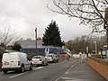
 Gillingham Level Crossing - geograph.org.uk - 2015687.jpg 3,488 × 2,616; 2.15 MB
-
 Gillingham Level Crossing, Ingram Road, Gillingham - geograph.org.uk - 5566352.jpg 3,264 × 2,448; 1.59 MB
-
 Give Way Railway Crossing - geograph.org.uk - 1874106.jpg 1,024 × 768; 215 KB
-
 Grain Crossing - geograph.org.uk - 3738317.jpg 3,488 × 2,616; 1.8 MB
-
 Grain Road approaching Stoke Crossing - geograph.org.uk - 3738212.jpg 3,488 × 2,616; 2.06 MB
-
 Gravelly Ways, Beltring - geograph.org.uk - 4750084.jpg 640 × 480; 112 KB
-
 Javelin crossing - geograph.org.uk - 3466414.jpg 1,024 × 768; 242 KB
-
 Kenardington Level Crossing (open).jpg 1,366 × 768; 108 KB
-
 Kenardington Level Crossing.jpg 1,366 × 768; 106 KB
-
 Kent and East Sussex Railway - geograph.org.uk - 4187861.jpg 5,472 × 3,648; 6.7 MB
-
 King Street approaching the level crossing - geograph.org.uk - 3984928.jpg 4,000 × 3,000; 4.38 MB
-
 Knodishall Green Level Crossing Gates - geograph.org.uk - 2010464.jpg 3,072 × 2,304; 1.41 MB
-
 Level Crossing - geograph.org.uk - 1525897.jpg 640 × 427; 78 KB
-
 Level crossing - geograph.org.uk - 2810677.jpg 640 × 430; 111 KB
-
 Level crossing - geograph.org.uk - 3597085.jpg 4,320 × 3,240; 3.3 MB
-
 Level crossing - geograph.org.uk - 408539.jpg 428 × 640; 316 KB
-
 Level crossing - geograph.org.uk - 5541214.jpg 640 × 426; 70 KB
-
 Level crossing and station - geograph.org.uk - 4814663.jpg 640 × 426; 84 KB
-
 Level crossing at Beltring - geograph.org.uk - 4750078.jpg 640 × 480; 87 KB
-
 Level crossing at Beltring station - geograph.org.uk - 3638381.jpg 640 × 360; 69 KB
-
 Level crossing at Chartham - geograph.org.uk - 4840830.jpg 640 × 426; 101 KB
-
 Level Crossing at Chartham - geograph.org.uk - 4947888.jpg 640 × 426; 71 KB
-
 Level crossing at Cuxton station - geograph.org.uk - 2662914.jpg 4,000 × 3,000; 4.14 MB
-
 Level crossing at Cuxton station - geograph.org.uk - 2662939.jpg 4,000 × 3,000; 4.02 MB
-
 Level crossing at East Farleigh station - geograph.org.uk - 3147069.jpg 4,000 × 3,000; 4.16 MB
-
 Level crossing at Grove Ferry - geograph.org.uk - 4934107.jpg 4,608 × 3,456; 3.37 MB
-
 Level crossing at Tenterden Town - geograph.org.uk - 6245473.jpg 1,280 × 960; 1,016 KB
-
 Level crossing at Warehorne - geograph.org.uk - 5655435.jpg 1,024 × 768; 146 KB
-
 Level crossing at Wateringbury - geograph.org.uk - 3706986.jpg 4,000 × 3,000; 4 MB
-
 Level crossing by Beltring Station - geograph.org.uk - 4962361.jpg 2,304 × 1,728; 837 KB
-
 Level Crossing by Teynham Station - geograph.org.uk - 3698873.jpg 3,488 × 2,616; 2.16 MB
-
 Level crossing east of Minster Station - geograph.org.uk - 2131318.jpg 3,072 × 2,304; 2.33 MB
-
 Level Crossing near Brook Farm - geograph.org.uk - 2005329.jpg 3,072 × 2,304; 2.87 MB
-
 Level crossing near Coldharbour Farm - geograph.org.uk - 2227059.jpg 3,072 × 2,304; 2.72 MB
-

-
 Level crossing near Eythorne - geograph.org.uk - 2219689.jpg 3,072 × 2,304; 2.58 MB
-
 Level crossing near Faversham - geograph.org.uk - 2656229.jpg 640 × 459; 72 KB
-
 Level crossing near Faversham - geograph.org.uk - 5106131.jpg 468 × 640; 93 KB
-
 Level Crossing near Hegg Hill Farm - geograph.org.uk - 1420780.jpg 640 × 480; 114 KB
-

-

-
 Level crossing near Otford Station - geograph.org.uk - 1256044.jpg 640 × 480; 127 KB
-
 Level Crossing near Paddock Wood - geograph.org.uk - 4309396.jpg 640 × 480; 93 KB
-
 Level crossing near Plum Pudding - geograph.org.uk - 2278584.jpg 3,072 × 2,304; 1.62 MB
-
 Level crossing near Sandwich station - geograph.org.uk - 3747660.jpg 913 × 684; 165 KB
-
 Level crossing near Stoneham Lock - geograph.org.uk - 1231818.jpg 640 × 480; 126 KB
-
 Level crossing near Watchester Lane - geograph.org.uk - 2131087.jpg 3,072 × 2,304; 2.5 MB
-
 Level Crossing near Wested Wood - geograph.org.uk - 1356937.jpg 640 × 480; 121 KB
-
 Level Crossing on Eythorne Road - geograph.org.uk - 2141868.jpg 3,072 × 2,304; 1.94 MB
-
 Level crossing on Shalloak Road - geograph.org.uk - 5072891.jpg 4,608 × 3,456; 3.4 MB
-
 Level crossing on St Dunstan's Street - geograph.org.uk - 3043128.jpg 3,872 × 2,592; 3.68 MB
-
 Level crossing on the Dungeness Road - geograph.org.uk - 4952424.jpg 640 × 480; 233 KB
-
 Level crossing on the KESR (1970).JPG 1,840 × 1,232; 1,009 KB
-
 Level crossing on the R.H.D.R. - geograph.org.uk - 408590.jpg 640 × 480; 66 KB
-
-

-
 Level crossing on Wagon Lane - geograph.org.uk - 1356944.jpg 640 × 480; 112 KB
-
 Level crossing on Whitehall Road - geograph.org.uk - 3780297.jpg 4,000 × 3,000; 4.07 MB
-
 Level Crossing over railway - geograph.org.uk - 1135862.jpg 640 × 481; 110 KB
-
 Level crossing over railway - geograph.org.uk - 1231692.jpg 640 × 480; 139 KB
-

-
 Level crossing to Bax Farm - geograph.org.uk - 5428523.jpg 640 × 428; 167 KB
-
 Level crossing to Ightham - geograph.org.uk - 1321203.jpg 640 × 480; 127 KB
-
 Level crossing, A290 - geograph.org.uk - 5188316.jpg 640 × 426; 66 KB
-
 Level crossing, Baldwin Rd - geograph.org.uk - 5541315.jpg 640 × 425; 73 KB
-
 Level Crossing, Baldwin Road, Greatstone-on-Sea - geograph.org.uk - 4635462.jpg 2,272 × 1,704; 769 KB
-
 Level Crossing, Battery Road, Lydd-on-Sea - geograph.org.uk - 4635141.jpg 2,272 × 1,704; 795 KB
-
 Level crossing, Bridge St - geograph.org.uk - 4259014.jpg 640 × 430; 58 KB
-
 Level Crossing, Burmarsh Road, Dymchurch - geograph.org.uk - 4649301.jpg 2,272 × 1,704; 830 KB
-
 Level crossing, Chartham - geograph.org.uk - 3112989.jpg 640 × 430; 75 KB
-
 Level Crossing, Coldblow Road, near Walmer - geograph.org.uk - 5061047.jpg 3,264 × 2,448; 2.18 MB
-
 Level Crossing, Coldblow Road, near Walmer - geograph.org.uk - 5061055.jpg 3,264 × 2,448; 2.29 MB
-
 Level Crossing, Dungeness - geograph.org.uk - 1415951.jpg 640 × 480; 52 KB
-
 Level Crossing, East Farleigh - geograph.org.uk - 3597183.jpg 3,488 × 2,616; 2.2 MB
-
 Level Crossing, East Farleigh - geograph.org.uk - 3597186.jpg 3,488 × 2,616; 2.15 MB
-
-
 Level crossing, Golgotha - geograph.org.uk - 219266.jpg 640 × 497; 76 KB
-
 Level crossing, Hoo Junction - geograph.org.uk - 6520866.jpg 1,024 × 768; 463 KB
-
 Level crossing, Jefferstone Lane - geograph.org.uk - 4814658.jpg 640 × 426; 65 KB
-
 Level crossing, Lockhurst Farm - geograph.org.uk - 4951162.jpg 640 × 426; 68 KB
-
 Level Crossing, Lower Frognal Farm, near Teynham - geograph.org.uk - 4483422.jpg 2,272 × 1,704; 852 KB
-
 Level Crossing, Lower Road, near Luddenham - geograph.org.uk - 4483462.jpg 2,272 × 1,704; 761 KB
-
 Level Crossing, Lower Road, near Luddenham - geograph.org.uk - 4483464.jpg 2,272 × 1,704; 784 KB
-
 Level Crossing, Lower Road, near Luddenham - geograph.org.uk - 4483466.jpg 2,272 × 1,704; 905 KB
-
 Level Crossing, Quarry Woods - geograph.org.uk - 1316087.jpg 640 × 430; 113 KB
-
 Level crossing, Rolvenden - geograph.org.uk - 389954.jpg 428 × 640; 314 KB
-
 Level Crossing, St Dunstan's Street - geograph.org.uk - 5161434.jpg 640 × 426; 64 KB
-
 Level crossing, St Dunstans Street, Canterbury - geograph.org.uk - 2211606.jpg 4,320 × 3,240; 3.86 MB
-
 Level Crossing, Tenterden Town Railway Station - geograph.org.uk - 5104507.jpg 3,264 × 2,448; 2 MB
-
 Level Crossing, Wagon Lane, near Paddock Wood - geograph.org.uk - 4916279.jpg 3,264 × 2,448; 2.62 MB
-
 Level Crossing, Woodnesborough Road, Sandwich - geograph.org.uk - 4516259.jpg 2,272 × 1,704; 869 KB
-
 Level Crossing, Wybournes Lane, near High Halstow - geograph.org.uk - 4957615.jpg 3,264 × 2,448; 1.69 MB
-
 Level crossing, Wye - geograph.org.uk - 3451883.jpg 640 × 430; 73 KB
-

-
 Lockhurst Farm Level Crossing - geograph.org.uk - 5340035.jpg 640 × 426; 88 KB
-
 Looking across Burmarsh Road level crossing - geograph.org.uk - 2675255.jpg 4,000 × 3,000; 3.99 MB
-
 Looking down the line from Midley Level Crossing - geograph.org.uk - 4993215.jpg 4,608 × 3,456; 3.36 MB
-
 Looking down the line from the level crossing at Grove Ferry - geograph.org.uk - 4934123.jpg 4,608 × 3,456; 3.39 MB
-
 Looking ENE along the railway line - geograph.org.uk - 985510.jpg 640 × 430; 79 KB
-

-
 Looking up the line from Coldharbour Lane Level Crossing - geograph.org.uk - 4993222.jpg 4,608 × 3,456; 3.42 MB
-
 Lydd-on-Sea, Battery Road, RH^DR level crossing - geograph.org.uk - 2610562.jpg 3,648 × 2,736; 1.08 MB
-
 Lydd-on-Sea, Battery Road, RH^DR level crossing - geograph.org.uk - 2610577.jpg 3,648 × 2,736; 1.1 MB
-
 Marsh Farm Road level crossing - Minster (2) - geograph.org.uk - 3547435.jpg 1,250 × 813; 1.19 MB
-
 Marsh Farm Road level crossing, Minster - geograph.org.uk - 5965335.jpg 5,202 × 3,465; 3.24 MB
-
 Mayflower pulling the Golden Arrow through Chartham station.jpg 2,048 × 1,365; 1.06 MB
-
-
 Midley Crossing - geograph.org.uk - 57748.jpg 640 × 480; 125 KB
-
 Midley Level Crossing - geograph.org.uk - 4993210.jpg 4,608 × 3,456; 3.35 MB
-
 Midley Wall approaching Midley Level Crossing - geograph.org.uk - 4993213.jpg 4,608 × 3,456; 3.38 MB
-
 No.9 Winston Churchill passing Botolph's Bridge level crossing.jpg 640 × 480; 43 KB
-
 Opening the crossing - geograph.org.uk - 6480488.jpg 1,024 × 684; 183 KB
-
 Paddock Wood Level Crossing (open).jpg 1,366 × 768; 200 KB
-
 Paddock Wood Level Crossing.jpg 1,366 × 768; 200 KB
.jpg)
.jpg)


.jpg)

.jpg)


,_Kent_(geograph_6907409).jpg)


.jpg)


.jpg)


.jpg)


_-_geograph.org.uk_-_3466465.jpg)


.jpg)


_-_geograph.org.uk_-_4542240.jpg)


.jpg)


.JPG)


_-_geograph.org.uk_-_3547435.jpg)


.jpg)
