Category:Letton, west Herefordshire
Jump to navigation
Jump to search
village and civil parish on the River Wye west of Hereford, in Herefordshire, England  | |||||
| Upload media | |||||
| Instance of | |||||
|---|---|---|---|---|---|
| Location | Herefordshire, West Midlands, England | ||||
| Population |
| ||||
 | |||||

Letton is a village and civil parish in west Herefordshire, England, and 11 miles west-northwest from the city and county town of Hereford. The parish contains the village of Letton, the hamlet of Waterloo, and the farming hamlets of Hurstley and Kinley.
Media in category "Letton, west Herefordshire"
The following 33 files are in this category, out of 33 total.
-

-
 1856 Letton in Post Office Directory of Herefordshire p.68.jpg 1,278 × 416; 239 KB
-
 Letton History, Topography & Directory of Herefordshire, 1858 p.220.jpg 895 × 684; 262 KB
-
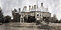 Letton Court Letton Herefordshire pre 1883.jpg 794 × 397; 354 KB
-
 1885 Letton in Kelly's Directory of Herefordshire p.1204.jpg 1,328 × 685; 456 KB
-
 Letton, Jakeman & Carver's Directory of Herefordshire 1890 p.538-40.jpg 438 × 1,029; 459 KB
-

-

-
 Letton School Letton Herefordshire pre 1911.jpg 1,410 × 817; 1,013 KB
-
 1913 Letton in Kelly's Directory of Herefordshire p.150.jpg 1,418 × 867; 560 KB
-
 Arable land near Willersley - geograph.org.uk - 2785614.jpg 1,024 × 680; 186 KB
-
 Derelict cottage - geograph.org.uk - 2785618.jpg 1,024 × 680; 255 KB
-
 Farmland in the Wye valley - geograph.org.uk - 2785609.jpg 1,024 × 680; 243 KB
-
 Farmland near Norton Wood - geograph.org.uk - 4129856.jpg 1,024 × 680; 364 KB
-
 Gate to Letton Court - geograph.org.uk - 3655569.jpg 3,366 × 2,523; 7.14 MB
-
 Green lane across Letton Lake - geograph.org.uk - 4823026.jpg 1,600 × 901; 753 KB
-
 Letton Court (geograph 3057842).jpg 3,392 × 2,174; 5.8 MB
-
 Low farmland near Letton Lake - geograph.org.uk - 4823022.jpg 1,600 × 901; 770 KB
-
 Low-lying green lane - geograph.org.uk - 4823019.jpg 1,600 × 901; 760 KB
-
 Low-lying land and lane at Letton - geograph.org.uk - 2787171.jpg 1,024 × 577; 290 KB
-
 Marshy land near Letton Lake - geograph.org.uk - 4823013.jpg 1,600 × 901; 693 KB
-
 Mile Stone, Letton - geograph.org.uk - 4758267.jpg 480 × 640; 124 KB
-
 On the Wye near Letton Court - geograph.org.uk - 4626766.jpg 3,089 × 2,048; 2.46 MB
-
 Ordnance Survey Cut Mark - geograph.org.uk - 4758266.jpg 640 × 480; 109 KB
-
 Ordnance Survey Cut Mark - geograph.org.uk - 4758268.jpg 480 × 640; 116 KB
-
 Ordnance Survey Cut Mark - geograph.org.uk - 5329250.jpg 640 × 390; 107 KB
-
 Ordnance Survey Rivet - geograph.org.uk - 4758264.jpg 640 × 480; 97 KB
-
 Parkland, Letton Court - geograph.org.uk - 3057869.jpg 3,329 × 2,390; 3.63 MB
-
 Pasture near Letton - geograph.org.uk - 2787166.jpg 1,024 × 577; 270 KB
-
 Stable block, Letton Court (geograph 3057949).jpg 3,456 × 2,592; 3.58 MB
-
 Twin towers, Letton (geograph 3057778).jpg 3,415 × 2,582; 2.69 MB
-
 Vaughan's Way sign - geograph.org.uk - 4824971.jpg 1,600 × 901; 719 KB
-
 Winter oak - geograph.org.uk - 2787188.jpg 1,024 × 768; 416 KB


_-_Surveyed_1884_to_1887,_Revised_1897,_Published_1898_-_One_inch_to_One_Mile.jpg)


.jpg)


.jpg)
.jpg)

