Category:Letheringsett with Glandford
Jump to navigation
Jump to search
English: Letheringsett with Glandford is a civil parish in the English county of Norfolk. It contains the village of Letheringsett and the hamlet of Glandford. The village straddles the A148 King’s Lynn to Cromer road. Letheringsett is 1.2 miles west of Holt, 32.2 west south west of King’s Lynn and 126 miles south south west of London. The nearest railway station is at Sheringham for the Bittern Line which runs between Sheringham, Cromer and Norwich. The nearest airport is Norwich International Airport.
civil parish in North Norfolk, Norfolk, England  | |||||
| Upload media | |||||
| Instance of | |||||
|---|---|---|---|---|---|
| Location | North Norfolk, Norfolk, East of England, England | ||||
| Population |
| ||||
| Area |
| ||||
 | |||||
Subcategories
This category has the following 2 subcategories, out of 2 total.
G
L
Media in category "Letheringsett with Glandford"
The following 80 files are in this category, out of 80 total.
-
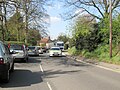 A bit of a squeeze on Holt Road Letheringsett - geograph.org.uk - 6147696.jpg 3,062 × 2,290; 3.42 MB
-
 A wildlife-friendly cottage garden - geograph.org.uk - 3011128.jpg 640 × 480; 171 KB
-
 A148 - geograph.org.uk - 3835067.jpg 640 × 430; 48 KB
-
 A148 westbound near Meadow Farm - geograph.org.uk - 3628376.jpg 640 × 480; 50 KB
-

-
 Allan Williams Turret at Bayfield Hall - geograph.org.uk - 3961683.jpg 640 × 480; 106 KB
-

-

-
 Angelic harpist - geograph.org.uk - 3011140.jpg 480 × 640; 73 KB
-
 Aqueduct - geograph.org.uk - 4294292.jpg 640 × 480; 180 KB
-
 Aqueduct feeding nearby lake - geograph.org.uk - 4294296.jpg 640 × 480; 214 KB
-
 At last^ - geograph.org.uk - 3450404.jpg 640 × 452; 144 KB
-
 Back to country lane from Glanford ford - geograph.org.uk - 6189331.jpg 4,504 × 3,314; 7.23 MB
-
 Bayfield Hall driveway, Norfolk - geograph.org.uk - 1306119.jpg 640 × 421; 154 KB
-
 Bayfield St Margaret's ruined church - geograph.org.uk - 2207501.jpg 700 × 525; 189 KB
-
 Cley Road through Cley Park - geograph.org.uk - 2347515.jpg 640 × 480; 268 KB
-
 Cottage on Cley Road - geograph.org.uk - 2347517.jpg 640 × 480; 182 KB
-
 Decapitated Alan Williams Turret - geograph.org.uk - 3961656.jpg 640 × 480; 136 KB
-
 Delivery to Neil Thompson Boats - geograph.org.uk - 4998556.jpg 1,600 × 1,200; 580 KB
-
-

-
 Fake speed camera in Blakeney Road - geograph.org.uk - 3962162.jpg 640 × 429; 153 KB
-
 Farm buildings on Wall's Lane - geograph.org.uk - 6189456.jpg 4,310 × 3,010; 5.41 MB
-
 Farmland behind St Martin, Glandford - geograph.org.uk - 5389360.jpg 640 × 480; 40 KB
-

-
-

-
 Flint and brick house in Blakeney Road - geograph.org.uk - 3962164.jpg 640 × 480; 174 KB
-
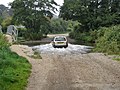
 Ford across River Glaven at Glandford - geograph.org.uk - 6189325.jpg 4,602 × 3,448; 7.11 MB
-
 Garden Lane north of Letheringsett - geograph.org.uk - 6189426.jpg 4,608 × 3,456; 4.2 MB
-
 Glaven valley near Glandford - geograph.org.uk - 1306140.jpg 600 × 424; 72 KB
-
 Gravelly river bed - geograph.org.uk - 4165191.jpg 1,024 × 660; 318 KB
-

-
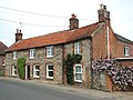
 House on Blakeney Road, Letheringsett - geograph.org.uk - 2982639.jpg 1,024 × 768; 208 KB
-
 House on Garden Lane north of Letheringsett - geograph.org.uk - 6189434.jpg 4,606 × 3,454; 6.39 MB
-
 Human sundial - geograph.org.uk - 3011125.jpg 640 × 480; 110 KB
-
 Hurdle Lane - geograph.org.uk - 4998565.jpg 1,600 × 1,200; 724 KB
-
 Hurdle Lane - geograph.org.uk - 5152105.jpg 1,600 × 1,200; 526 KB
-
 Hurdle Lane - geograph.org.uk - 5152107.jpg 1,200 × 1,600; 1.22 MB
-
 Hurdle Lane - geograph.org.uk - 5152110.jpg 1,200 × 1,600; 881 KB
-
 Hurdle Lane - geograph.org.uk - 5152134.jpg 1,600 × 1,200; 641 KB
-
 Maybe the sign needs re-writing - geograph.org.uk - 4166077.jpg 1,024 × 719; 321 KB
-
 Metal sculpture - geograph.org.uk - 3149493.jpg 768 × 1,024; 265 KB
-
 On the A148 - geograph.org.uk - 6229445.jpg 1,882 × 1,273; 382 KB
-
 Outdoor reared pigs - geograph.org.uk - 4908373.jpg 1,600 × 1,200; 605 KB
-
 Outdoor reared pigs - geograph.org.uk - 5152103.jpg 1,600 × 1,200; 473 KB
-
 Outdoor reared pigs by Hurdle Lane - geograph.org.uk - 5152109.jpg 1,600 × 1,200; 486 KB
-
 Outdoor reared pigs by Hurdle Lane - geograph.org.uk - 5152135.jpg 1,600 × 1,200; 474 KB
-
 Pastures by Bayfield Hall - geograph.org.uk - 3962212.jpg 640 × 480; 156 KB
-
 Path by Bayfield Lake - geograph.org.uk - 3962202.jpg 640 × 480; 297 KB
-
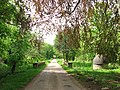
 Permissive path and woodland, Bayfield Hall - geograph.org.uk - 3705743.jpg 3,648 × 2,736; 2.8 MB
-

-

-
 River Glaven - geograph.org.uk - 4166075.jpg 1,600 × 1,200; 1.01 MB
-
 Road near Hall Farm - geograph.org.uk - 4294295.jpg 640 × 480; 132 KB
-
 Rolling roadworks on Blakeney Road - geograph.org.uk - 3450398.jpg 800 × 575; 205 KB
-
 Ruined building by Bayfield Lake - geograph.org.uk - 3962205.jpg 640 × 480; 315 KB
-
 Rush hour in Glandford - geograph.org.uk - 5351863.jpg 480 × 640; 46 KB
-

-

-
 Sign beside track to Bayfield Brecks - geograph.org.uk - 2347520.jpg 480 × 640; 327 KB
-
 Sign for The Little Café in the Woods - geograph.org.uk - 4166071.jpg 1,234 × 1,600; 426 KB
-
 Small cemetery beside Blakeney Road - geograph.org.uk - 3962166.jpg 640 × 480; 182 KB
-

-
 Track into Eighteen Acre Plantation - geograph.org.uk - 515802.jpg 640 × 480; 150 KB
-
 Track on the Bayfield Hall estate - geograph.org.uk - 3962213.jpg 640 × 561; 346 KB
-
 Travelling along the A148 - geograph.org.uk - 6229666.jpg 2,000 × 1,333; 1.62 MB
-
 Tree over the River Glaven - geograph.org.uk - 3011123.jpg 640 × 480; 158 KB
-
 Unsuitable for motor vehicles - loose gravel bed - geograph.org.uk - 4166078.jpg 1,024 × 768; 285 KB
-

-

-
 Wall's Lane toward Cley next the Sea - geograph.org.uk - 6189470.jpg 4,608 × 3,456; 6.43 MB
-
 Wall's Lane toward Glandford ford (2) - geograph.org.uk - 6189488.jpg 2,994 × 2,198; 2.47 MB
-
 Wall's Lane toward Glandford ford - geograph.org.uk - 6189483.jpg 4,608 × 3,456; 5.37 MB
-
 Water lily - opening bud - geograph.org.uk - 4166092.jpg 883 × 1,024; 263 KB
-
 Water Power - geograph.org.uk - 1895779.jpg 800 × 531; 159 KB
-

-
 Wildlife pond - geograph.org.uk - 3011124.jpg 640 × 480; 140 KB
-
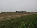
 Wind farm cable works - geograph.org.uk - 4907286.jpg 1,600 × 1,200; 569 KB
-
 Woodland near Bayfield Hall - geograph.org.uk - 1306111.jpg 640 × 426; 178 KB


_-_geograph.org.uk_-_6189488.jpg)


