Category:Les Pallargues
Jump to navigation
Jump to search
| Object location | | View all coordinates using: OpenStreetMap |
|---|
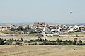
human settlement in Els Plans de Sió, Segarra, Ponent, Spain  | |||||
| Upload media | |||||
| Instance of |
| ||||
|---|---|---|---|---|---|
| Location | Els Plans de Sió, Segarra, Ponent, Lleida Province, Catalonia | ||||
| Located in or next to body of water | |||||
| Population |
| ||||
| Elevation above sea level |
| ||||
 | |||||
Català: Les Pallargues, poble del municipi dels Plans de Sió (Segarra)
Subcategories
This category has the following 2 subcategories, out of 2 total.
B
H
Media in category "Les Pallargues"
The following 4 files are in this category, out of 4 total.
-
 Les Pallargues (La Segarra).jpg 3,008 × 2,000; 2.36 MB
-
 Les Pallargues, la Segarra, Lleida.jpg 4,800 × 3,200; 3.57 MB
-
 Les Pallargues.JPG 1,977 × 1,315; 572 KB
-
 Plans de Sió - 3.jpg 4,176 × 3,072; 5.79 MB
.jpg)

