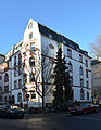
Category:Lersnerstraße 32 (Frankfurt)
Jump to navigation
Jump to search
| Object location | | View all coordinates using: OpenStreetMap |
|---|
Media in category "Lersnerstraße 32 (Frankfurt)"
The following 2 files are in this category, out of 2 total.
-
 Frankfurt, Lersnerstraße 32 (1).jpg 5,280 × 4,928; 17.13 MB
-
 Frankfurt, Lersnerstraße 32.jpg 3,776 × 4,864; 12.44 MB
.jpg)
