Category:Leighton–Linslade
Jump to navigation
Jump to search
English: Leighton–Linslade is a civil parish in the district of Central Bedfordshire in Bedfordshire, England, with a population of 32,417 (2001 census).
civil parish in England, United Kingdom  | |||||
| Upload media | |||||
| Instance of | |||||
|---|---|---|---|---|---|
| Location | Central Bedfordshire, Bedfordshire, East of England, England | ||||
| Population |
| ||||
| official website | |||||
 | |||||
Subcategories
This category has the following 3 subcategories, out of 3 total.
L
S
- Southcote, Bedfordshire (1 F)
Media in category "Leighton–Linslade"
The following 200 files are in this category, out of 751 total.
(previous page) (next page)-
 0741 Looking south from over Leighton Buzzard - geograph.org.uk - 1832498.jpg 1,024 × 768; 119 KB
-
 12, North Street.jpg 2,542 × 4,032; 2.21 MB
-
 20mph sign in New Road - geograph.org.uk - 2668358.jpg 480 × 640; 65 KB
-

-
 A4146 heading east - geograph.org.uk - 6340843.jpg 1,024 × 684; 262 KB
-
 A505 heading east - geograph.org.uk - 6340819.jpg 1,024 × 684; 211 KB
-
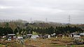 Allotments by the WCML - geograph.org.uk - 3628784.jpg 640 × 358; 40 KB
-

-
 Allotments south of Leighton Buzzard - geograph.org.uk - 2858875.jpg 640 × 430; 48 KB
-
 Alms Houses on Church Street - geograph.org.uk - 3511787.jpg 1,600 × 1,068; 657 KB
-
 Amalfi Tiles, Bridge Street - geograph.org.uk - 2622247.jpg 480 × 640; 59 KB
-
 Anthony Betts Garage, Leighton Buzzard - geograph.org.uk - 5279812.jpg 2,304 × 1,728; 830 KB
-
 Anubis and the Bay Tree - geograph.org.uk - 956592.jpg 640 × 480; 106 KB
-
 Anytime Fitness on Billington Road, Leighton Buzzard - geograph.org.uk - 5672676.jpg 1,936 × 1,374; 943 KB
-
 Approaching a bend in Victoria Road - geograph.org.uk - 2644733.jpg 640 × 480; 65 KB
-

-
 Approaching Leighton Buzzard Station - geograph.org.uk - 2644631.jpg 640 × 480; 52 KB
-

-

-

-

-

-

-

-

-

-

-

-
-

-

-

-

-

-
 Arch in New Road - geograph.org.uk - 2667893.jpg 640 × 480; 62 KB
-
 Ark House Vets on Hockliffe Street, Leighton Buzzard - geograph.org.uk - 3195203.jpg 2,048 × 1,536; 2.13 MB
-
 Autumn in Mentmore Road - geograph.org.uk - 2659382.jpg 640 × 480; 109 KB
-
 Bar Buddha, Bridge Street - geograph.org.uk - 2622230.jpg 480 × 640; 55 KB
-
 Base of pylon by Great Western Mainline - geograph.org.uk - 6497429.jpg 1,024 × 681; 151 KB
-

-
 Below Leighton Lock - geograph.org.uk - 956600.jpg 640 × 480; 89 KB
-
 Bench with a view of the works - geograph.org.uk - 3412494.jpg 1,600 × 1,072; 553 KB
-
 Bend in Leopold Road - geograph.org.uk - 2644465.jpg 640 × 480; 67 KB
-
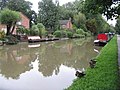
 Bend in the Grand Union - geograph.org.uk - 3178650.jpg 1,600 × 1,066; 576 KB
-
 Bethel Chapel datestone, New Road - geograph.org.uk - 2668605.jpg 640 × 480; 59 KB
-
 Bethel Chapel Garden, New Road - geograph.org.uk - 2668603.jpg 480 × 640; 109 KB
-
 Bin collection day in Soulbury Road - geograph.org.uk - 2644421.jpg 640 × 480; 81 KB
-

-
 Bin collection day in St Mary's Way - geograph.org.uk - 2644444.jpg 640 × 480; 74 KB
-

-
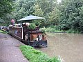
 Boats and houses at Linslade - geograph.org.uk - 956586.jpg 640 × 480; 89 KB
-

-
 Bookies in Lake Street - geograph.org.uk - 2593869.jpg 480 × 640; 81 KB
-
 Bookies in Mentmore Road - geograph.org.uk - 2668360.jpg 640 × 480; 81 KB
-
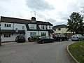
 Bowdens, Old Road - geograph.org.uk - 2641069.jpg 480 × 640; 58 KB
-
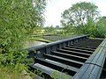
 Bridge 110 on the Grand Union Canal - geograph.org.uk - 3178612.jpg 1,600 × 1,067; 510 KB
-
 Bridge 110, Grand Union Canal - geograph.org.uk - 6324245.jpg 1,280 × 851; 336 KB
-
 Bridge 111 on the Grand Union Canal - geograph.org.uk - 3178656.jpg 1,600 × 1,069; 578 KB
-
 Bridge 111, Grand Union Canal - geograph.org.uk - 1286794.jpg 640 × 480; 88 KB
-
 Bridge 112, Grand Junction Canal - geograph.org.uk - 2705060.jpg 4,000 × 3,000; 4.65 MB
-
 Bridge 113, Grand Junction Canal - geograph.org.uk - 2704921.jpg 4,000 × 3,000; 4.74 MB
-
 Bridge 113, Grand Junction Canal - geograph.org.uk - 2704926.jpg 4,000 × 3,000; 4.77 MB
-
 Bridge 113, Grand Junction Canal - geograph.org.uk - 2704929.jpg 4,000 × 3,000; 4.57 MB
-
 Bridge 115, Grand Union Canal - geograph.org.uk - 1286984.jpg 640 × 480; 77 KB
-
 Bridge 115A, Grand Union Canal - geograph.org.uk - 3997899.jpg 640 × 480; 154 KB
-
 Bridge 115A, Grand Union Canal - geograph.org.uk - 5782314.jpg 1,024 × 768; 413 KB
-
 Bridge across the Grand Union Canal, Old Linslade - geograph.org.uk - 6520993.jpg 1,824 × 1,114; 1.6 MB
-
 Bridge over A4146, Leighton Buzzard - geograph.org.uk - 6340823.jpg 1,024 × 512; 177 KB
-
 Bridge Street in Leighton Buzzard - geograph.org.uk - 6603402.jpg 4,800 × 3,600; 1.22 MB
-
 Bridleway - geograph.org.uk - 4189945.jpg 640 × 480; 143 KB
-
 Bronze flyer - geograph.org.uk - 2730471.jpg 1,024 × 768; 206 KB
-
 Browns Angling Centre, Leighton Buzzard - geograph.org.uk - 5279429.jpg 2,304 × 1,728; 1.21 MB
-

-
 Building by the main line - geograph.org.uk - 4765347.jpg 640 × 488; 39 KB
-
 Bungalows in Ledburn Grove - geograph.org.uk - 2644871.jpg 640 × 480; 48 KB
-
 Burgins Taxis, Linslade - geograph.org.uk - 2644675.jpg 640 × 480; 97 KB
-
 Bus on mini roundabout, Linslade - geograph.org.uk - 3997370.jpg 640 × 480; 95 KB
-
 Bus stop and savaged oak - geograph.org.uk - 3252469.jpg 1,200 × 1,600; 546 KB
-
 Bus stop and sheltered housing on Heath Road - geograph.org.uk - 3511781.jpg 1,600 × 1,066; 361 KB
-
 Bus stop in Golden Riddy - geograph.org.uk - 2641220.jpg 640 × 480; 76 KB
-
 Bus stop in New Road - geograph.org.uk - 2668355.jpg 640 × 480; 74 KB
-
 Bus stop in Old Road - geograph.org.uk - 2669493.jpg 640 × 480; 61 KB
-
 Bus stop in Southcourt Road - geograph.org.uk - 2644500.jpg 640 × 480; 66 KB
-
 Bus stop outside Market House - geograph.org.uk - 2638634.jpg 480 × 640; 72 KB
-
 Business premises in Market Street - geograph.org.uk - 2638595.jpg 480 × 640; 67 KB
-
 Business premises in Mentmore Road - geograph.org.uk - 2667889.jpg 640 × 480; 81 KB
-
 Business Units, Grovebury Road - geograph.org.uk - 3449972.jpg 4,032 × 2,652; 1.89 MB
-
 Butchers in Market Square - geograph.org.uk - 2638657.jpg 480 × 640; 65 KB
-
 Buttles Building Materials - geograph.org.uk - 3449985.jpg 4,050 × 2,856; 2.3 MB
-
 Buzzard Screen Print, Mentmore Road - geograph.org.uk - 2668372.jpg 640 × 480; 72 KB
-

-
 Canal Bridge - geograph.org.uk - 2674975.jpg 4,176 × 2,784; 4.98 MB
-

-
 Car in the Golden Riddy spur - geograph.org.uk - 2641190.jpg 640 × 480; 54 KB
-
 Car park in New Road - geograph.org.uk - 2668353.jpg 480 × 640; 72 KB
-

-

-
 CarterS, Market Square - geograph.org.uk - 2638646.jpg 480 × 640; 61 KB
-

-

-
 Central Bedfordshire , The A418 - geograph.org.uk - 5732765.jpg 6,000 × 4,000; 7.24 MB
-
 Central Bedfordshire , The A505 - geograph.org.uk - 5732762.jpg 6,000 × 4,000; 7.2 MB
-
 Central Post Office - geograph.org.uk - 4364609.jpg 1,024 × 683; 242 KB
-

-

-
 Chemists in Market Square - geograph.org.uk - 2638666.jpg 640 × 480; 75 KB
-
 Chippie in Old Road - geograph.org.uk - 2669496.jpg 640 × 480; 64 KB
-
 Church Avenue - geograph.org.uk - 2651670.jpg 640 × 480; 87 KB
-
 Church Lane, Old Linslade - geograph.org.uk - 2593878.jpg 640 × 480; 43 KB
-
 Church Road - geograph.org.uk - 1347669.jpg 640 × 430; 156 KB
-
 Church Square - geograph.org.uk - 4364612.jpg 1,024 × 683; 193 KB
-
 Church Square in early autumn - geograph.org.uk - 2633606.jpg 640 × 480; 89 KB
-
 Church View Court - geograph.org.uk - 2644693.jpg 640 × 480; 66 KB
-

-
 Coming soon in Victoria Road - geograph.org.uk - 2644726.jpg 640 × 480; 80 KB
-

-
 Cooper Drive closed off - geograph.org.uk - 3320757.jpg 640 × 480; 89 KB
-
 Corbettshill Farm - geograph.org.uk - 2858857.jpg 640 × 430; 45 KB
-
 Cottage stores - geograph.org.uk - 4189953.jpg 640 × 480; 66 KB
-
 Countryside near Old Linslade - geograph.org.uk - 3628793.jpg 640 × 418; 46 KB
-
 Crash, Bang, Bo££**k$ - geograph.org.uk - 3449963.jpg 4,320 × 3,240; 3.2 MB
-
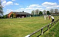 Croquet in the Park - geograph.org.uk - 3524359.jpg 640 × 402; 73 KB
-
 Cross Bucks Way - geograph.org.uk - 2746977.jpg 640 × 480; 91 KB
-
 Cross Bucks Way - geograph.org.uk - 2746981.jpg 640 × 480; 75 KB
-
 Cross Bucks Way - geograph.org.uk - 2746988.jpg 640 × 480; 90 KB
-
 Cross Bucks way leaves Old Linslade Road - geograph.org.uk - 3178643.jpg 1,600 × 1,069; 369 KB
-
 Crossing Appenine Way - geograph.org.uk - 3449084.jpg 3,516 × 2,592; 2.62 MB
-
 Crossing Stanbridge Road - geograph.org.uk - 3995197.jpg 640 × 480; 115 KB
-

-
 Cycle path into Linslade Rec - geograph.org.uk - 2644687.jpg 640 × 480; 78 KB
-

-
 D.King, North Street - geograph.org.uk - 2638652.jpg 480 × 640; 61 KB
-
 Date stone in Old Road - geograph.org.uk - 2669494.jpg 480 × 640; 91 KB
-
 Diesel and vintage steam locomotives at Page's Park - geograph.org.uk - 5811992.jpg 4,644 × 3,077; 3.52 MB
-
 Dilapidated farm buildings and icy waterlogged field - geograph.org.uk - 3251250.jpg 1,600 × 1,071; 471 KB
-
 Distinctive tree on Heath Road - geograph.org.uk - 3511784.jpg 1,600 × 1,069; 362 KB
-
-

-
 Disused swing bridge - geograph.org.uk - 1354424.jpg 640 × 480; 101 KB
-
 Doll at Page's Park Station - geograph.org.uk - 5556534.jpg 640 × 427; 153 KB
-
 Dorvic's, Bridge Street - geograph.org.uk - 2622159.jpg 640 × 480; 75 KB
-
 Double yellow lines in Mentmore Road - geograph.org.uk - 2668347.jpg 640 × 480; 73 KB
-
 Double yellow lines in New Road - geograph.org.uk - 2668010.jpg 640 × 480; 66 KB
-
 Double yellow lines in Victoria Road - geograph.org.uk - 2644743.jpg 480 × 640; 83 KB
-

-
 Dry cleaners in Market Square - geograph.org.uk - 2638661.jpg 480 × 640; 76 KB
-
 Early autumn in Rok Lane - geograph.org.uk - 2644489.jpg 640 × 480; 68 KB
-
 Eastern end of Rothschild Road - geograph.org.uk - 2640072.jpg 640 × 480; 63 KB
-
 Eastern end of Southcourt Avenue - geograph.org.uk - 2644527.jpg 640 × 480; 49 KB
-
 Eastern end of Victoria Road - geograph.org.uk - 2644735.jpg 640 × 480; 68 KB
-

-
 Electrical Distribution Station - geograph.org.uk - 6712222.jpg 1,024 × 679; 129 KB
-
 Electricity poles in the field - geograph.org.uk - 3251217.jpg 1,600 × 1,076; 222 KB
-
 Elegant houses in Church Square - geograph.org.uk - 2593839.jpg 640 × 480; 83 KB
-
 Elegant terrace in Church Square - geograph.org.uk - 2633589.jpg 640 × 480; 75 KB
-
 Elf at Page's Park - geograph.org.uk - 3449168.jpg 856 × 1,280; 340 KB
-
 Empty parking spaces in New Road - geograph.org.uk - 2668002.jpg 640 × 480; 60 KB
-
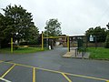
 Entrance to Linslade Lower School - geograph.org.uk - 2644470.jpg 640 × 480; 67 KB
-
 Exit to Mentmore Rec Car Park - geograph.org.uk - 2659619.jpg 640 × 480; 69 KB
-
 Farmland north of Leighton Buzzard - geograph.org.uk - 4348725.jpg 640 × 430; 50 KB
-

-
 Farmland, Old Linslade - geograph.org.uk - 2741100.jpg 640 × 430; 32 KB
-
 Faulkener's Way in early September - geograph.org.uk - 2641047.jpg 640 × 480; 67 KB
-
 Field at the end of Bossington Lane - geograph.org.uk - 2593804.jpg 640 × 480; 94 KB
-
 Fields south of Linslade - geograph.org.uk - 4549566.jpg 1,600 × 899; 165 KB
-
 Fishing at Tiddenfoot Waterside Park - geograph.org.uk - 3488949.jpg 3,556 × 2,667; 1.58 MB
-
 Fishing at Tiddenfoot Waterside Park - geograph.org.uk - 3488957.jpg 3,650 × 2,737; 1.86 MB
-
 Flats by the West Coast Main Line - geograph.org.uk - 2858872.jpg 640 × 347; 29 KB
-
 Flats in Leighton Road - geograph.org.uk - 2641108.jpg 480 × 640; 105 KB
-
 Flats in Old Road - geograph.org.uk - 2669506.jpg 640 × 480; 92 KB
-
 Flooded Quarry - Tiddenfoot Waterside Park - geograph.org.uk - 3488939.jpg 2,810 × 2,108; 1.3 MB
-
 Flower stall - geograph.org.uk - 4427250.jpg 683 × 1,024; 388 KB
-
 Flower troughs in Leighton Road - geograph.org.uk - 2641129.jpg 640 × 480; 105 KB
-
 Foot and cycle bridge over Grand Union Canal - geograph.org.uk - 5783359.jpg 1,024 × 768; 385 KB
-
 Foot and cycle bridge over Grand Union Canal - geograph.org.uk - 5783535.jpg 1,024 × 768; 381 KB
-

-

-
 Footbridge on the Greensand Ridge Walk - geograph.org.uk - 3178659.jpg 1,600 × 1,067; 416 KB
-
 Footbridge over Grand Union Canal - geograph.org.uk - 5782191.jpg 1,024 × 768; 477 KB
-
 Footbridge over West Coast Main Line - geograph.org.uk - 1876127.jpg 640 × 480; 128 KB
-
 Footpath coming down to Knaves Hill - geograph.org.uk - 2746992.jpg 640 × 480; 73 KB
-
 Footpath from Derwent Road - geograph.org.uk - 3412459.jpg 1,200 × 1,600; 684 KB
-
 Footpath to Eggington - geograph.org.uk - 3411588.jpg 1,600 × 1,068; 747 KB
-
 Footpath to Old Road - geograph.org.uk - 1347679.jpg 427 × 640; 240 KB
-
 Footpath to Rocklane Farm - geograph.org.uk - 3412468.jpg 1,600 × 1,067; 550 KB
-
 Footpath toward Grovebury Farm - geograph.org.uk - 3412515.jpg 1,600 × 1,068; 790 KB
-
 Footpath with level crossing - geograph.org.uk - 3511756.jpg 1,600 × 1,067; 478 KB
-
 Foundation stone, Forster Hall - geograph.org.uk - 2594220.jpg 480 × 640; 85 KB
-

-
 Friends Meeting House - geograph.org.uk - 4368955.jpg 1,024 × 683; 279 KB
-

-
 Funki Doogals in Mentmore Road - geograph.org.uk - 2668357.jpg 640 × 480; 64 KB
-

-
 Gate on the Greensand Ridge Walk by bridge 111 - geograph.org.uk - 3178663.jpg 1,600 × 1,073; 582 KB
-
 Gatepost on Heath Park Road - geograph.org.uk - 3186833.jpg 1,600 × 1,066; 510 KB
-
 Gatepost, Heath Park Road - geograph.org.uk - 4189947.jpg 640 × 480; 107 KB
-
 George V postbox - geograph.org.uk - 3511776.jpg 1,200 × 1,600; 576 KB
-
 Georgian postbox by the crossroads - geograph.org.uk - 3186774.jpg 1,200 × 1,600; 579 KB
-
 Globe Lane Bridge No 111 - geograph.org.uk - 5000130.jpg 800 × 600; 166 KB
-
 Gogs Farm - geograph.org.uk - 2741104.jpg 640 × 430; 34 KB


_Station_-_geograph.org.uk_-_2247551.jpg)


