Category:Legerwood
Jump to navigation
Jump to search
Deutsch: Legerwood ist eine Ortschaft in der schottischen Council Area Scottish Borders beziehungsweise in der traditionellen Grafschaft Berwickshire. Sie liegt rund sieben Kilometer südöstlich von Lauder und 15 Kilometer nordwestlich von Kelso am Ledgerwood Burn, der westlich in das Leader Water mündet. (→Legerwood)

village in Scottish Borders, Scotland, UK  | |||||
| Upload media | |||||
| Instance of | |||||
|---|---|---|---|---|---|
| Location |
| ||||
 | |||||
Media in category "Legerwood"
The following 29 files are in this category, out of 29 total.
-
 Converted Cottages - geograph.org.uk - 842048.jpg 640 × 480; 79 KB
-
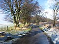 Country road in the Borders - geograph.org.uk - 1131009.jpg 640 × 480; 139 KB
-
 Farm track near Corsbie Farm - geograph.org.uk - 842054.jpg 640 × 480; 61 KB
-
 Farmland at Legerwood - geograph.org.uk - 902090.jpg 640 × 427; 129 KB
-
 Harvest bales at Legerwood - geograph.org.uk - 902095.jpg 640 × 427; 122 KB
-
 Legerwood - geograph.org.uk - 1079178.jpg 640 × 480; 58 KB
-
 Legerwood - geograph.org.uk - 208856.jpg 640 × 480; 105 KB
-
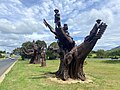 Legerwood Carved Trees - Bobby & Trippy's Love Story.jpg 4,032 × 3,024; 3.29 MB
-
 Legerwood Carved Trees - Characters from Caring Husband Till the End.jpg 3,024 × 4,032; 1.17 MB
-
 Legerwood Hill - geograph.org.uk - 1079174.jpg 640 × 480; 105 KB
-
 Legerwood in the Scottish Borders - geograph.org.uk - 829393.jpg 640 × 480; 105 KB
-
 Minor road north of Legerwood - geograph.org.uk - 1131029.jpg 640 × 387; 57 KB
-
 Morriston Strip - geograph.org.uk - 1075919.jpg 640 × 480; 132 KB
-
 North from Legerwood - geograph.org.uk - 1051704.jpg 640 × 360; 82 KB
-
 Pasture on Legerwood Hill - geograph.org.uk - 1444109.jpg 640 × 427; 158 KB
-
 Rough Winter grazing - geograph.org.uk - 1131026.jpg 640 × 480; 79 KB
-
 Stubble field and bales - geograph.org.uk - 902101.jpg 639 × 387; 176 KB
-
 The only way to church. - geograph.org.uk - 842186.jpg 640 × 480; 139 KB
-
 Tramlines in a field at Legerwood - geograph.org.uk - 902110.jpg 640 × 427; 224 KB
-
 A long 6 weeks. - geograph.org.uk - 208857.jpg 477 × 640; 65 KB
-
 Barley field - geograph.org.uk - 526605.jpg 640 × 480; 134 KB
-
 Bassendean-Legerwood road - geograph.org.uk - 208844.jpg 640 × 480; 84 KB
-
 Crab apple tree by the Legerwood road - geograph.org.uk - 259973.jpg 640 × 480; 72 KB
-
 Farm track, Legerwood - geograph.org.uk - 540733.jpg 640 × 480; 99 KB
-
 Farmland, Legerwood - geograph.org.uk - 540744.jpg 640 × 480; 69 KB
-
 Grazing sheep, Legerwood - geograph.org.uk - 540736.jpg 640 × 480; 79 KB
-
 Legerwood - geograph.org.uk - 208854.jpg 640 × 480; 68 KB
-
 Road up Boon Hill - geograph.org.uk - 208861.jpg 640 × 480; 118 KB
-
 Rough grazing field near Legerwood - geograph.org.uk - 259969.jpg 640 × 354; 43 KB


