Category:Lees Lane, Neston
Jump to navigation
Jump to search
| Object location | | View all coordinates using: OpenStreetMap |
|---|
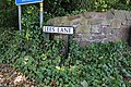
Lees Lane runs roughly northeast from the centre of Little Neston to the Chester High Road at Hinderton.
Subcategories
This category has the following 2 subcategories, out of 2 total.
L
W
Media in category "Lees Lane, Neston"
The following 2 files are in this category, out of 2 total.
-
 Lees Lane from Chester High Road.jpg 5,072 × 3,252; 9.72 MB
-
 Lees Lane sign.jpg 5,184 × 3,456; 8.64 MB

