Category:Leekfrith
Jump to navigation
Jump to search
English: Leekfrith is a civil parish in the Staffordshire Moorlands district, in the county of Staffordshire, England.
civil parish in Staffordshire Moorlands, Staffordshire, England | |||||
| Upload media | |||||
| Instance of | |||||
|---|---|---|---|---|---|
| Location | Staffordshire Moorlands, Staffordshire, West Midlands, England | ||||
| Population |
| ||||
 | |||||
Subcategories
This category has the following 6 subcategories, out of 6 total.
Media in category "Leekfrith"
The following 200 files are in this category, out of 624 total.
(previous page) (next page)-
 'The Wombat' on the Upper Tier - geograph.org.uk - 6394115.jpg 5,640 × 3,760; 1.92 MB
-
 A bend in the road - geograph.org.uk - 3805257.jpg 3,648 × 2,736; 3.49 MB
-
 A choice of paths - geograph.org.uk - 6183408.jpg 3,492 × 2,661; 3.19 MB
-
 A footpath across pasture - geograph.org.uk - 2815060.jpg 1,142 × 857; 281 KB
-

-
 A pair of dead conifer trees below The Roaches - geograph.org.uk - 4918396.jpg 3,648 × 2,048; 2.1 MB
-
 A remote cottage - geograph.org.uk - 2039879.jpg 3,872 × 2,471; 2.89 MB
-

-
 A small outcrop at Roach End - geograph.org.uk - 2034478.jpg 3,872 × 2,592; 3.69 MB
-

-
 A solitary tree resplendent in moorland spring sunlight - geograph.org.uk - 4918459.jpg 3,648 × 2,048; 1.78 MB
-
 A stone stile on the path to Roche Grange - geograph.org.uk - 2815068.jpg 1,142 × 857; 350 KB
-
 A53 at Blackshaw Moor village boundary - geograph.org.uk - 6295812.jpg 1,024 × 769; 152 KB
-
 A53 near Birchtree Farm - geograph.org.uk - 6295823.jpg 1,024 × 769; 104 KB
-
 A53 south of Blackshaw Grange - geograph.org.uk - 5568351.jpg 1,600 × 1,280; 842 KB
-
 Abandoned farmhouse east of The Roaches - geograph.org.uk - 5695659.jpg 4,592 × 3,056; 2.65 MB
-

-
 Across the moor - geograph.org.uk - 6168417.jpg 3,465 × 2,588; 2.55 MB
-
 Advertising on Walkway - geograph.org.uk - 4180131.jpg 427 × 640; 300 KB
-
 Aftermath from last years fire - geograph.org.uk - 6199252.jpg 2,000 × 1,330; 2.4 MB
-
 Alongside Hind's Clough Wood - geograph.org.uk - 6183260.jpg 4,000 × 3,000; 3.59 MB
-
 Alongside the Dane - geograph.org.uk - 6168468.jpg 4,000 × 3,000; 4.08 MB
-
 An old gate post - geograph.org.uk - 6199285.jpg 2,000 × 1,330; 2.5 MB
-
 Anthropomorphic hollow tree - geograph.org.uk - 3805271.jpg 2,346 × 3,128; 2.26 MB
-
 Appaloosa Sunset, 3rd Cloud - geograph.org.uk - 6414547.jpg 5,640 × 3,760; 2.12 MB
-
 Approaching Clough Head Farm - geograph.org.uk - 5405878.jpg 1,600 × 1,200; 532 KB
-
 Approaching Gun Plantation - geograph.org.uk - 3060422.jpg 3,926 × 2,900; 2.81 MB
-
 Approaching North Hillswood - geograph.org.uk - 3249817.jpg 4,000 × 2,248; 1.7 MB
-
 Approaching Ramshaw Rocks - geograph.org.uk - 4965939.jpg 3,648 × 2,432; 7.55 MB
-
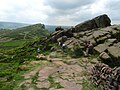
 Approaching the Roaches - geograph.org.uk - 6199225.jpg 2,000 × 1,330; 1.58 MB
-
 Aprés Sport - geograph.org.uk - 6183312.jpg 3,684 × 2,705; 3.17 MB
-
 At Roach End - a pointed outcrop - geograph.org.uk - 4462202.jpg 3,319 × 4,317; 2.58 MB
-
 At the Jetty - geograph.org.uk - 6183314.jpg 3,616 × 2,617; 1.97 MB
-
 Atop the Hangingstone Ridge - geograph.org.uk - 3330707.jpg 1,280 × 853; 231 KB
-
 Back along the ridge - geograph.org.uk - 2403982.jpg 4,000 × 3,000; 3.84 MB
-
 Back Forest - geograph.org.uk - 6463027.jpg 1,024 × 687; 177 KB
-
 Back Forest Farmhouse - geograph.org.uk - 4688162.jpg 1,024 × 768; 182 KB
-
 Back Forest Ridge - geograph.org.uk - 6613784.jpg 4,032 × 3,024; 3.09 MB
-
 Back Forest, footpath - geograph.org.uk - 4688100.jpg 768 × 1,024; 296 KB
-
 Back Forest, gate - geograph.org.uk - 4688012.jpg 1,024 × 768; 220 KB
-
 Back Forest, outcrop - geograph.org.uk - 4687999.jpg 1,024 × 768; 178 KB
-
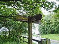
 Back Forest, signpost - geograph.org.uk - 4688086.jpg 1,024 × 768; 276 KB
-
 Back Forest, stile - geograph.org.uk - 4688138.jpg 1,024 × 768; 296 KB
-
 Back Forest, woodland - geograph.org.uk - 4688017.jpg 1,024 × 768; 345 KB
-
 Back on the footpath - geograph.org.uk - 6199278.jpg 2,000 × 1,330; 2.23 MB
-
 Barn at Stockmeadows - geograph.org.uk - 5405897.jpg 1,600 × 1,200; 431 KB
-
 Bearstone Rock - geograph.org.uk - 5080253.jpg 800 × 600; 102 KB
-
 Beeches of Forest Wood - geograph.org.uk - 317889.jpg 480 × 640; 172 KB
-
 Below Hen Cloud - geograph.org.uk - 3065767.jpg 640 × 480; 126 KB
-
 Below the Roaches - geograph.org.uk - 6199262.jpg 2,000 × 1,330; 2.43 MB
-
 Benthead Farm - geograph.org.uk - 4966138.jpg 2,918 × 1,946; 5.38 MB
-
 Between the rocks - geograph.org.uk - 2404144.jpg 4,000 × 3,000; 2.79 MB
-
 Bilberry bank - geograph.org.uk - 2395930.jpg 4,000 × 3,000; 4.13 MB
-
 Bilberry futures - geograph.org.uk - 2402014.jpg 4,000 × 3,000; 4.28 MB
-
 Birch trees above Big Wood - geograph.org.uk - 3806454.jpg 2,346 × 3,128; 2.45 MB
-
 Birches in Forest Wood - geograph.org.uk - 317945.jpg 480 × 640; 175 KB
-
 Black Brook and the ford - geograph.org.uk - 2404281.jpg 4,000 × 3,000; 5.4 MB
-
 Black Brook Valley and Gradbach Wood - geograph.org.uk - 6616653.jpg 4,032 × 3,024; 2.14 MB
-
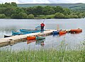
 Boats on the reservoir - geograph.org.uk - 4238947.jpg 1,024 × 768; 134 KB
-
 Boundary stone, Gun - geograph.org.uk - 851476.jpg 480 × 640; 96 KB
-
 Boundary Wall, Back Forest - geograph.org.uk - 6616431.jpg 4,032 × 3,024; 2.28 MB
-
 Bridleway descending to Roaches School - geograph.org.uk - 6616651.jpg 3,024 × 4,032; 2.85 MB
-
 Bridleway, Black Brook Valley - geograph.org.uk - 6618516.jpg 3,024 × 4,032; 3.09 MB
-
 Broad horizons, Roach End - geograph.org.uk - 4402810.jpg 4,962 × 3,309; 2.27 MB
-
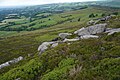
 Castle Cliff Rocks - geograph.org.uk - 3028838.jpg 640 × 427; 268 KB
-
 Castle Cliff Rocks - geograph.org.uk - 6611848.jpg 3,024 × 4,032; 3.22 MB
-
 Castle Cliff Rocks, Gradbach - geograph.org.uk - 6641627.jpg 2,000 × 1,333; 2.27 MB
-
 Castle cliff rocks. - geograph.org.uk - 5192946.jpg 640 × 480; 77 KB
-
 Cattle enjoying some winter sunshine - geograph.org.uk - 3250470.jpg 800 × 533; 92 KB
-
 Cattle grazing at Roach End - geograph.org.uk - 5585939.jpg 4,000 × 3,000; 4.69 MB
-
 Cattle grid near Clough Head - geograph.org.uk - 2038470.jpg 3,872 × 2,480; 3.09 MB
-
 Cattle Grid near Hillswood Farm - geograph.org.uk - 2376720.jpg 3,072 × 2,304; 3.35 MB
-
 Cattle Grid, Roach End - geograph.org.uk - 3028873.jpg 640 × 427; 241 KB
-
 Cattle on a distant hillside - geograph.org.uk - 4239023.jpg 1,024 × 768; 90 KB
-
 Churnet Valley east of Tittesworth Reservoir - geograph.org.uk - 3667383.jpg 1,024 × 768; 167 KB
-
 Cliffs at River Dane - geograph.org.uk - 2404367.jpg 4,000 × 3,000; 4.05 MB
-
 Climbing on Hen Cloud with view to Keekorok Lodge - geograph.org.uk - 6459132.jpg 1,799 × 1,199; 458 KB
-
 Climbing the Hangingstone Ridge - geograph.org.uk - 3330698.jpg 1,280 × 853; 195 KB
-
 Climbing to The Roaches through trees - geograph.org.uk - 5080165.jpg 800 × 600; 211 KB
-
 Clough Head - geograph.org.uk - 2038430.jpg 3,685 × 2,466; 2.93 MB
-
 Coming down from Roach End - geograph.org.uk - 2404262.jpg 4,000 × 3,000; 5.16 MB
-
 Commemorative pillar at Tittesworth Reservoir - geograph.org.uk - 6352085.jpg 2,000 × 1,257; 3.27 MB
-
 Confluence of Black Brook and the River Dane - geograph.org.uk - 3212512.jpg 3,872 × 2,592; 6 MB
-
 Construction work, Roaches School - geograph.org.uk - 5226475.jpg 800 × 533; 81 KB
-
 Corner Cottage - geograph.org.uk - 5404702.jpg 1,600 × 1,200; 687 KB
-
 Cote Lane Junction - geograph.org.uk - 5908107.jpg 800 × 600; 121 KB
-
 Cottages below the Roaches - geograph.org.uk - 2039859.jpg 3,872 × 2,457; 3 MB
-
 Cotton Grass - geograph.org.uk - 2404208.jpg 4,000 × 3,000; 4.51 MB
-
 Countryside south of Hanging Stone - geograph.org.uk - 4461937.jpg 5,184 × 3,475; 5.14 MB
-
 Countryside west of Meerbrook - geograph.org.uk - 5817649.jpg 1,600 × 1,200; 611 KB
-
 Countryside west of Meerbrook - geograph.org.uk - 5817662.jpg 1,600 × 1,200; 631 KB
-
 Countryside west of Meerbrook - geograph.org.uk - 5817694.jpg 1,600 × 1,200; 652 KB
-
 Cows on the road - geograph.org.uk - 2034249.jpg 3,872 × 2,592; 3.48 MB
-
 Crags, Back Forest - geograph.org.uk - 6464026.jpg 1,024 × 538; 169 KB
-
 Dains Water Mill, Upper Hulme - geograph.org.uk - 6411461.jpg 2,000 × 1,333; 2.77 MB
-
 Dane valley from above Rockhall - geograph.org.uk - 906558.jpg 640 × 427; 83 KB
-
 Danebridge, cattle grazing - geograph.org.uk - 4687734.jpg 1,024 × 768; 183 KB
-
 Danebridge, Dane Valley - geograph.org.uk - 4688144.jpg 1,024 × 768; 168 KB
-
 Danebridge, moorland - geograph.org.uk - 4687754.jpg 1,024 × 768; 239 KB
-
 Danebridge, stile - geograph.org.uk - 4688154.jpg 1,024 × 768; 246 KB
-
 Derelict Barn, The Roaches - geograph.org.uk - 6411449.jpg 2,000 × 1,333; 3.24 MB
-
 Descending Gun with Leek in the distance - geograph.org.uk - 3060420.jpg 4,000 × 3,000; 2.98 MB
-
 Descending path above Red Earth Farm with Leek in distance - geograph.org.uk - 3060443.jpg 4,000 × 3,000; 2.48 MB
-
 Descending the Dam - geograph.org.uk - 6183248.jpg 4,000 × 3,000; 4.1 MB
-
 Descending to Roach End from the Roaches ridge - geograph.org.uk - 6640159.jpg 1,024 × 693; 350 KB
-
 Disused gateposts - geograph.org.uk - 4238963.jpg 1,024 × 768; 206 KB
-

-
 Doxey Pool - geograph.org.uk - 5406591.jpg 1,600 × 1,200; 421 KB
-
 Doxey Pool - geograph.org.uk - 6199246.jpg 2,000 × 1,330; 2.27 MB
-
 Doxey Pool on The Roaches - geograph.org.uk - 5589173.jpg 4,000 × 3,000; 4.81 MB
-
 Doxey Pool on The Roaches - geograph.org.uk - 5589177.jpg 4,000 × 3,000; 4.79 MB
-
 Doxey Pool on The Roaches - geograph.org.uk - 5589181.jpg 4,000 × 3,000; 5.03 MB
-
 Doxey Pool, The Roaches - geograph.org.uk - 6326428.jpg 2,000 × 1,333; 1.83 MB
-
 Dry stone wall below The Roaches - geograph.org.uk - 906530.jpg 427 × 640; 101 KB
-
 Dry Stone Wall, Roach End - geograph.org.uk - 3028863.jpg 640 × 427; 256 KB
-
 Dry stone walls near Roche Grange - geograph.org.uk - 906715.jpg 640 × 427; 95 KB
-
 Dry stream crossing - geograph.org.uk - 4239013.jpg 1,024 × 768; 257 KB
-
 Eastern slopes of The Roaches - geograph.org.uk - 3205776.jpg 800 × 600; 98 KB
-
 Entrance and guardian - Whitty Lane(^) - geograph.org.uk - 4965702.jpg 3,648 × 2,432; 5.26 MB
-
 Entrance to Meerbrook - geograph.org.uk - 3215770.jpg 640 × 480; 115 KB
-
 Entrance to Roach House Farm - geograph.org.uk - 5588394.jpg 4,000 × 3,000; 4.89 MB
-
 Entrance to Stockmeadows Farm - geograph.org.uk - 4185458.jpg 640 × 427; 77 KB
-
 Erratic boulder - geograph.org.uk - 1759221.jpg 2,048 × 1,536; 605 KB
-
 Evening light on Hen Cloud - geograph.org.uk - 6459131.jpg 1,800 × 1,200; 372 KB
-
 Evening on the Staffordshire Roaches - geograph.org.uk - 6459133.jpg 1,799 × 1,199; 356 KB
-
 Factory in Upper Hulme - geograph.org.uk - 5405066.jpg 1,600 × 1,200; 471 KB
-
 Farm entrance and footpath - geograph.org.uk - 5405912.jpg 1,600 × 1,200; 402 KB
-
 Farm track - geograph.org.uk - 1554842.jpg 640 × 403; 68 KB
-
 Farm track - geograph.org.uk - 6135645.jpg 768 × 1,024; 112 KB
-
 Farm track and valley meadows - geograph.org.uk - 2813831.jpg 1,306 × 979; 371 KB
-
 Farm track to Frith Bottom - geograph.org.uk - 1441825.jpg 640 × 426; 359 KB
-
 Farm Track to Greenhouse - geograph.org.uk - 4185485.jpg 640 × 427; 245 KB
-
 Farmhouse at Meadows Farm - geograph.org.uk - 5405885.jpg 1,600 × 1,200; 503 KB
-
 Farmland - geograph.org.uk - 6183270.jpg 4,000 × 3,000; 3.4 MB
-
 Field barn at Meadows Farm - geograph.org.uk - 2814992.jpg 979 × 734; 331 KB
-
 Field north of North Hillswood farm - geograph.org.uk - 3667470.jpg 1,024 × 768; 164 KB
-
 Field, Back Forest Farm - geograph.org.uk - 2401885.jpg 640 × 426; 83 KB
-
 Footbridge - geograph.org.uk - 6183303.jpg 4,000 × 3,000; 3.93 MB
-
 Footbridge near Gradbach Mill - geograph.org.uk - 6610727.jpg 3,024 × 4,032; 5.43 MB
-
 Footbridge over a stream - geograph.org.uk - 4238932.jpg 1,024 × 768; 255 KB
-
 Footpath along the edge of farmland - geograph.org.uk - 2038528.jpg 3,872 × 2,592; 2.83 MB
-
 Footpath along the Roaches - geograph.org.uk - 6199254.jpg 2,000 × 1,330; 1.66 MB
-
 Footpath crossroads - geograph.org.uk - 2038503.jpg 3,872 × 2,592; 2.8 MB
-
 Footpath from Roche Grange to Meadows Farm - geograph.org.uk - 2815037.jpg 1,240 × 930; 314 KB
-
 Footpath junction near Hanging Stone - geograph.org.uk - 1903024.jpg 1,600 × 1,200; 653 KB
-
 Footpath junction near the Hanging Stone - geograph.org.uk - 3330693.jpg 1,280 × 853; 217 KB
-
 Footpath junction near the Hanging Stone - geograph.org.uk - 3336649.jpg 853 × 1,280; 291 KB
-
 Footpath near High Forest - geograph.org.uk - 2400129.jpg 640 × 426; 112 KB
-
 Footpath Signpost - geograph.org.uk - 4185483.jpg 640 × 427; 242 KB
-
 Footpath through Gradbach Wood - geograph.org.uk - 2039812.jpg 3,872 × 2,592; 6.43 MB
-
 Footpath to Clough Head - geograph.org.uk - 2038405.jpg 3,774 × 2,466; 3.49 MB
-
 Footpath to Roach End - geograph.org.uk - 2400154.jpg 640 × 426; 97 KB
-
 Footpath towards Gradbach - geograph.org.uk - 2400167.jpg 640 × 426; 134 KB
-
 Footpath View - geograph.org.uk - 5908073.jpg 800 × 591; 126 KB
-
 Ford, Upper Hulme - geograph.org.uk - 2925488.jpg 640 × 427; 229 KB
-
 Forest Wood - geograph.org.uk - 4275451.jpg 480 × 640; 151 KB
-
 Forest Wood near Gradbach - geograph.org.uk - 5935715.jpg 5,600 × 4,200; 4.9 MB
-
 Former farm building (^) - geograph.org.uk - 6183427.jpg 3,037 × 2,241; 1.63 MB
-
 Gate into Field Near Stockmeadows - geograph.org.uk - 4185461.jpg 640 × 427; 297 KB
-
 Gate Posts, Hens Cloud - geograph.org.uk - 6411480.jpg 2,000 × 1,333; 2.2 MB
-
 Gate to the Roaches - geograph.org.uk - 5907492.jpg 587 × 800; 126 KB
-
 Gradbach Woodland - geograph.org.uk - 6641628.jpg 2,000 × 1,371; 4.16 MB
-
 Gradbach, footpath - geograph.org.uk - 4687981.jpg 1,024 × 768; 218 KB
-
 Gradbach, moorland - geograph.org.uk - 4687986.jpg 1,024 × 768; 219 KB
-
 Gradbach, River Dane - geograph.org.uk - 4688107.jpg 1,024 × 768; 315 KB
-
 Gradbach, woodland - geograph.org.uk - 4688128.jpg 1,024 × 768; 374 KB
-
 Grass and bushes on east side of Tittesworth Reservoir - geograph.org.uk - 6352831.jpg 1,999 × 1,175; 2.12 MB
-
 Grazing below Hen Cloud - geograph.org.uk - 5404653.jpg 1,600 × 1,200; 478 KB
-
 Grazing land beside the track to Meadows Farm - geograph.org.uk - 5406397.jpg 1,600 × 1,200; 546 KB
-
 Grazing pasture with sheep - geograph.org.uk - 3805265.jpg 3,648 × 2,736; 2.84 MB
-
 Green lane at Roach End - geograph.org.uk - 5588390.jpg 4,000 × 3,000; 4.84 MB
-
 Gun - geograph.org.uk - 5081732.jpg 5,184 × 3,143; 1.72 MB
-
 Gun at my back ... - geograph.org.uk - 2329961.jpg 1,704 × 2,272; 1.16 MB
-
 Gun Plantation - geograph.org.uk - 5082154.jpg 5,133 × 2,597; 1.85 MB
-
 Gun Plantation, a long thin wood as seen from the road - geograph.org.uk - 3806421.jpg 3,648 × 2,736; 2.18 MB
-
 Gun, Summit - geograph.org.uk - 12729.jpg 640 × 390; 52 KB
-
 Hawthorne Wood - geograph.org.uk - 2945315.jpg 640 × 480; 67 KB
-
 Hay bales near Meerbrook - geograph.org.uk - 198561.jpg 640 × 480; 82 KB
-
 Heather moorland with scrub silver birch below Gun Hill - geograph.org.uk - 3806424.jpg 3,128 × 2,346; 2.05 MB
-
 Hebridean sheep near Black Forest Farm - geograph.org.uk - 3212658.jpg 3,872 × 2,592; 6.3 MB
-
 Helmesley Farm from above Forest Wood - geograph.org.uk - 6641758.jpg 1,024 × 683; 326 KB
-
 Hen Cloud - geograph.org.uk - 5638843.jpg 4,592 × 3,056; 5.56 MB
-
 Hen Cloud - geograph.org.uk - 5687765.jpg 2,000 × 1,333; 1.66 MB
-
 Hen Cloud - geograph.org.uk - 6183404.jpg 4,000 × 3,000; 3.23 MB
-
 Hen Cloud and the Roaches - geograph.org.uk - 5406602.jpg 1,600 × 1,200; 436 KB
-
 Hen Cloud from the southern end of The Roaches - geograph.org.uk - 5589105.jpg 4,000 × 3,000; 4.91 MB
-
 Hen Cloud from the southern end of The Roaches - geograph.org.uk - 5589136.jpg 4,000 × 3,000; 4.52 MB
-
 Hen Cloud View - geograph.org.uk - 5907480.jpg 800 × 600; 186 KB
-
 High Forest - geograph.org.uk - 6462705.jpg 1,024 × 689; 193 KB
-
 High Forest Farm - geograph.org.uk - 2038532.jpg 3,830 × 2,466; 2.68 MB
-
 Hillside in Gradbach Wood - geograph.org.uk - 2039818.jpg 3,872 × 2,592; 5.94 MB
-
 Hogweed - geograph.org.uk - 4238908.jpg 1,024 × 768; 322 KB
-
 House in the clouds - geograph.org.uk - 5145206.jpg 3,456 × 4,608; 2.76 MB
-
 House on The Roaches in the Snow - geograph.org.uk - 5084432.jpg 1,500 × 1,004; 1.3 MB
-
 House sparrow with insect - geograph.org.uk - 4238903.jpg 640 × 480; 29 KB
-
 Ice cream van at Roach End - geograph.org.uk - 4461683.jpg 4,219 × 3,370; 2.22 MB
-
 Ice Cream Van at Roach End - geograph.org.uk - 5405868.jpg 1,600 × 1,200; 477 KB
-
 In Forest Wood - geograph.org.uk - 6135644.jpg 768 × 1,024; 325 KB
-
 In Forest Wood - geograph.org.uk - 6168466.jpg 3,875 × 2,906; 4.08 MB
-
 In Hawthorne Wood - geograph.org.uk - 6183283.jpg 4,000 × 3,000; 4.53 MB


_-_geograph.org.uk_-_4965702.jpg)


_-_geograph.org.uk_-_6183427.jpg)


