Category:Leavenheath
Jump to navigation
Jump to search
English: Leavenheath is a village and civil parish in Suffolk, England. Located on the A134 between Sudbury and Colchester, it is part of Babergh district. The parish also contains the hamlets of Cock Street and Honey Tye, and in 2001 had a population of 1,373.
village in Suffolk, England, UK  | |||||
| Upload media | |||||
| Instance of | |||||
|---|---|---|---|---|---|
| Location | Babergh, Suffolk, East of England, England | ||||
 | |||||
Subcategories
This category has the following 3 subcategories, out of 3 total.
H
- Hare and Hounds, Leavenheath (1 F)
S
Media in category "Leavenheath"
The following 56 files are in this category, out of 56 total.
-
 Arable field boundary, near Kingsland Lane, Leavenheath - geograph.org.uk - 4463092.jpg 3,648 × 2,736; 3.32 MB
-
 Arable field, Honey Tye - geograph.org.uk - 4463105.jpg 3,648 × 2,736; 1.99 MB
-
 B1068 north of Harrow Street Farm - geograph.org.uk - 3581797.jpg 3,555 × 2,571; 1.34 MB
-
 B1068 passes Steward's Farm - geograph.org.uk - 3581810.jpg 3,648 × 2,736; 1.89 MB
-
 B1068 Sudbury Road, Stoke By Nayland - geograph.org.uk - 4142418.jpg 3,072 × 2,304; 960 KB
-
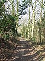
 Bluebell path, Leavenheath - geograph.org.uk - 4463101.jpg 3,648 × 2,736; 6.36 MB
-
 Bridleway - geograph.org.uk - 2878581.jpg 768 × 1,024; 403 KB
-
 Bridleway - geograph.org.uk - 2878586.jpg 768 × 1,024; 407 KB
-
 Broken Stile - geograph.org.uk - 2878615.jpg 1,024 × 768; 337 KB
-
 Corner of orchard - geograph.org.uk - 4792183.jpg 640 × 480; 158 KB
-
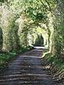
 Country Lane And Footpath - geograph.org.uk - 3748277.jpg 1,024 × 768; 401 KB
-
 Footpath Post - geograph.org.uk - 2876366.jpg 1,024 × 768; 389 KB
-
 Footpath through arable land near Brunnings Farm, Honey Tye - geograph.org.uk - 4463108.jpg 3,648 × 2,736; 2.21 MB
-
 Frosty lane, Stoke by Nayland - geograph.org.uk - 3257371.jpg 640 × 427; 108 KB
-

-
 Fruit Trees And Boxes - geograph.org.uk - 2878619.jpg 1,024 × 768; 246 KB
-
 Grass growing through the stubble of last year's crop - geograph.org.uk - 6326003.jpg 4,608 × 3,072; 5.9 MB
-
 Harrow Street junction near the fruit farm - geograph.org.uk - 4635810.jpg 1,240 × 930; 492 KB
-
 Harrow Street Levenheath - geograph.org.uk - 3748263.jpg 768 × 1,024; 390 KB
-
 Horse land - geograph.org.uk - 2046632.jpg 1,600 × 1,200; 573 KB
-
 Keepers Lane sign - geograph.org.uk - 4142437.jpg 3,072 × 2,304; 1.97 MB
-
 Keepers Lane, Stoke By Nayland - geograph.org.uk - 4142431.jpg 3,072 × 2,304; 1.75 MB
-
 Keepers Lane, Stoke By Nayland - geograph.org.uk - 4142448.jpg 3,072 × 2,304; 887 KB
-
 Keepers Lane, Stoke By Nayland - geograph.org.uk - 4143203.jpg 3,072 × 2,304; 1.76 MB
-
 Keepers Lane, Stoke By Nayland - geograph.org.uk - 4143210.jpg 3,072 × 2,304; 1.81 MB
-
 Leavenheath Village Hall - geograph.org.uk - 186545 (cropped).jpg 506 × 380; 61 KB
-
 Leavenheath Village Hall - geograph.org.uk - 186545.jpg 640 × 480; 98 KB
-
 Leavenheath village sign - geograph.org.uk - 4293206.jpg 480 × 640; 205 KB
-
 Leavenheath War Memorials in St. Matthew's church - geograph.org.uk - 6325979.jpg 3,909 × 2,932; 4.32 MB
-
 Looks like it's going to rain - geograph.org.uk - 6325973.jpg 4,608 × 3,072; 3.99 MB
-
 No unauthorised use - geograph.org.uk - 1314155.jpg 480 × 640; 193 KB
-
 Open ground - geograph.org.uk - 2878594.jpg 1,024 × 768; 343 KB
-
 Part of Daltons Farm - geograph.org.uk - 837812.jpg 640 × 480; 67 KB
-
 Part of High Road, approaching Leavenheath - geograph.org.uk - 2339353.jpg 3,593 × 2,585; 1.45 MB
-
 Plough Lane, Leavenheath - geograph.org.uk - 4463087.jpg 3,648 × 2,736; 5.01 MB
-
 Pond in Spouse's Grove - geograph.org.uk - 2453485.jpg 640 × 480; 321 KB
-
 Radley's Lane at Honey Tye - geograph.org.uk - 2339381.jpg 3,648 × 2,736; 1.37 MB
-
 Road Junction - geograph.org.uk - 3748259.jpg 1,024 × 768; 307 KB
-
 Sign of The Lion at Leavenheath - geograph.org.uk - 6325987.jpg 2,452 × 2,685; 1.35 MB
-
 Small Garden of Remembrance at Leavenheath church - geograph.org.uk - 6325983.jpg 4,608 × 3,072; 5.99 MB
-
 Small piece of woodland beside St. Matthew's church - geograph.org.uk - 6325982.jpg 4,608 × 3,072; 6.01 MB
-
 Stile - geograph.org.uk - 2878599.jpg 1,024 × 768; 366 KB
-
 The approach to the A134 on High Road, Leavenheath - geograph.org.uk - 2339362.jpg 3,648 × 2,736; 1.56 MB
-
 The End Of Harrow Street - geograph.org.uk - 3748281.jpg 1,024 × 768; 288 KB
-
 The Lion, Leavenheath - geograph.org.uk - 5469416.jpg 4,608 × 3,456; 1.04 MB
-
 The Lion, Leavenheath - geograph.org.uk - 6325985.jpg 4,608 × 2,812; 3.05 MB
-
 Two Gates - geograph.org.uk - 2878608.jpg 1,024 × 768; 384 KB
-
 Village Sign - geograph.org.uk - 3748270.jpg 768 × 1,024; 302 KB
-
 War Memorial - geograph.org.uk - 3748268.jpg 912 × 1,024; 173 KB
-
 Wheat field near Harrow Street Farm, Leavenheath - geograph.org.uk - 4619357.jpg 1,024 × 683; 252 KB
-
 Wheat field near Harrow Street, Leavenheath - geograph.org.uk - 4619355.jpg 1,024 × 683; 261 KB
-
-
 Part of Harrow Street Farm - geograph.org.uk - 378308.jpg 640 × 480; 115 KB
-
 Road to Brunning's Farm - geograph.org.uk - 374034.jpg 640 × 424; 55 KB
-
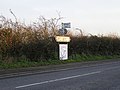 Signpost to Leavenheath Village Hall - geograph.org.uk - 288451.jpg 640 × 479; 88 KB
-
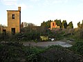
 Water Tower, viewed from the A.134 - geograph.org.uk - 374063.jpg 640 × 465; 50 KB


.jpg)


