Category:Leasingham
Jump to navigation
Jump to search
English: Leasingham is a village and civil parish in the District of North Kesteven in Lincolnshire, England. It has 713 households and is situated less than two miles north of Sleaford, just off the A15.
village and civil parish in Lincolnshire, United Kingdom  | |||||
| Upload media | |||||
| Instance of | |||||
|---|---|---|---|---|---|
| Location | North Kesteven, Lincolnshire, East Midlands, England | ||||
| Said to be the same as | Leasingham (Wikimedia duplicated page, civil parish) | ||||
 | |||||
Subcategories
This category has the following 2 subcategories, out of 2 total.
L
- Leasingham War Memorial (1 F)
Media in category "Leasingham"
The following 89 files are in this category, out of 89 total.
-
 A15 heading North from Holdingham - geograph.org.uk - 4787274.jpg 1,024 × 778; 180 KB
-
 A15 near Leasingham - geograph.org.uk - 4787277.jpg 1,024 × 747; 80 KB
-

-
 A153 heading south - geograph.org.uk - 3565134.jpg 640 × 480; 59 KB
-
 A17 lay-by - geograph.org.uk - 4734297.jpg 640 × 480; 53 KB
-
 A17 west of Leasingham - geograph.org.uk - 3651556.jpg 640 × 481; 57 KB
-
 Ancient petrol pump - geograph.org.uk - 1630096.jpg 479 × 640; 140 KB
-

-
 B1209 heading east - geograph.org.uk - 2828215.jpg 640 × 480; 53 KB
-
 Broadacres - Leasingham Moor - geograph.org.uk - 1882059.jpg 1,500 × 996; 1.43 MB
-
 Captain's Hill - geograph.org.uk - 4428386.jpg 683 × 1,024; 152 KB
-
 Captain's Hill - geograph.org.uk - 5383091.jpg 640 × 480; 66 KB
-
 Captain's Hill milepost - geograph.org.uk - 4428380.jpg 1,024 × 683; 377 KB
-
 Captain's Hill, Leasingham, Lincs - geograph.org.uk - 6261153.jpg 4,608 × 3,072; 5.69 MB
-
 Chicken and a basket - geograph.org.uk - 6489580.jpg 2,688 × 1,520; 1.75 MB
-
 Church in Leasingham - geograph.org.uk - 5383089.jpg 640 × 480; 49 KB
-
 Crop field off Moor Lane - geograph.org.uk - 3565111.jpg 640 × 480; 69 KB
-
 Crop field, Deepdale - geograph.org.uk - 3565119.jpg 640 × 480; 78 KB
-
 Drain and pylon - geograph.org.uk - 6343936.jpg 1,024 × 768; 254 KB
-

-
 Drain running north off Moor Lane - geograph.org.uk - 3565128.jpg 640 × 480; 76 KB
-
 Evening Storm - geograph.org.uk - 3599873.jpg 800 × 600; 79 KB
-
 Fallen elm on Green Lane - geograph.org.uk - 6191599.jpg 1,024 × 768; 336 KB
-
 Farmland and pylons - geograph.org.uk - 3491186.jpg 913 × 1,024; 111 KB
-
 Field edge near Leasingham - geograph.org.uk - 6386587.jpg 1,024 × 768; 258 KB
-
 Flaxwell Way, Leasingham - geograph.org.uk - 2239534.jpg 800 × 600; 291 KB
-
 Footbridge and footpath off Moor Lane - geograph.org.uk - 2954601.jpg 1,280 × 853; 289 KB
-
 Footbridge on Moor Lane - geograph.org.uk - 678806.jpg 640 × 427; 70 KB
-
 Footbridge on the Green Lane - geograph.org.uk - 6489585.jpg 2,688 × 1,520; 2.37 MB
-
 Footpath To Leasingham - geograph.org.uk - 122453.jpg 640 × 480; 132 KB
-
 Gated track at Leasingham, Lincs - geograph.org.uk - 6270543.jpg 4,608 × 3,072; 5.53 MB
-
 Glasshouse - geograph.org.uk - 678791.jpg 640 × 427; 75 KB
-
 Grazing land, Peartree Farm - geograph.org.uk - 2828214.jpg 640 × 480; 45 KB
-
 Green Lane - geograph.org.uk - 2953060.jpg 682 × 1,024; 315 KB
-
 Green Lane - geograph.org.uk - 6191605.jpg 1,024 × 768; 169 KB
-
 Hall Farmhouse - geograph.org.uk - 4428194.jpg 1,024 × 683; 203 KB
-
 House in Leasingham - geograph.org.uk - 2828210.jpg 640 × 480; 52 KB
-
 Leasingham, Moor Lane c.1910.jpg 1,107 × 688; 457 KB
-

-
 Lincoln Road to Captain's Hill - geograph.org.uk - 2892735.jpg 4,320 × 3,240; 5.3 MB
-
 Lincoln Road, Leasingham - geograph.org.uk - 1630091.jpg 640 × 440; 87 KB
-
 Lone rider - geograph.org.uk - 3490404.jpg 800 × 600; 120 KB
-
 Low Lane, a Dirt Track - geograph.org.uk - 2953052.jpg 1,280 × 853; 317 KB
-
 Milepost - geograph.org.uk - 2869043.jpg 1,024 × 768; 306 KB
-
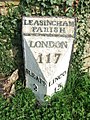
 Milestone, Leasingham - geograph.org.uk - 1630090.jpg 640 × 479; 133 KB
-
 Moor Farm - geograph.org.uk - 3565135.jpg 640 × 480; 49 KB
-
 Moor Lane (B1209) - geograph.org.uk - 3565113.jpg 640 × 480; 59 KB
-
 Moor Lane - geograph.org.uk - 2954586.jpg 1,280 × 853; 239 KB
-
 Moor Lane and level crossing - geograph.org.uk - 6343932.jpg 1,024 × 768; 169 KB
-
 Moor Lane towards Leasingham - geograph.org.uk - 2239516.jpg 800 × 600; 217 KB
-
 Moor Lane, Leasingham - geograph.org.uk - 6343934.jpg 1,024 × 768; 184 KB
-
 Moor Lane, Leasingham - geograph.org.uk - 6343951.jpg 1,024 × 768; 209 KB
-
 North Rauceby farmland - geograph.org.uk - 2107111.jpg 640 × 427; 76 KB
-
 North Rauceby farmland - geograph.org.uk - 2107117.jpg 640 × 427; 45 KB
-
 Oilseed rape crop north of Sleaford - geograph.org.uk - 3491184.jpg 640 × 480; 59 KB
-
 Ordnance Survey 1GL Bolt - geograph.org.uk - 5482729.jpg 640 × 368; 119 KB
-
 Papermill Lane - Evedon - geograph.org.uk - 1639346.jpg 640 × 425; 127 KB
-
 Papermill Lane at its junction with the A153 - geograph.org.uk - 1882072.jpg 1,500 × 996; 1.6 MB
-
 Ploughed field and plantation near Old Hall Farm - geograph.org.uk - 6335521.jpg 1,024 × 768; 179 KB
-
 Ploughed field on the edge of Leasingham - geograph.org.uk - 6336150.jpg 1,024 × 768; 214 KB
-
 Potato field, Broadacres - geograph.org.uk - 3565133.jpg 640 × 480; 77 KB
-
 Railway line to Sleaford - geograph.org.uk - 782043.jpg 640 × 427; 103 KB
-
 Rigg Farm - geograph.org.uk - 6191594.jpg 1,024 × 768; 272 KB
-
 Sewage Farm, Meadow Lane, Leasingham. - geograph.org.uk - 368256.jpg 640 × 480; 99 KB
-
 Sleaford 2 - geograph.org.uk - 2869039.jpg 768 × 1,024; 356 KB
-
 Sleaford Road (B1209) - geograph.org.uk - 2828213.jpg 640 × 480; 57 KB
-
 Spring Lane - geograph.org.uk - 5383103.jpg 640 × 480; 100 KB
-
 Stormy sunset - geograph.org.uk - 3599882.jpg 1,024 × 768; 86 KB
-
 Sunday school - geograph.org.uk - 4430514.jpg 1,024 × 683; 241 KB
-
 The A15 approaches Leasingham - geograph.org.uk - 2953045.jpg 1,280 × 853; 273 KB
-
 The A15 at Leasingham - geograph.org.uk - 2239540.jpg 800 × 600; 286 KB
-
 The Duke of Wellington - geograph.org.uk - 5383096.jpg 640 × 480; 41 KB
-
 Track off bridle way - geograph.org.uk - 3490411.jpg 800 × 600; 141 KB
-
 Track to New Hall Farm - geograph.org.uk - 3210825.jpg 3,004 × 1,829; 3.99 MB
-
 Travelling to Lincoln - geograph.org.uk - 782050.jpg 640 × 427; 97 KB
-
 War Memorial, Leasingham - geograph.org.uk - 6200464.jpg 1,024 × 768; 250 KB
-
 Wheatfield, Leasingham Moor - geograph.org.uk - 6191602.jpg 1,024 × 768; 174 KB
-
 Cottage Farm - geograph.org.uk - 214625.jpg 640 × 480; 88 KB
-
 End of the public road - geograph.org.uk - 360386.jpg 640 × 480; 131 KB
-
 Field at Westfield Farm - geograph.org.uk - 554494.jpg 640 × 480; 64 KB
-
 Footpath from Sleaford meets B1209 - geograph.org.uk - 360360.jpg 640 × 480; 148 KB
-

-
 Leasingham Village Hall. - geograph.org.uk - 365429.jpg 640 × 480; 91 KB
-
-
 Nearly There - geograph.org.uk - 554500.jpg 640 × 480; 87 KB
-
 Rigg Farm - geograph.org.uk - 678795.jpg 640 × 427; 59 KB
-
-
 Vehicle Testing Area - geograph.org.uk - 122443.jpg 640 × 480; 99 KB
-
 Wood east of Westfield Wood - geograph.org.uk - 360382.jpg 640 × 480; 141 KB


_-_geograph.org.uk_-_3565113.jpg)


_-_geograph.org.uk_-_2828213.jpg)


