Category:Lea, Derbyshire
Jump to navigation
Jump to search
hamlet in Derbyshire, England, UK  | |||||
| Upload media | |||||
| Instance of | |||||
|---|---|---|---|---|---|
| Location | Dethick, Lea and Holloway, Amber Valley, Derbyshire, East Midlands, England | ||||
 | |||||
Media in category "Lea, Derbyshire"
The following 39 files are in this category, out of 39 total.
-
 Black plastic on barbed wire - geograph.org.uk - 1564243.jpg 640 × 480; 94 KB
-
 Bow Wood, Lea Bridge - geograph.org.uk - 281275.jpg 640 × 480; 223 KB
-
 Bridge in Lea - geograph.org.uk - 2397169.jpg 1,472 × 1,008; 308 KB
-
 Bridge over Lea Brook - geograph.org.uk - 1539702.jpg 640 × 480; 138 KB
-
 Chevrons at a sharp bend - geograph.org.uk - 1564250.jpg 640 × 480; 77 KB
-
 Cottage near Lea - geograph.org.uk - 3662636.jpg 1,280 × 853; 160 KB
-
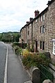
 Cottages, Sledgegate Lane, Lea - geograph.org.uk - 3356040.jpg 850 × 505; 112 KB
-

-
 Farm buildings - geograph.org.uk - 1564229.jpg 640 × 480; 80 KB
-
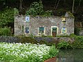 Former Lengthman's Cottage.jpg 4,000 × 3,000; 4.8 MB
-
 From Coumbs Wood - geograph.org.uk - 1539665.jpg 640 × 480; 55 KB
-
 It's all uphill from here - geograph.org.uk - 1452798.jpg 640 × 480; 126 KB
-
 Jug and Glass, Lea.jpg 3,456 × 2,304; 3.32 MB
-
 Jug ^ Glass Inn and terraced cottages, Lea - geograph.org.uk - 4407273.jpg 3,954 × 2,164; 5.73 MB
-
 Jug ^ Glass Inn, Lea - geograph.org.uk - 6126304.jpg 1,024 × 768; 203 KB
-
 Junction of Sledgegate Lane, Lea - geograph.org.uk - 3356037.jpg 850 × 638; 177 KB
-
 Lea - Church Street View - geograph.org.uk - 735613.jpg 640 × 480; 89 KB
-
 Lea - footbridge on footpath to Dethick - geograph.org.uk - 2550632.jpg 1,600 × 1,200; 1.15 MB
-
 Lea - houses to east of Jug ^ Glass - geograph.org.uk - 2550658.jpg 1,600 × 1,138; 644 KB
-
 Lea - Jug and Glass - geograph.org.uk - 2550652.jpg 1,600 × 1,409; 711 KB
-
 Lea Brook - geograph.org.uk - 1452812.jpg 640 × 480; 158 KB
-
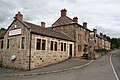
 Lea Primary School - geograph.org.uk - 3356065.jpg 850 × 638; 159 KB
-
 Lea Rhododendron Gardens - geograph.org.uk - 14635.jpg 640 × 423; 145 KB
-

-
 LeabridgeDerb.JPG 3,072 × 2,304; 3.97 MB
-
 Nos. 1 and 2 The Row, Lea.jpg 2,304 × 3,456; 3.16 MB
-
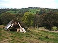
 Old stone barn in Lea - geograph.org.uk - 4757585.jpg 5,184 × 3,888; 5.56 MB
-
 Pumping Station, near Lea Brook - geograph.org.uk - 1539671.jpg 640 × 480; 86 KB
-
 Remember, remember - geograph.org.uk - 1539688.jpg 640 × 480; 87 KB
-
 Repton House, Lea, Derbyshire 01.jpg 4,032 × 3,024; 4.28 MB
-
 Shaw lane - geograph.org.uk - 792110.jpg 640 × 480; 108 KB
-
 Tree on the south side of Lea Main Road, Lea - geograph.org.uk - 5105204.jpg 768 × 1,024; 212 KB
-
 Turn this key^ - geograph.org.uk - 1564237.jpg 640 × 480; 74 KB
-
 Approaching Lea Brook - geograph.org.uk - 1452804.jpg 640 × 480; 161 KB
-
 Lea - Holt Lane view of Jug and Glass Pub - geograph.org.uk - 735598.jpg 640 × 480; 111 KB
-
 Lea - Lane Junction - geograph.org.uk - 735141.jpg 640 × 480; 77 KB
-
 Lea - Long Lane - geograph.org.uk - 735610.jpg 640 × 480; 129 KB
-
 Lea Gardens - View from Long Lane - geograph.org.uk - 735606.jpg 640 × 480; 126 KB
-
 Lea Green Development Centre Grounds - geograph.org.uk - 735603.jpg 640 × 480; 83 KB


