Category:Le Mesnil-le-Roi
Jump to navigation
Jump to search
Le Mesnil-le-Roi est une commune du département des Yvelines en France et la région Île-de-France.
Voir l'article sur la Wikipédia francophone Le Mesnil-le-Roi.
Le Mesnil-le-Roi is a municipality in the french departement Yvelines and the region Île-de-France.
See the article on the french Wikipedia Le Mesnil-le-Roi.
commune in Yvelines, France  .svg)  | |||||
| Upload media | |||||
| Pronunciation audio | |||||
|---|---|---|---|---|---|
| Instance of | |||||
| Location | |||||
| Located in or next to body of water | |||||
| Head of government |
| ||||
| Population |
| ||||
| Area |
| ||||
| Elevation above sea level |
| ||||
| official website | |||||
 | |||||
Subcategories
This category has the following 5 subcategories, out of 5 total.
Media in category "Le Mesnil-le-Roi"
The following 39 files are in this category, out of 39 total.
-
 Blason ville fr Le Mesnil-le-Roi (Yvelines).svg 600 × 660; 47 KB
-
 Carrières-sous-Bois-Les Flageaux.jpg 3,240 × 4,320; 2.5 MB
-
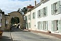
 Château de Vaux (Le Mesnil-le-Roi).jpg 1,600 × 999; 1.23 MB
-
 Graffiti sous l'A14 au niveau de Le Mesnil-le-Roi 01.jpg 3,264 × 1,836; 2.61 MB
-
 Graffiti sous l'A14 au niveau de Le Mesnil-le-Roi 02.jpg 3,264 × 1,836; 2.69 MB
-
 Graffiti sous l'A14 au niveau de Le Mesnil-le-Roi 03.jpg 3,264 × 1,836; 2.18 MB
-
 Graffiti sous l'A14 au niveau de Le Mesnil-le-Roi 04.jpg 3,264 × 1,836; 2.34 MB
-
 Graffiti sous l'A14 au niveau de Le Mesnil-le-Roi 05.jpg 3,264 × 1,836; 2.07 MB
-
 Graffiti sous l'A14 au niveau de Le Mesnil-le-Roi 06.jpg 3,264 × 1,836; 2.18 MB
-
 Graffiti sous l'A14 au niveau de Le Mesnil-le-Roi 07.jpg 3,264 × 1,836; 2.44 MB
-
 Graffiti sous l'A14 au niveau de Le Mesnil-le-Roi 08.jpg 3,264 × 1,836; 2.36 MB
-
 Graffiti sous l'A14 au niveau de Le Mesnil-le-Roi 09.jpg 3,264 × 1,836; 2.65 MB
-
 Graffiti sous l'A14 au niveau de Le Mesnil-le-Roi 10.jpg 3,264 × 1,836; 2.49 MB
-
 Graffiti sous l'A14 au niveau de Le Mesnil-le-Roi 11.jpg 3,264 × 1,836; 2.53 MB
-
 Graffiti sous l'A14 au niveau de Le Mesnil-le-Roi 12.jpg 3,264 × 1,836; 2.15 MB
-
 Graffiti sous l'A14 au niveau de Le Mesnil-le-Roi 13.jpg 3,264 × 1,836; 2.68 MB
-
 Graffiti sous l'A14 au niveau de Le Mesnil-le-Roi 14.jpg 3,264 × 1,836; 2.74 MB
-
 Graffiti sous l'A14 au niveau de Le Mesnil-le-Roi 15.jpg 3,264 × 1,836; 2.07 MB
-
 Graffiti sous l'A14 au niveau de Le Mesnil-le-Roi 16.jpg 3,264 × 1,836; 2.24 MB
-
 Graffiti sous l'A14 au niveau de Le Mesnil-le-Roi 17.jpg 3,264 × 1,836; 2.05 MB
-
 Graffiti sous l'A14 au niveau de Le Mesnil-le-Roi 18.jpg 3,264 × 1,836; 1.66 MB
-
 Graffiti sous l'A14 au niveau de Le Mesnil-le-Roi 19.jpg 3,264 × 1,836; 1.92 MB
-
 Graffiti sous l'A14 au niveau de Le Mesnil-le-Roi 20.jpg 3,264 × 1,836; 1.93 MB
-
 Graffiti sous l'A14 au niveau de Le Mesnil-le-Roi 21.jpg 3,264 × 1,836; 2.78 MB
-
 Graffiti sous l'A14 au niveau de Le Mesnil-le-Roi 22.jpg 3,264 × 1,836; 2.72 MB
-
 Graffiti sous l'A14 au niveau de Le Mesnil-le-Roi 23.jpg 3,264 × 1,836; 2.48 MB
-
 Graffiti sous l'A14 au niveau de Le Mesnil-le-Roi 24.jpg 3,264 × 1,836; 2.49 MB
-
 Le Mesnil-le-Roi - Centre Brassens.jpg 1,675 × 1,116; 1.38 MB
-
 Le Mesnil-le-Roi - La Seine (1).jpg 2,711 × 1,708; 428 KB
-
 Le Mesnil-le-Roi - La Seine (2).jpg 2,678 × 1,701; 542 KB
-
 Le Mesnil-le-Roi - La Seine (3).jpg 2,695 × 1,707; 374 KB
-
 Le Mesnil-le-Roi - La Seine vue de la terrasse de Saint-Germain terrains inondés.jpg 2,699 × 1,717; 338 KB
-
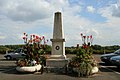 Le Mesnil-le-Roi - Monument aux morts.jpg 1,659 × 1,106; 931 KB
-
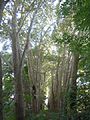
 Le Mesnil-le-Roi - Porte de la forêt.jpg 3,318 × 2,212; 2.97 MB
-
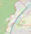 Le Mesnil-le-Roi OSM 01.png 571 × 629; 445 KB
-
 Le Mesnil-le-Roi OSM 02.png 571 × 629; 690 KB
-
 Le Mesnil-leRoi bd Pasteur brocante.png 3,712 × 2,088; 8.53 MB
-
 Population - Municipality code 78396.svg 475 × 355; 13 KB
-
 Yvelines communes Le Mesnil-le-Roi.svg 2,745 × 3,321; 663 KB

.jpg)


.jpg)
.jpg)
.jpg)


