Category:Layer-de-la-Haye (civil parish)
Jump to navigation
Jump to search
English: Layer-de-la-Haye is a civil parish in the Colchester district, in the county of Essex, England.
civil parish in Essex, England, UK | |||||
| Upload media | |||||
| Instance of | |||||
|---|---|---|---|---|---|
| Location | Colchester, Essex, East of England, England | ||||
| Population |
| ||||
 | |||||

Media in category "Layer-de-la-Haye (civil parish)"
The following 67 files are in this category, out of 67 total.
-
 A farm building on Fields Farm Road - geograph.org.uk - 812278.jpg 640 × 480; 79 KB
-
 Abberton Reservoir - geograph.org.uk - 2234957.jpg 4,000 × 3,000; 2.86 MB
-
 Abberton Reservoir - geograph.org.uk - 3448151.jpg 3,648 × 2,736; 3.23 MB
-
 Abberton Reservoir - geograph.org.uk - 4596775.jpg 1,600 × 1,064; 344 KB
-
 Abberton Reservoir - geograph.org.uk - 5382877.jpg 4,896 × 3,672; 6.67 MB
-
 Abberton Reservoir - geograph.org.uk - 6071366.jpg 1,920 × 1,280; 1.06 MB
-
 Abberton Reservoir - geograph.org.uk - 6071367.jpg 1,920 × 1,280; 1.02 MB
-
 Abberton Reservoir - geograph.org.uk - 6071380.jpg 1,920 × 1,280; 811 KB
-
 Abberton Reservoir - geograph.org.uk - 6540244.jpg 1,024 × 684; 56 KB
-
 Abberton Reservoir and pumphouse - geograph.org.uk - 4172853.jpg 4,254 × 3,152; 3.84 MB
-
 Abberton Reservoir from the air - geograph.org.uk - 2358351.jpg 640 × 414; 112 KB
-
 Abberton Reservoir, Sluice gate - geograph.org.uk - 4173669.jpg 4,320 × 3,240; 5.09 MB
-
 Abberton Visitor Centre - geograph.org.uk - 242349.jpg 640 × 432; 122 KB
-
 Abberton Visitors Centre - geograph.org.uk - 2911455.jpg 640 × 429; 62 KB
-
 Abberton Work Camp - geograph.org.uk - 2403470.jpg 640 × 428; 57 KB
-
 Along the dam, Abberton Reservoir - geograph.org.uk - 5329514.jpg 640 × 427; 74 KB
-
 Blind Knights - geograph.org.uk - 218820.jpg 640 × 426; 92 KB
-
 Bounsted Brook - geograph.org.uk - 55350.jpg 482 × 640; 116 KB
-

-
 Crossroads at Malting Green - geograph.org.uk - 3967547.jpg 1,011 × 758; 163 KB
-

-

-
 Expanding Lake - geograph.org.uk - 2403460.jpg 640 × 428; 61 KB
-
 Extension of Abberton Reservoir - geograph.org.uk - 5329630.jpg 640 × 427; 84 KB
-
 Field gates, Rye Farm - geograph.org.uk - 5329523.jpg 640 × 427; 90 KB
-

-
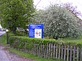 Footpath sign Church Lane, Layer-de-la-Haye - geograph.org.uk - 1849833.jpg 3,264 × 2,448; 2.67 MB
-
 Glaciation Limit - geograph.org.uk - 3022316.jpg 640 × 429; 51 KB
-
 Grassland near Abberton Reservoir - geograph.org.uk - 3286616.jpg 640 × 480; 50 KB
-
 Kingsford Bridge carrying the B1026 toward Colchester - geograph.org.uk - 1851502.jpg 3,264 × 2,448; 2.68 MB
-
 Layer de la Haye - geograph.org.uk - 4173623.jpg 4,320 × 3,240; 3.79 MB
-

-
 Layer de la Haye, village sign (detail) - geograph.org.uk - 4173614.jpg 4,320 × 3,240; 4.97 MB
-
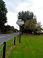 Layer de la Haye, village sign - geograph.org.uk - 4173600.jpg 3,240 × 4,320; 4.35 MB
-

-
 Michalea Strachan - geograph.org.uk - 3022315.jpg 429 × 640; 86 KB
-
 Mill, Layer de la Haye - geograph.org.uk - 5037188.jpg 480 × 640; 105 KB
-
 Needle Eye Wood, Roman River Valley Nature Reserve - geograph.org.uk - 3448148.jpg 3,648 × 2,736; 5.97 MB
-
 New Abberton Reserve - geograph.org.uk - 2911425.jpg 640 × 435; 64 KB
-
 New Car Park at Abberton Reservoir - geograph.org.uk - 3286640.jpg 640 × 480; 62 KB
-
 New Reserve Abberton - geograph.org.uk - 2911434.jpg 640 × 429; 59 KB
-

-
 Newly Planted Trees - geograph.org.uk - 3286581.jpg 640 × 480; 54 KB
-
 Old garage and pumps, Layer de la Haye - geograph.org.uk - 6071362.jpg 1,856 × 1,174; 1.03 MB
-

-

-

-
 Pump, The Heath, Layer de la Haye - geograph.org.uk - 5041491.jpg 480 × 640; 171 KB
-
 Purple Toothwort, Roman River Valley Nature Reserve - geograph.org.uk - 3449572.jpg 3,648 × 2,736; 5.44 MB
-
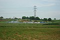
 Pylon by Abberton Reservoir - geograph.org.uk - 6071369.jpg 1,920 × 1,280; 1.08 MB
-
 Red Campion - geograph.org.uk - 2403426.jpg 428 × 640; 76 KB
-
 Red Campion up Close - geograph.org.uk - 2403434.jpg 428 × 640; 52 KB
-
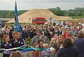 Ribbon Cutting - geograph.org.uk - 3022314.jpg 640 × 437; 78 KB
-
 Roman River Valley Nature Reserve - geograph.org.uk - 3448141.jpg 3,648 × 2,736; 4.67 MB
-
 Ron King Hide ^ Work Camp - geograph.org.uk - 2911444.jpg 640 × 429; 57 KB
-
 Small pond by footpath - geograph.org.uk - 5037182.jpg 640 × 480; 166 KB
-
 The Old Forge Garage, Layer de la Haye - geograph.org.uk - 4173635.jpg 4,320 × 3,240; 4.54 MB
-
 Tree and Red Campion - geograph.org.uk - 2403415.jpg 428 × 640; 98 KB
-
 Trees ^ Red Campion - geograph.org.uk - 2403448.jpg 640 × 428; 103 KB
-
 View from carpark at Abberton Reservoir Nature Reserve - geograph.org.uk - 2234956.jpg 4,000 × 3,000; 2.82 MB
-

-

-
 Visitor Centre Crowd - geograph.org.uk - 3022313.jpg 640 × 429; 62 KB
-
 Visitors Centre Abberton Reserve - geograph.org.uk - 2911465.jpg 640 × 429; 48 KB
-
 Visitors Centre, Abberton Reservoir - geograph.org.uk - 5382879.jpg 4,896 × 3,672; 5.59 MB
-
 Visitors' Centre, Abberton Reservoir - geograph.org.uk - 4596769.jpg 1,600 × 1,064; 475 KB
-
 Wooden war memorial, Layer de la Haye - geograph.org.uk - 4173629.jpg 3,240 × 4,320; 5.82 MB


_-_geograph.org.uk_-_4173614.jpg)


