Category:Lauriergracht 114, Amsterdam
Jump to navigation
Jump to search
| Object location | | View all coordinates using: OpenStreetMap |
|---|
 | |||||
| Upload media | |||||
| Instance of |
| ||||
|---|---|---|---|---|---|
| Location | Amsterdam, North Holland, Netherlands | ||||
| Street address |
| ||||
| Located on street | |||||
| Heritage designation |
| ||||
 | |||||
|
This is a category about rijksmonument number 3230
|
| Address |
|
Media in category "Lauriergracht 114, Amsterdam"
The following 11 files are in this category, out of 11 total.
-
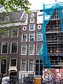 Amsterdam Lauriergracht 114 across.jpg 1,728 × 2,304; 1.37 MB
-
 Amsterdam Lauriergracht 114 detail.jpg 1,728 × 2,304; 954 KB
-
 Amsterdam Lauriergracht 114 door.jpg 1,728 × 2,304; 995 KB
-
 Amsterdam Lauriergracht 114 top.jpg 1,728 × 2,304; 1,008 KB
-
 Hoek Laurierdwarsstr. 64, voorgevels - Amsterdam - 20018672 - RCE.jpg 1,195 × 1,200; 297 KB
-
 Laurierdwarsstr. 64, voorgevels - Amsterdam - 20018670 - RCE.jpg 1,177 × 1,200; 297 KB
-
 Lauriergracht 112 Amsterdam.jpg 1,536 × 2,048; 1.28 MB
-
 Philips Jacobsz., C. (Caspar; 1732-1789), Afb 010094005459.jpg 4,224 × 3,216; 3.35 MB
-
 Philips Jacobsz., C. (Caspar; 1732-1789), Afb 010097011674.jpg 4,568 × 3,496; 4.01 MB
-
 Voorgevel - Amsterdam - 20018671 - RCE.jpg 3,066 × 3,083; 2.35 MB
-
 Voorgevels - Amsterdam - 20018676 - RCE.jpg 1,195 × 1,200; 386 KB


,_Afb_010094005459.jpg)
,_Afb_010097011674.jpg)

