Category:Lauriergracht 11, Amsterdam
Jump to navigation
Jump to search
| Object location | | View all coordinates using: OpenStreetMap |
|---|
 | |||||
| Upload media | |||||
| Instance of |
| ||||
|---|---|---|---|---|---|
| Location | Amsterdam, North Holland, Netherlands | ||||
| Street address |
| ||||
| Located on street | |||||
| Heritage designation |
| ||||
 | |||||
|
This is a category about rijksmonument number 3202
|
| Address |
|
Media in category "Lauriergracht 11, Amsterdam"
The following 8 files are in this category, out of 8 total.
-
 Amsterdam Lauriergracht 11 across.jpg 1,728 × 2,304; 1 MB
-
 Amsterdam Lauriergracht 11 door.jpg 2,304 × 1,728; 734 KB
-
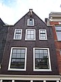 Amsterdam Lauriergracht 11 top.jpg 1,728 × 2,304; 912 KB
-
 George Hendrik Breitner, Afb 010104000201.jpg 4,136 × 2,861; 1.24 MB
-
 Stadsarchief Amsterdam, Afb PBKD00104000001.jpg 1,784 × 1,145; 257 KB
-
 Voorgevels - Amsterdam - 20018625 - RCE.jpg 1,195 × 1,200; 385 KB
-
 Voorgevels - Amsterdam - 20018627 - RCE.jpg 1,193 × 1,200; 371 KB
-
 Voorgevels - Amsterdam - 20018628 - RCE.jpg 1,181 × 1,200; 314 KB


